Annular Eclipse 2023 - Days 5-6
| Miles for the Days 5-6: | 440 |
| Total Trip Miles: | 2137 |
| Start Point: | Amarillo TX |
| End Point: | Grants NM |
Table of Contents
 Google Map Track Log
 YouTube Video
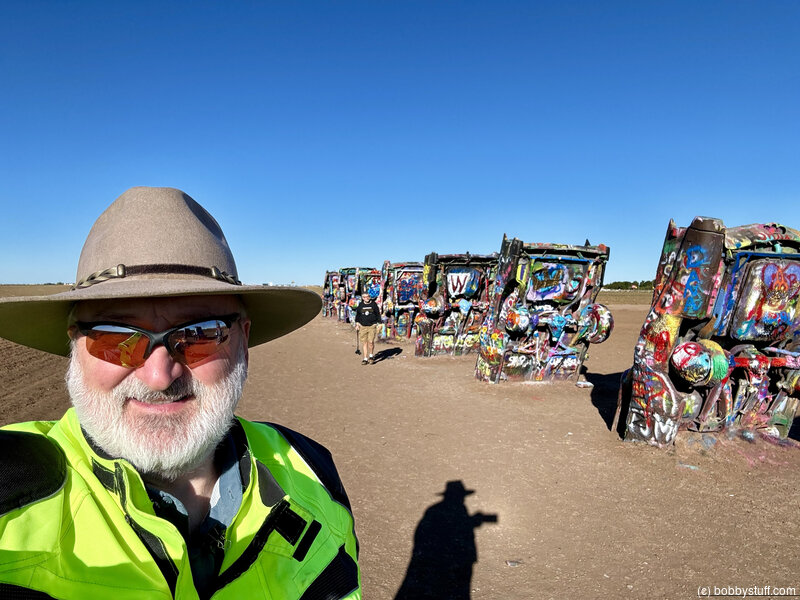
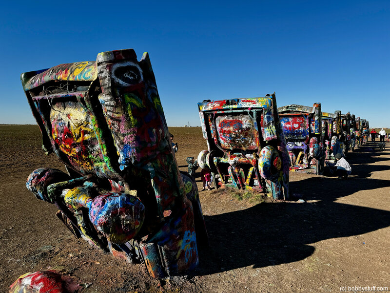
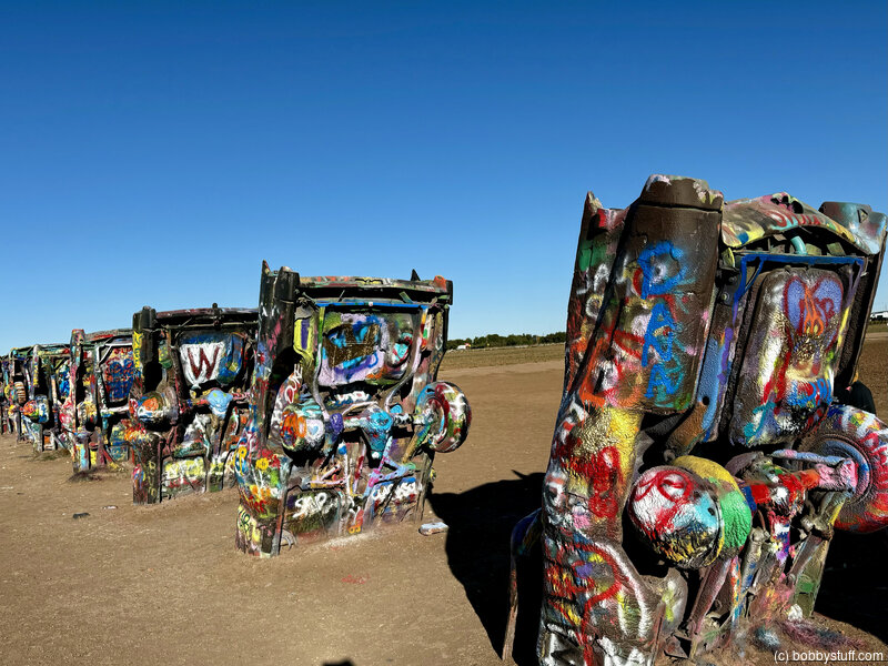
 Cadillac Ranch, Amarillo TX
View a list of places like this or a map.wikipedia.org
Cadillac Ranch is a public art installation and sculpture in Amarillo, Texas, USA. It was created in 1974 by Chip Lord, Hudson Marquez and Doug Michels, who were a part of the art group Ant Farm.
The installation consists of ten Cadillacs (1949-1963) buried nose-first in the ground. Installed in 1974, the cars were either older running, used or junk cars — together spanning the successive generations of the car line — and the defining evolution of their tail fins.
Cadillac Ranch was originally located in a wheat field, but in 1997, the installation was quietly moved by a local contractor to a location two miles (three kilometers) to the west, to a cow pasture along Interstate 40, in order to place it farther from the limits of the growing city. Both sites belonged to the local millionaire Stanley Marsh 3, the patron of the project.[6] Marsh was well known in the city for his longtime patronage of artistic endeavors including the Cadillac Ranch; Floating Mesa; Amarillo Ramp, a work by land artist Robert Smithson; and a series of fake traffic signs throughout the city known collectively as the Dynamite Museum.
Bobby
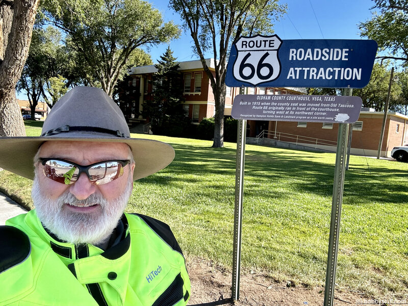
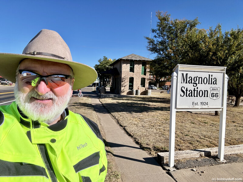
Oldham County Courthouse, Vega TX
View a list of places like this or a map.Historical Marker
Built in 1915 when the county seat was moved from Old Tascosa. Route 66 originally ran in front of the courthouse, turning west at its northwest corner.
Bobby
Bobby
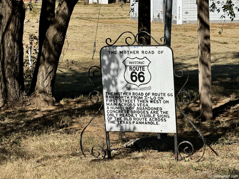
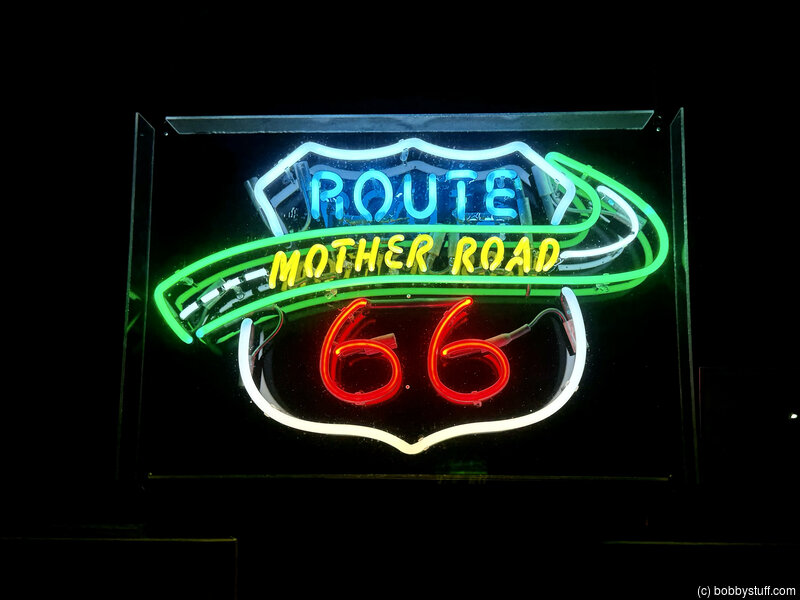
The Mother Road of Historic Route 66
View a list of places like this or a map.Historical Marker
The Mother Road of Route 66 ran north from I-40 on First Street then west on Main across Vega. A number of abandoned concrete bridges are the only readily visible signs of the old route across the Texas panhandle.
Regarding The Mother Road of Historic Route 66
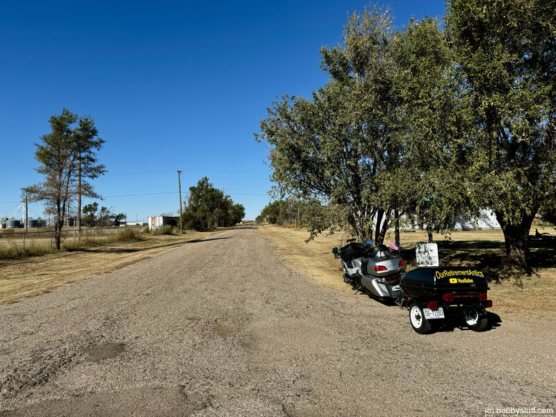
West Main Street in Vega was part of the original Route 66 alignment from 1926 to 1936. That segment of the road passed through downtown where the Oldham County Courthouse as well as the Magnolia Gas Station and Milburn-Price Museum are located. That all changed sometime in 1936 when Route 66 was re-routed to what is now Vega Boulevard (also known as Business Interstate 40). Both alignments would head west to the next town, Adrian. Much of the original Route 66 alignment west of Vega is now on private property, making it difficult to access for travelers.
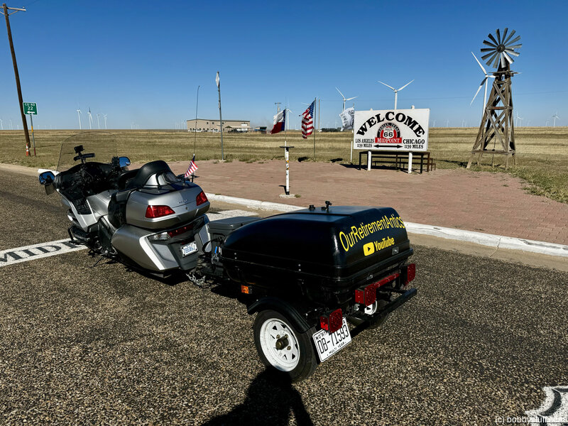
Route 66 Midpoint, Adrian TX
View a list of places like this or a map.theroute-66.com
Midpoint Cafe and Cars - Pixar was inspired by the Midpoint Cafe to create Flo's V8 Cafe in the animated film Cars (2006).
The characters Flo, Mia and Tia were based on Fran Houser and two of her restaurant's employees, the sisters Christina and Mary Lou Mendez.
The movie's credits acknowledges the cafe and Fran Houser.
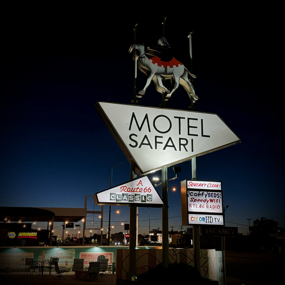
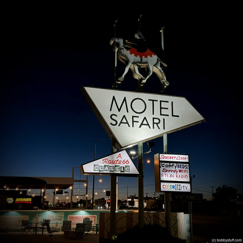
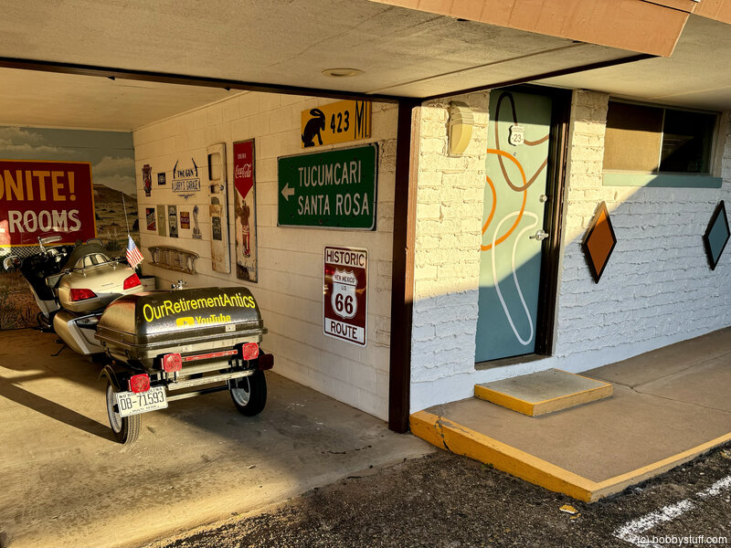
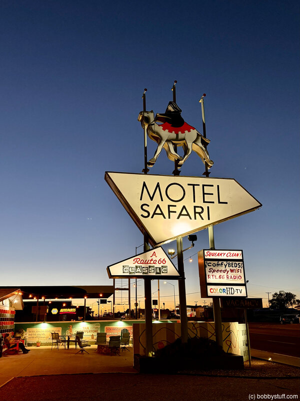
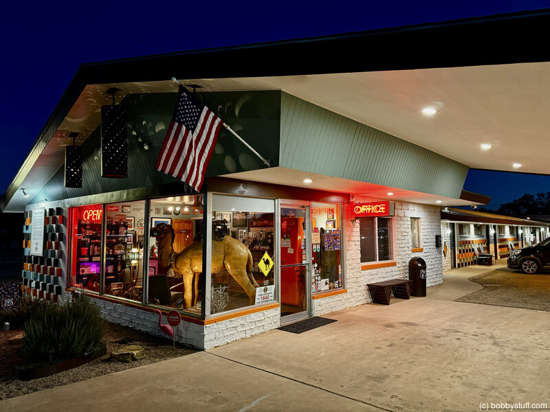
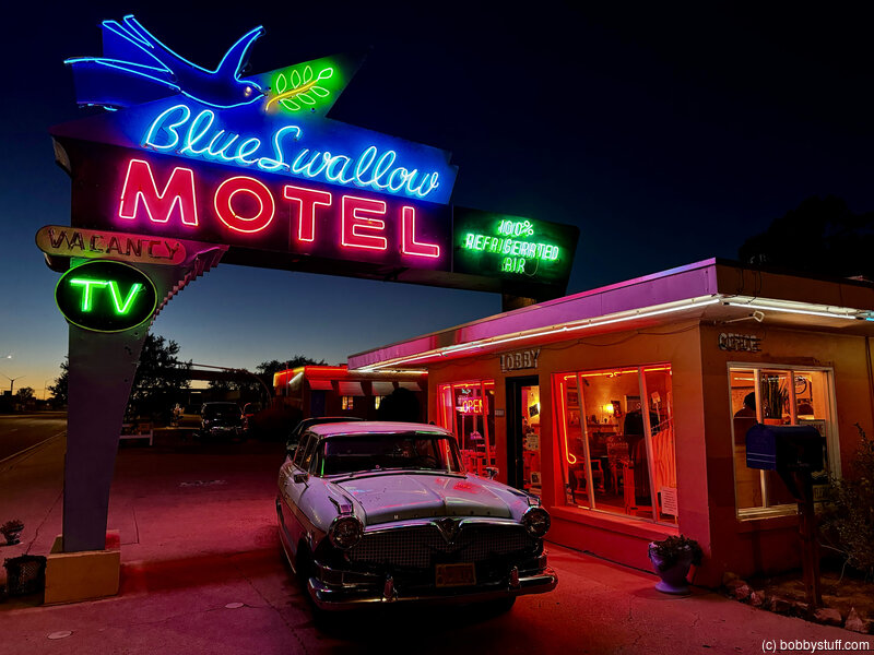
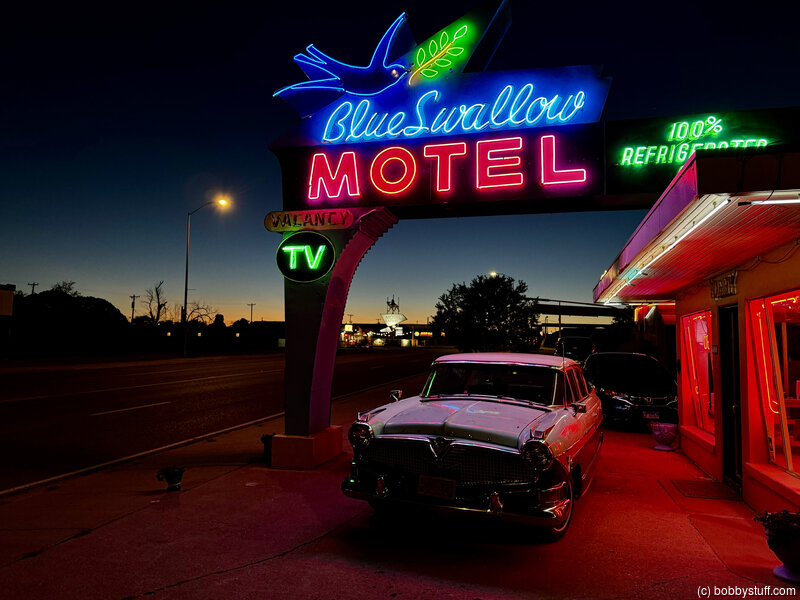
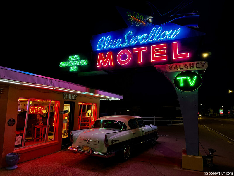
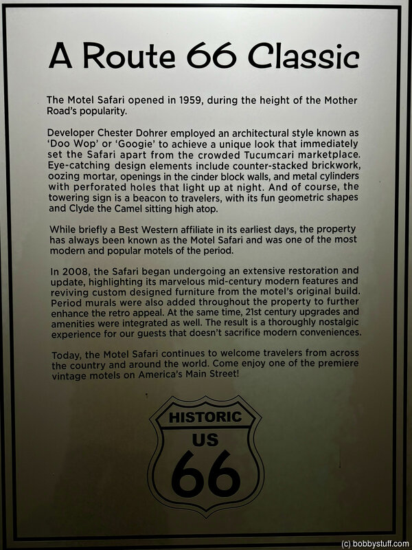
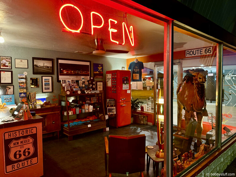
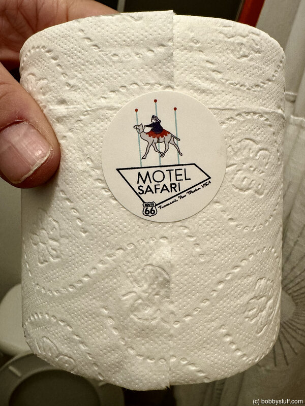
Motel Safari, Tucumcari NM
View a list of places like this or a map.themotelsafari.com
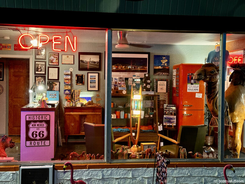
The Motel Safari opened in 1959, designed and built by Chester Dohrer, an independent motel developer, using an architectural style known today as 'Googie' or 'Doo Wop.' Many of the original design elements are still very evident today, including the quirky geometric sign, oozing brick mortar and counter stacked bricks in the facade, square holes in the cinder block structures, and the metal cylinders with perforations that light up at night.
The Motel Safari derives its name from the words Motel, meaning 'motor hotel,' and Safari, meaning 'a long journey.' In other words, a motor hotel where you can park your vehicle near your room after a long journey on the open road.
After the Dohrers' brief initial ownership, the Motel Safari was lovingly owned and operated for many years by Ronald and Arlene Frey. They amazingly raised five children on the property while also establishing the motel as one of Tucumcari's most popular. Upon their retirement, other owners followed... some good, some not so much. By the mid-2000s, the motel, like many others on 66, had fallen into great disrepair due to neglect and bad management and was on the brink of fading away into memories of what used to be.
Fortunately, the Motel Safari was saved when Richard & Gail Talley purchased the property in 2007 and began intensive renovation and restoration efforts. With their combined hotel experience and design expertise, they integrated top-of-the-line modern amenities into the room's original dècor without sacrificing its historic appearance. In each of the standard guest rooms, artwork of original photo archives from Tucumcari's Route 66 heyday is displayed, along with old linen postcard prints of local motels that are sadly no longer standing. Much of the furniture are original mid-century modern pieces custom created onsite during the motel's construction in the late 1950s. Newer pieces were carefully selected to complement this decor.
Current owner Larry Smith bought the property in summer 2017, moving from his Tennessee home and leaving behind a soul-sucking corporate job to follow his dream of running and preserving a Route 66 business. Like the Talleys, he is a big Mother Road enthusiast and is excited to be part of the larger 66 community. Carrying the torch onward, Larry has already built on the Talleys' big success with new murals, the opening of two new guest rooms, a custom patio fire pit, and the addition of Clyde Jr, a vintage, near life-size camel in the lobby. Coming soon are a guest vending room and the long-awaited relighting of Clyde the Camel atop the Motel Safari sign.
I really enjoyed this motel. Be sure to watch the YouTube video for a tour. The owner even gave me the room with the garage where I could park Silvia for the night.
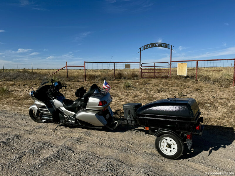
 Lucy Cemetery, Lucy NM
View a list of places like this or a map.eastmountainhistory.org
.........Still out of sight, however, was the treasure across the street. We spent a lot of time in the Lucy Cemetery, marked then only by scattered, tilting fence posts. It would have been easy to miss if we hadn't been on foot. Fences were down, the tombstones toppled by wandering cattle.
Today the two sides of Lucy's street couldn't be more different.
On the east side, the school walls are gone. The little house burned down.
But on the west side, the cemetery has risen like a phoenix, taking its place as Lucy's landmark, its spirit and legacy. Sturdy red corral bars and net wire protect its plots from cattle; headstones have been raised up and righted. In a large black arch over the corral-quality gate, lettered metal carries the "Lucy Cemetery" name.
Bernadine Harper Creager, whose mother Willie Belle Boyd Harper is buried in Lucy (b. 1894, d. 1933), was dismayed at the cemetery's condition when she came up one day from her southern New Mexico home in Anthony. And she decided to do something about it.
She talked to fellow Lucy native Armon Austin, who suggested calling rancher Leroy Humphries. "My mother died when I was 2 and my father would take me to play ball at the cemetery rather than a park. So, I grew up liking cemeteries," Humphries noted. Humphries drew plans for a fence to encircle the cemetery, got materials at a discount and had his ranch manager, Allen Brown, weld pipe and do construction. Brown's two children helped. Austin provided the gate and Creager's daughter Judy Hilger came up with the cemetery arch.
On June 23, 2013, the Harper family and others gathered to rededicate the newly cleaned and protected cemetery in the memory of all who are buried there. Austin died this past February at the age of 95, but Creager noted, "He lived long enough to see his dream come true, the cemetery refurbished. That was part of our goal. He cried when he saw it." Austin's daughter, Bonnie Sue Thomas, brought him out to the rededication in a wheel chair and will accept Austin's EMHS Award of Recognition on his behalf. "I would like to honor my Dad," she said.
"Daddy was born and raised at Lucy," she added. "He has nobody buried in that cemetery. It's just part of his heritage and where he went to school as a child." Boyd Harper, Bernadine Creager's brother, was a classmate.
In an oral history conducted in 2007 for the New Mexico Farm and Ranch Heritage Museum, Armon T. Austin described the town of Lucy as having a school, depot, blacksmith, justice of the peace, two stores, a post office and gas station, plus a ladies' auxiliary. According to Legends of America, Lucy also was the original location of the Cline's Corners Trading Post, before Roy Cline moved it to the more frequently traveled Route 66.
Austin was born in Lucy on a snowy night in February 1919 and, according to his oral history, "The doctor had come from Willard by train, and Armon's dad had sledded him to the house where Armon was born." Creager says she was born in that same house, though she and Armon are unrelated and were born 10 years apart. She said the doctor came from Willard on horseback to deliver her.
Armon's family supported themselves by farming and selling corn and beans. They raised chickens and traded eggs and cream for groceries. Austin told his oral historian that railroad workers would "throw coal off the train as it went by so that poor families could use it in the winter." The family kept a barrel of water in the kitchen for drinking, and in winter, it often froze.
Creager did some research while working on the cemetery and learned that Hanlon Funeral Home was housed in a general store in Willard in 1908 and did not officially open in Mountainair until 1948. She said her mother's casket from Willard was made of wood with a covering of black crepe, cost $65, "and was paid for by my dad, William E. Harper". Harper was a ranch hand in Lucy until the family moved to Albuquerque, where he started the Five Points Rodeo.
Ghost Town of Lucy NM
View a list of places like this or a map.elchuqueno.com
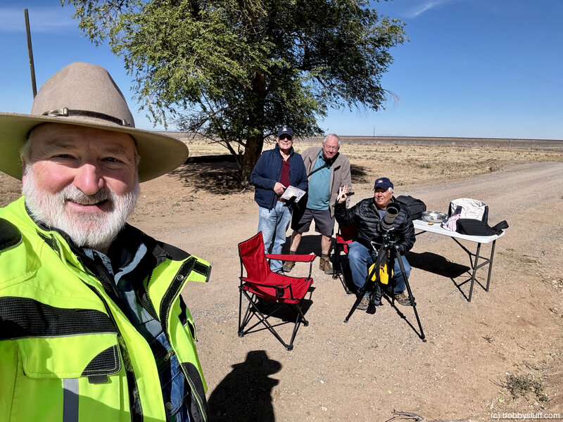
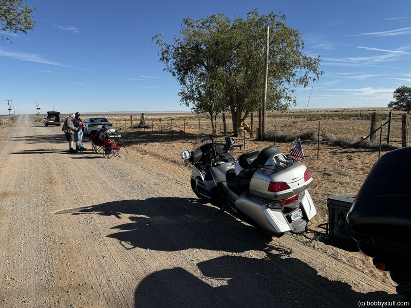
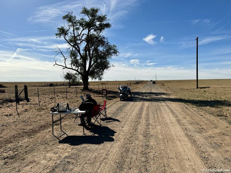
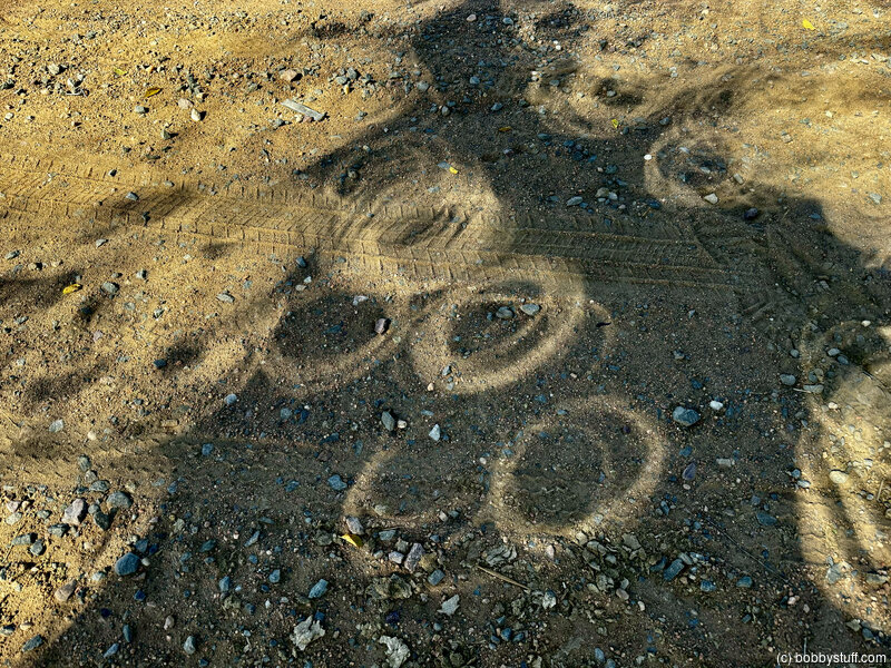
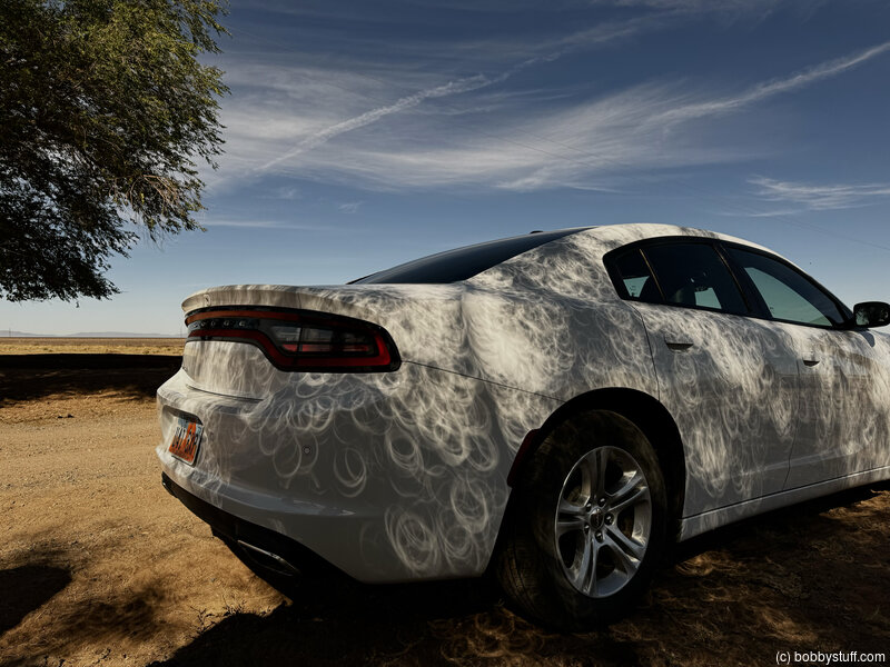
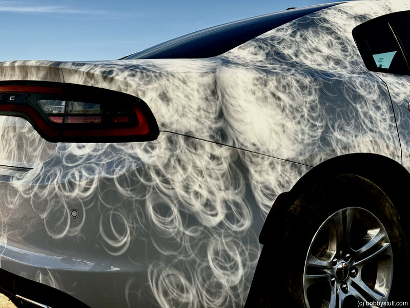
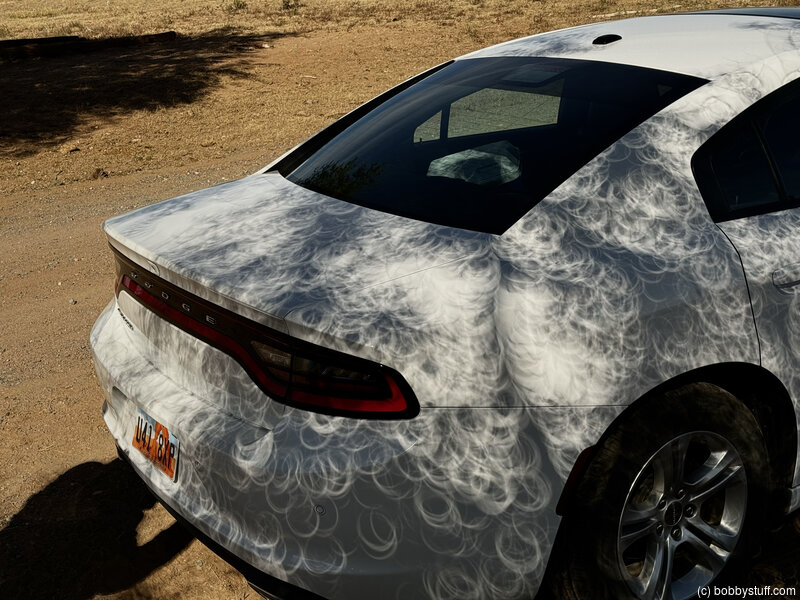
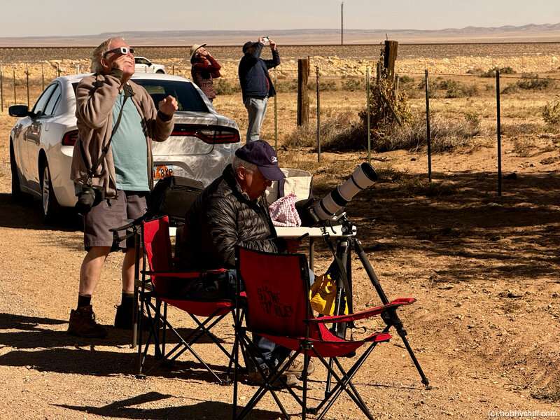
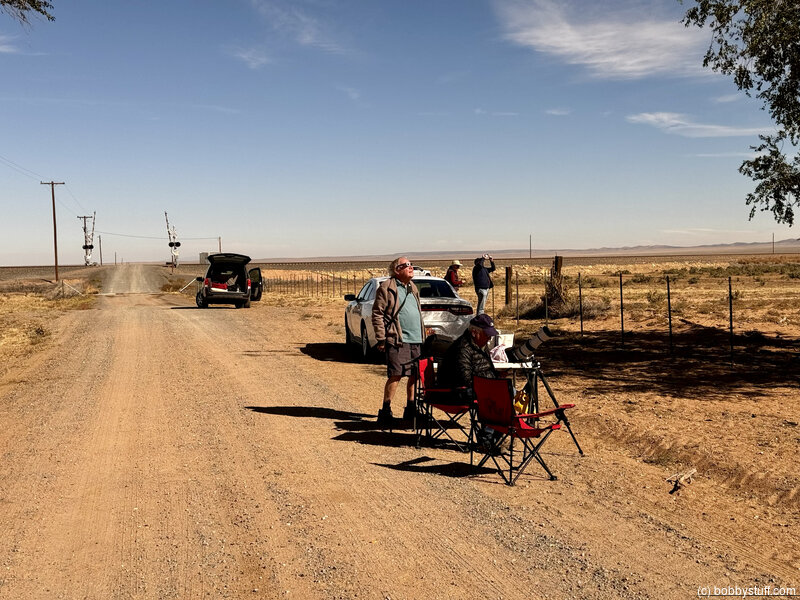
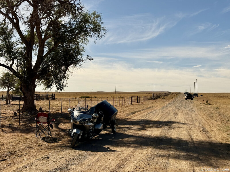
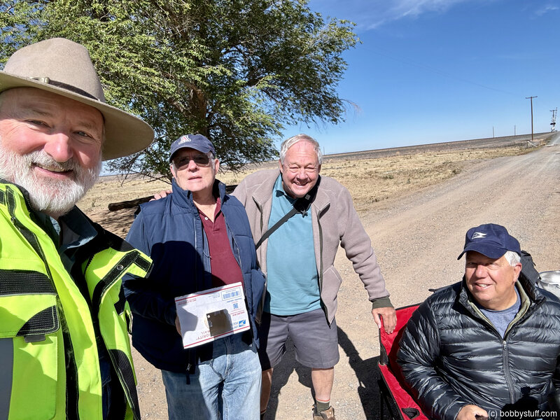
Let's get back on Highway 60 and drive just a little bit west of Negra to the ghost town of Lucy, New Mexico. Like Negra, Lucy is on the south side of the highway, tucked back beyond the railroad tracks, so you could drive past day-after-day and never even know it's there.I was going to watch the eclipse from the Lucy Cemetery, but decided to move back up the road a few hundred yards to this site. There were only 3-4 cars at this spot and some friendly looking old fellows with nice looking camera gear.There are three versions of how Lucy got its name and no one knows which is correct, although they all involve the railroad. The first is that Lucy was named for the wife of James Dunn, chief engineer of the Atchison, Topeka & Santa Fe (AT&SF). The second is that it was named after the mother of an attorney for the AT&SF. The third is that the town's namesake is Lucy Myers, daughter of railroad construction engineer Frank Myers. Maybe they're all true. Oddly enough, despite these three stories, Lucy's original name was the Spanish Lucia and the town only became Lucy in 1914, nine years after it had been established by homesteaders. Makes a person wonder who Lucia was, doesn't it?
By 1916, Lucy had a post office (est. in Lucia in 1908), two general stores, a one-room schoolhouse, a 16' x 40' Santa Fe depot, and almost ten homes. A four-room hotel was built in the fall of 1917. Lucy actually had three schoolhouses over the course of its life, the first being used only until 1910. A second school operated into 1920 and had an average attendance of 18 pupils, all the children within a radius of nine miles. Or, at least, the children that wanted to go to school. The last school was fairly large and used from 1920 into the 1940's. These schools were the center of community in the town.
Church was also held in the schools and often the congregations of Lucy–Methodist and Baptist–had to lead their own services, ministers not making it to town every Sunday. It's said there was a lot of singing in town and much of the population would head down to the depot to see the passenger train come through from the east once each day. Flour sacks often provided material for clothing Lucy's citizens.
But by the 1920's and 1930's, it started to get more difficult to make a living in Lucy. Families began leaving and during the Dust Bowl it became nearly impossible for farmers to tough it out. Often a homestead would be abandoned in the middle of the night, the residents unable to pay their debts. This was quite a blow to store owners, who had extended credit in many cases and now had to try to absorb the losses. Other homesteaders sold to ranchers.
By 1940, there were no longer enough students to justify keeping the Lucy school open and soon the few children in the area began to be bussed to nearby Willard. The post office closed in 1942. The rail depot was moved to Estancia and later ended up on a local ranch. The last event of real note in Lucy was a train wreck on April 14, 1979, in which 42 cars derailed, spilling Lincoln Continentals and Ford Broncos all over the tracks.
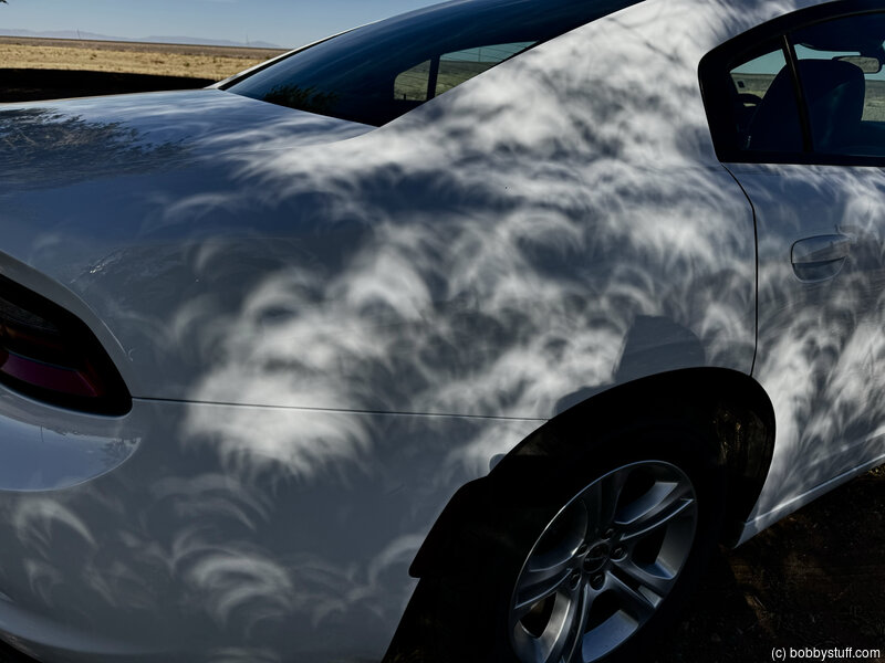
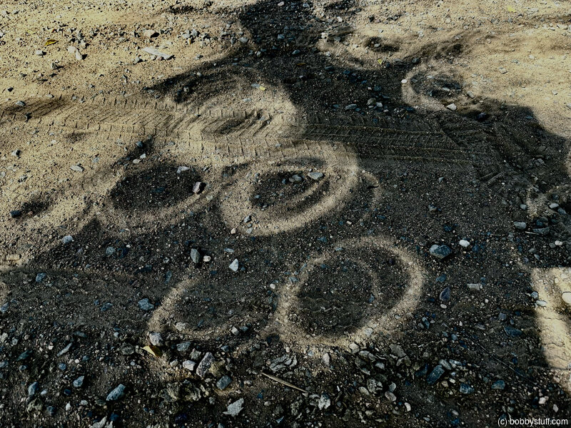
We had a good time talking and watching the eclipse.


Bobby