Annular Eclipse 2023 - Days 1-4
| Miles for the Days 1-4: | 1697 |
| Total Trip Miles: | 1697 |
| Start Point: | Home |
| End Point: | Amarillo TX |
Table of Contents
My wife and I talked about going to New Mexico to see the annular eclipse but for family reasons, she could not go. However, she told me to go anyway and enjoy myself.
This was a quick trip with long days and not many stops but the autumn scenery was great and I enjoyed the annular eclipse in Lucy New Mexico. Be sure to watch the YouTube video.
 Google Map Track Log
 YouTube Video
Bobby
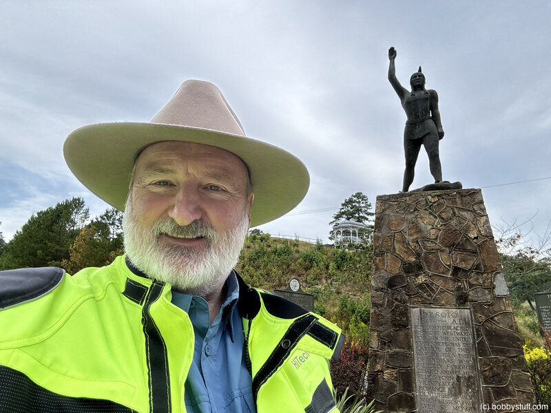
Bobby
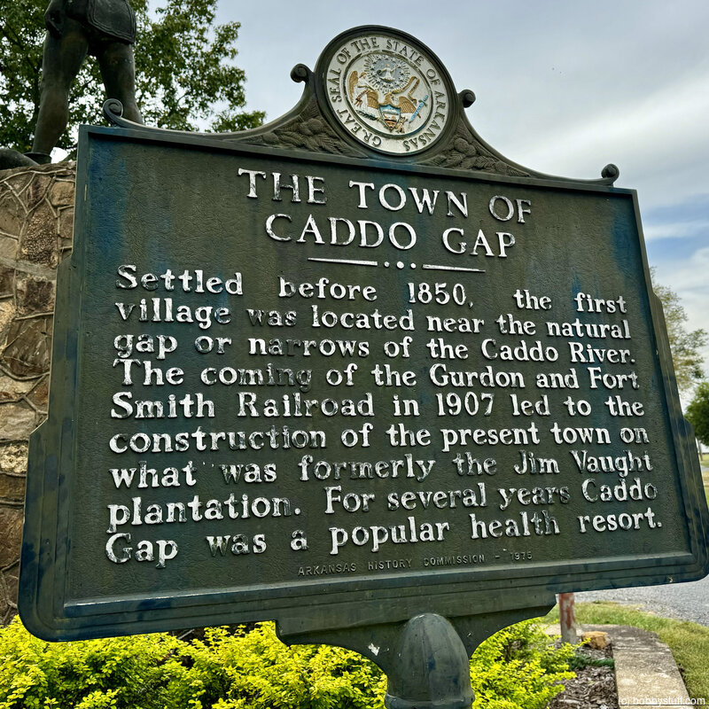
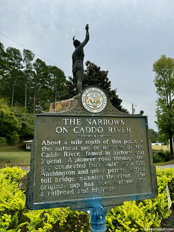
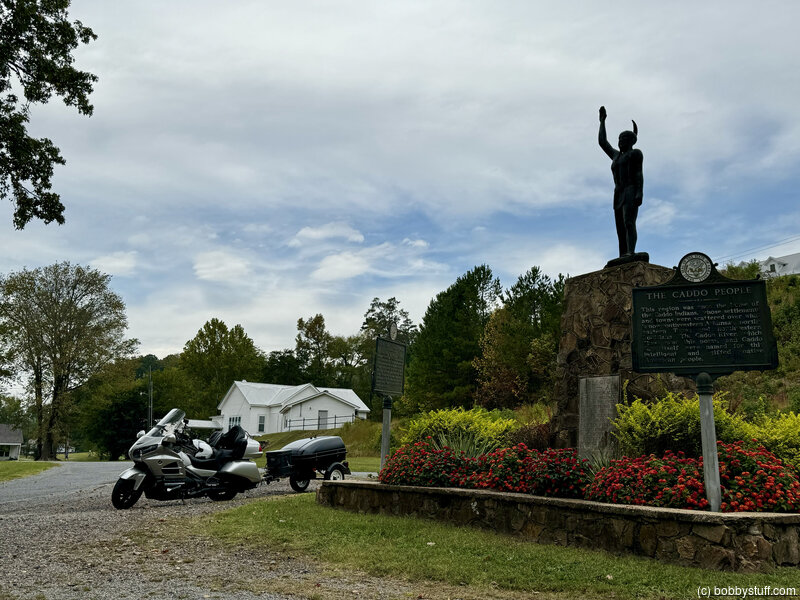
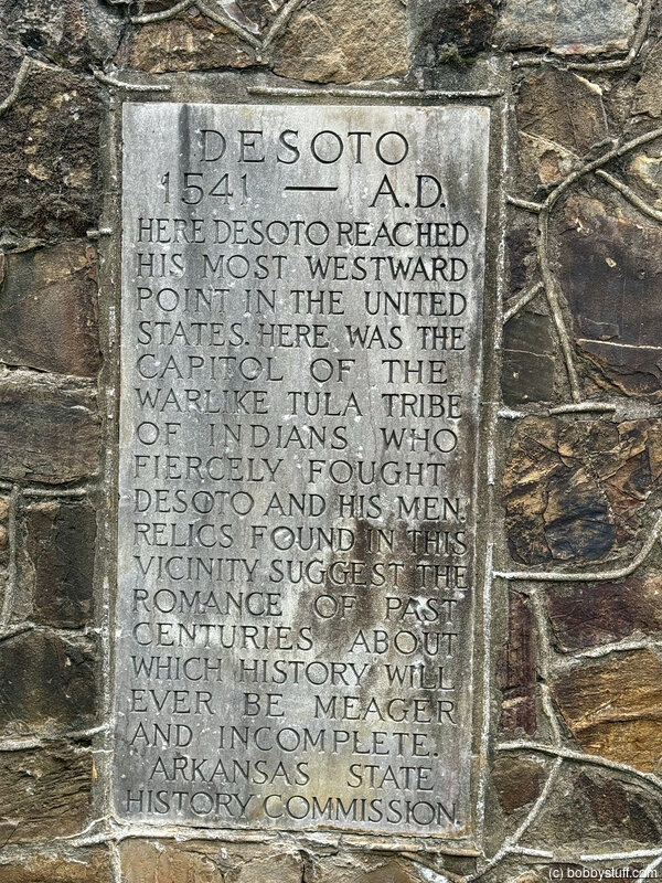
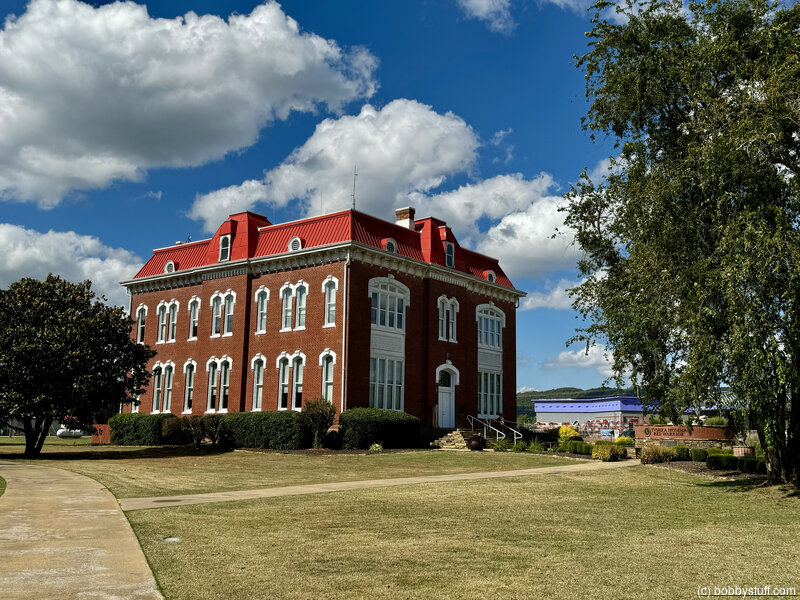
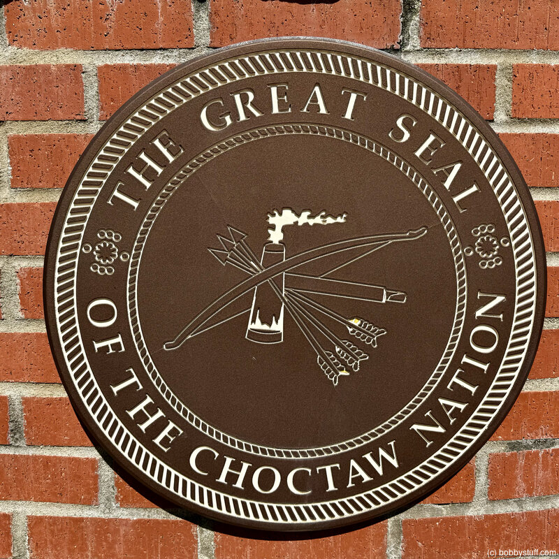
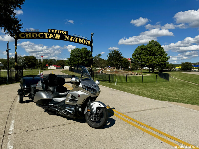
 Choctaw Nation Museum
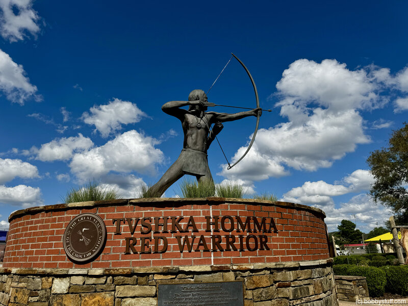
View a list of places like this or a map.From choctawnation.com/about/
The Choctaw Nation is the third-largest Indian nation in the United States, with over 225,000 tribal members and 12,000-plus associates. The first tribe over the Trail of Tears, historic boundaries are in the southeast corner of Oklahoma. The Choctaw Nation's vision, "Living out the Chahta Spirit of faith, family and culture," is evident as it continues to focus on providing opportunities for growth and prosperity.From choctawnationculture.com
The Choctaw Capitol Museum is located in the Choctaw Capitol Building on the Tvshka Homma grounds (between Clayton and Talihina). This impressive red-brick structure was built in 1884 and has served as the Capitol of the Choctaw Nation. Today, it is on the National Register of Historic Places. The Museum features displays on Choctaw history before European contact, the Trail of Tears and Death, Choctaw life in Oklahoma, Choctaw Lighthorsemen, Choctaw Code Talkers, Choctaw basketry, and has a gift shop selling Choctaw-made artwork, and much more.
Quanah Parker
View a list of places like this or a map.Historical Marker
Quanah Parker, the Last Comanche ChiefQuanah Parker, the last Comanche Chief, was born in Elk Creek just below the Wichita mountains circa 1850. Quanah, the son of Petah Nocony and Cynthia Ann Parker who was captured by the Comanches, became a fierce warrior and skillfully defended Comancheria against all invaders.
Col. Ranald McKenzie pursued Quanah for years but never captured or defeated him. The destruction of the buffalo forced Quanah to lead the Comanche down this trail to Fort Sill in June 1875.
A born leader, Quanah bridged the great gap between the old world as a War Chief to the new life as a Civil Chief without losing his Comanche identity. A prominent and influential figure, he made numerous trips to Washington to negotiate political and economic issues.
In 1889, he built Star House, a ten room two-story home ten miles NE of this site for his wives, children and anyone who was seeking help. Quanah was buried in 1911 at Post Oak Mission, seven miles NE and reburied 1957 at Fort Sill.
The spirit of Quanah Parker, the Eagle of the Comanches, welcomes you to his sacred home the Wichita Mountains.
Historical Marker
Comancheria
The domain of the Comanches from early 1700's to mid 1800's, reached from the foothills of the Rockies to New Mexico eastward to the cross timbers of Texas and Oklahoma and from the Arkansas River in Kansas South to the Texas Pecos River-Rio Grande area. The Nation was 600 miles from North to South, 400 miles East to West.
Among the first Plains Indians to acquire horses from Spanish settlers, Comanches soon became legendary horsemen seizing control of Comancheria and securing their land of waving grass and buffaloes from intruders.
These ancient Wichita mountains you are now viewing were centered in the heart of Comancheria and sacred to the Comanches. The aged cedars, used in ceremonials for centuries, still stand guard.

Bobby
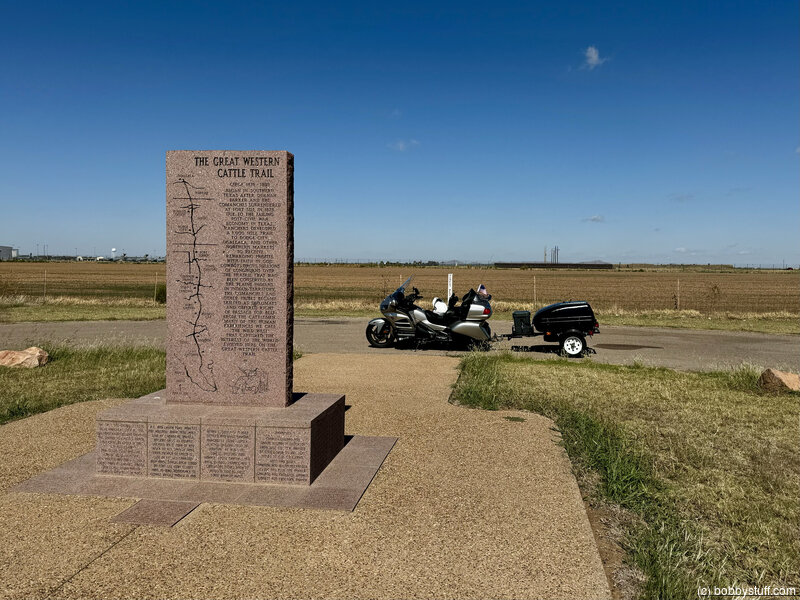
The Great Western Cattle Trail Circa 1876 - 1895
View a list of places like this or a map.Historical Marker
Began in southern Texas after Quanah Parker and the Comanches surrendered at Fort Sill in 1875. Due to the failing Post-Civil war economy in Texas, ranchers developed a 1,000 mile trail to Dodge City, Ogallala, and other northern markets to receive rewarding profits. With faith in God, Cowboys drove millions of Longhorns over the prairie that had been conserved by the Plains Indians. In Indian Territory, the Comanches and other tribes became skilled as diplomats and offered right of passage for beef from the cattlemen. Many of the human experiences we call "The Wild West" that captured the interest of the world evolved here on the Great Western Cattle Trail.
Erected on the Quanah Parker Trailway in 1995 by the Jackson County Historical Society, The Oklahoma Dept. of Transportation, the Jack and Marie Mills Family, The Jackson County Farm Bureau, and Friends of the Western Cattle Trail, one hundred years after the close of the trail.
As the Trail ceased to be used and the land openings began settlers moved onto the Great Plains. Many descendants of old Greer County Pioneers still live in Southwest Oklahoma.
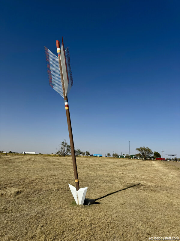
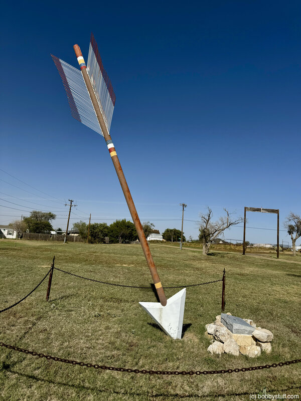
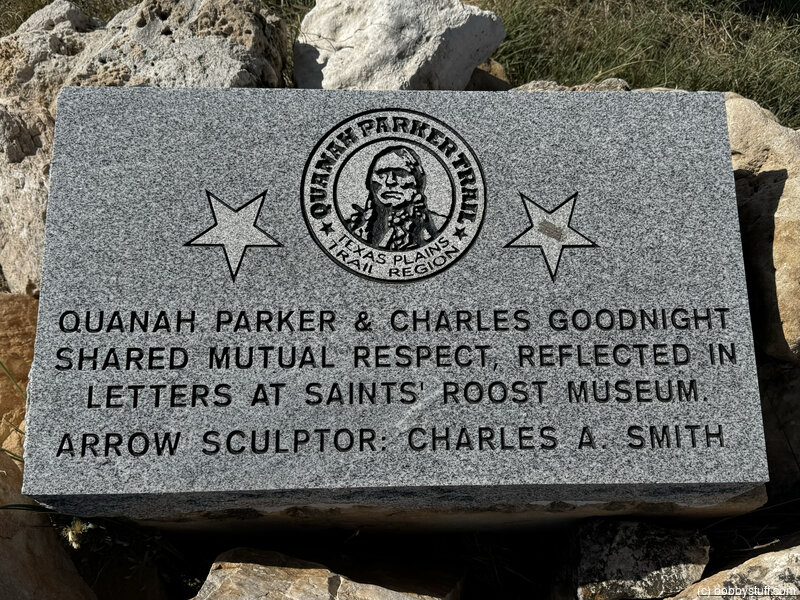
Quanah Parker Trail, Texas Plains Trail Region
View a list of places like this or a map.Historical Marker
Quanah Parker & Charles Goodnight shared mutual respect, reflected in letters at Saints' Roost Museum.
Arrow Sculptor: Charles A Smith
Site of Old Goodnight Ranch
View a list of places like this or a map.Historical Marker
First ranch in the Texas panhandle
Established in 1876 by
Charles Goodnight
1836- 1929
Noted scout, Indian fighter, trail blazer and rancher
The Burbank of the range
From Historical Marker Data Base
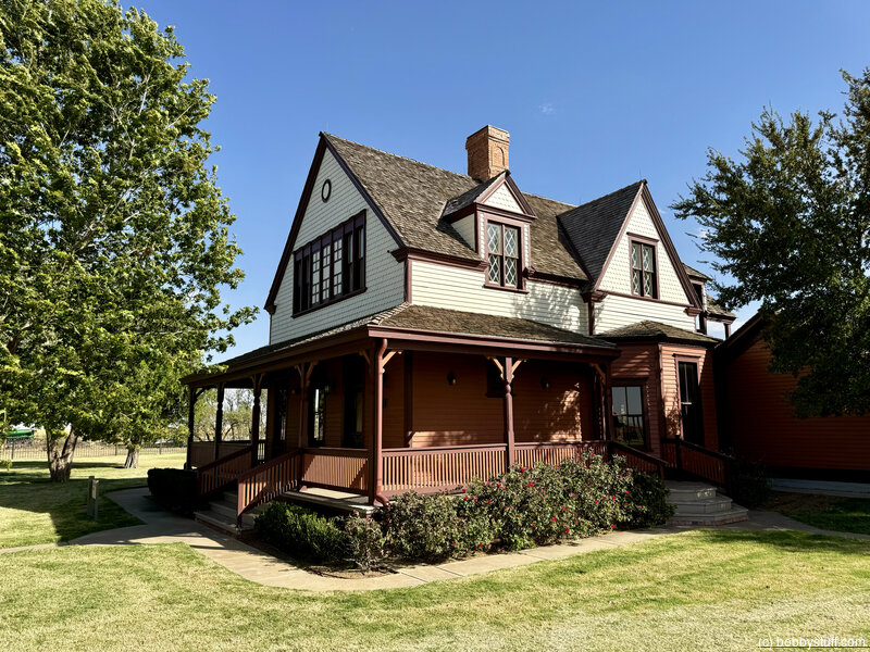
The Goodnights moved in this spacious, two-story house on December 27, 1887. Records show that he hired a carpenter for $100 a month to travel to Louisiana to select cypress wood for the house, which became the first home in Goodnight, Texas. The 2,900 square foot, two-story Victorian style home contains hardwood floors made in Trinidad, Colorado, and has leaded stained glass in the windows. The house contains a 361 square foot basement and a 268-square foot sleeping porch on the south side. Two out buildings still stand on the property. Over the years , plumbing and bathrooms, were added, but the house remains essentially as Goodnight had it built and was occupied until 1998. The house was state of the art in its day, a graceful structure with five chimneys and a three color paint scheme. It included wide porches and bay windows. inside, beneath 9'4" ceilings, were four bedrooms, a parlor, Goodnights office, a dining room, a kitchen and a ballroom where Molly Goodnight entertained. The house was bought by the Mattie Hedgecock estate in 1933, and used as ranch headquarters until 1998. Mr. and Mrs. Brent Caviness, and Mr. and Mrs. Marsh Pittman bought the house in 2004. In 2005, they donated the home and 30 acres to the Armstrong county museum. In 2007 the house received Historical designation from the state of Texas and the national register of historical places.