
Day 7, Beautiful Sunrise Ride and Looking For Gasoline
| Miles: | 381 |
| Start Point: | Van Horn, TX |
| End Point: | Deming, NM |
| End Weather: | At 6:00 PM MDT, the temperature was 74 degrees with 9 percent humidity. The conditions were clear. |
| Sun Rise: | 8:03 AM CDT |
| Sun Set: | 7:22 PM MDT |
Table of Contents

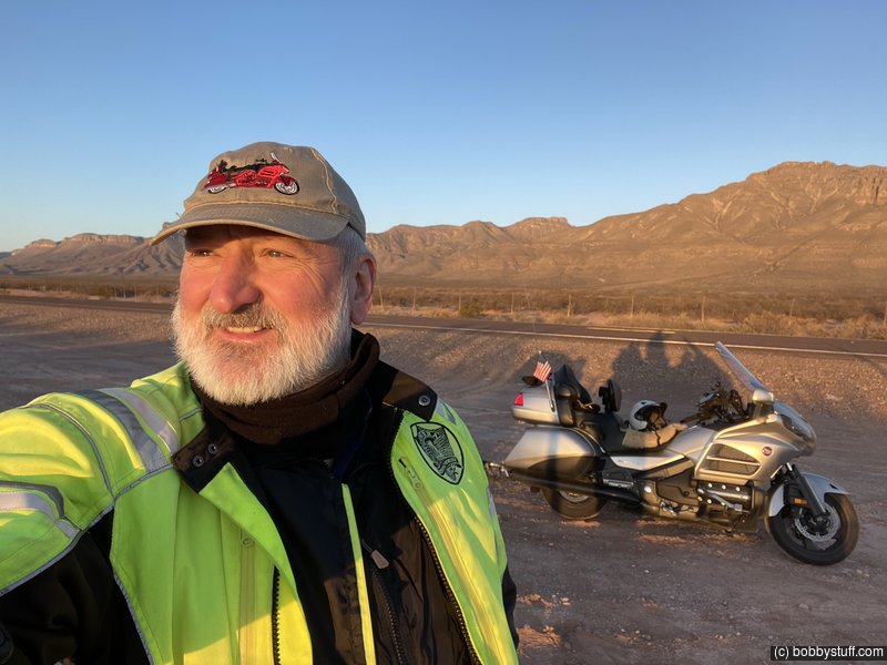
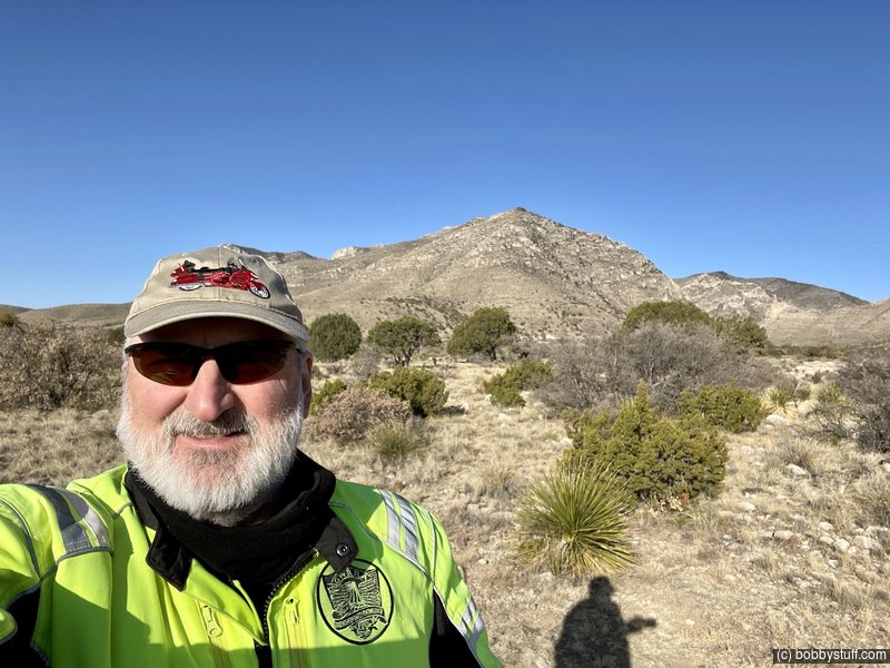
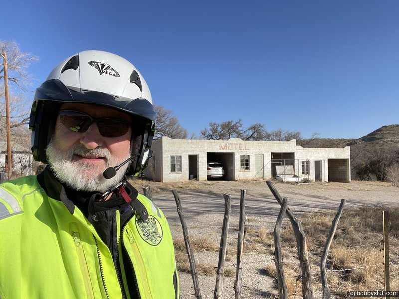
I got out before sunrise based on the recommendations of my cousin and I was not disappointed. Please watch the video. It is shorter than yesterday and has some neat content.
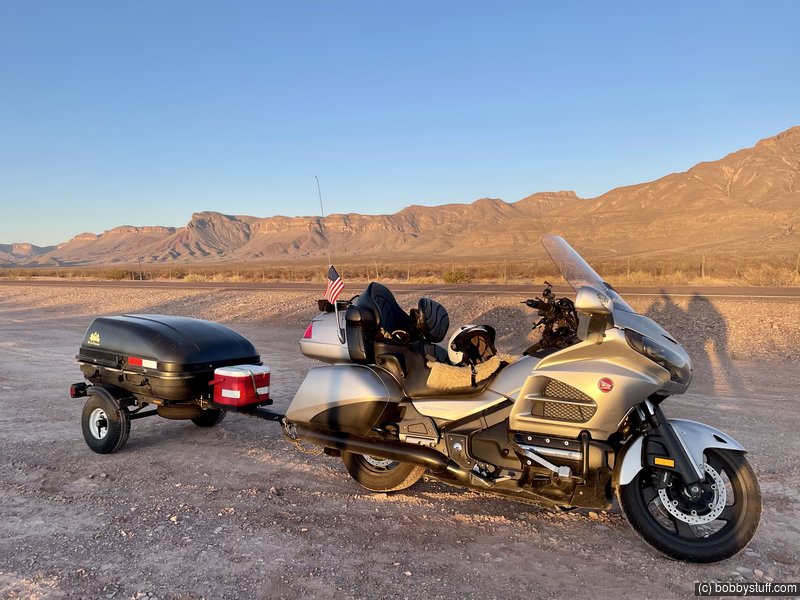
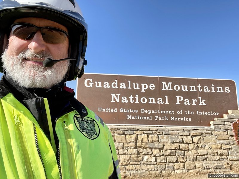
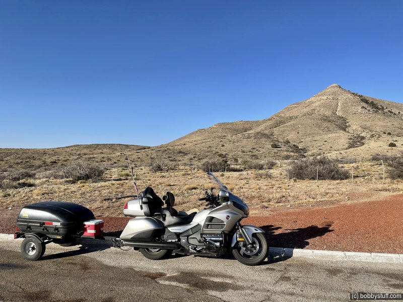
The video has the details, but I had to do some interesting math today. I fueled up last night and rode roughly 80 miles this morning to get to Guadalupe National Park. Conservatively, I can get 180 miles to a tank of fuel. I now have about 100 miles left. When I left the park and headed west, I consulted my GPS, as I often do, and the next fuel was 95 miles ahead. Now, I was pretty sure I would be fine, but I don't want to stare at the fuel gauge for 95 miles and stress over it. So I punch in coordinates for about 100 miles in the other direction and there is gas at 35 miles. Dang! I decide to ride 35 miles in the wrong direction to get gas so I have some margin.
When I fuel up, I have 180 miles of gas. I am 35 miles beyond the point where I needed 95 miles. So I figure 130 miles on a 180 mile tank of gas. I am set. As I leave that wide spot in the road there is a sign that says 145 miles to the next gas.
I have travelled many places like Nevada where the next services are 100 miles plus a little bit, but never have I been 145 miles from the next gas station. Only in Texas. I told my Dad that anyplace you want to go in Texas is 59 miles away but at 100 MPH, like everyone drives, it is no big deal.
In case you have not noticed, these trips are about the ride, not the destination. I wish Laurie could have been with me. But she understands that I need trips like these. They recharge me. Everyone could benefit from spending time truly alone with themselves.
Last fall I lost my mother after many years of pain and suffering. Years ago I made sure there was nothing unsaid between us so I had no regrets when she passed. Yesterday on a lonely stretch of beautiful road, I grieved a little for my mother. It hits me out of the blue sometimes.
Today I was lonely for my wife. I wish she could be with me. But she understands.
I love the American west. I will retire this year. These kinds of trips might become a yearly thing. I am the kind of man that also has to prove to myself that I can still ride 5-6k miles on a motorcycle. I love it.
 Video
Video
Bobby
Sunrise Photos
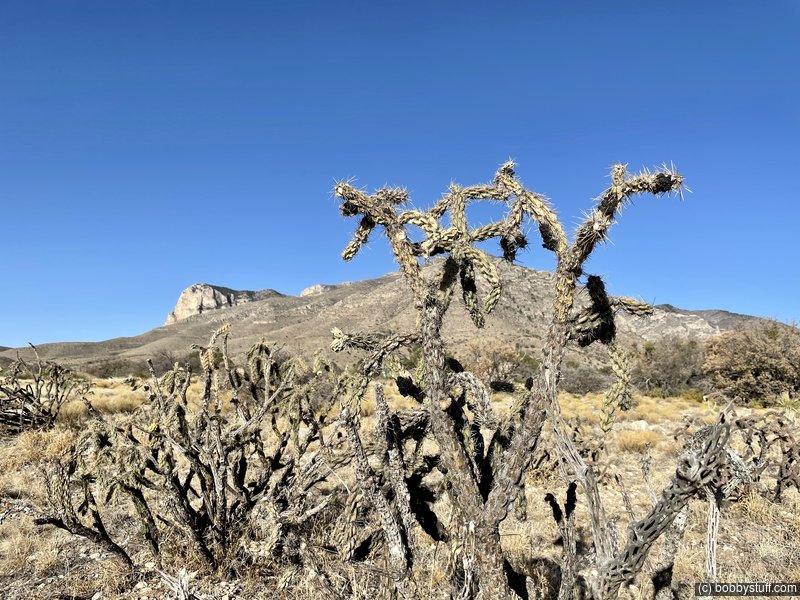
Misc Photos
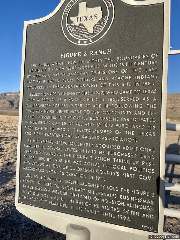
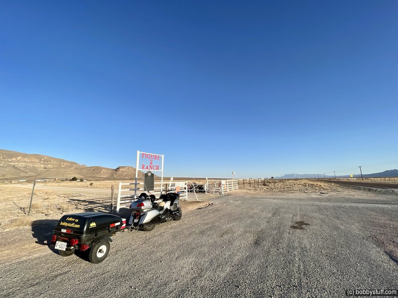
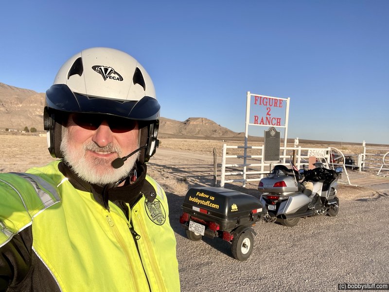
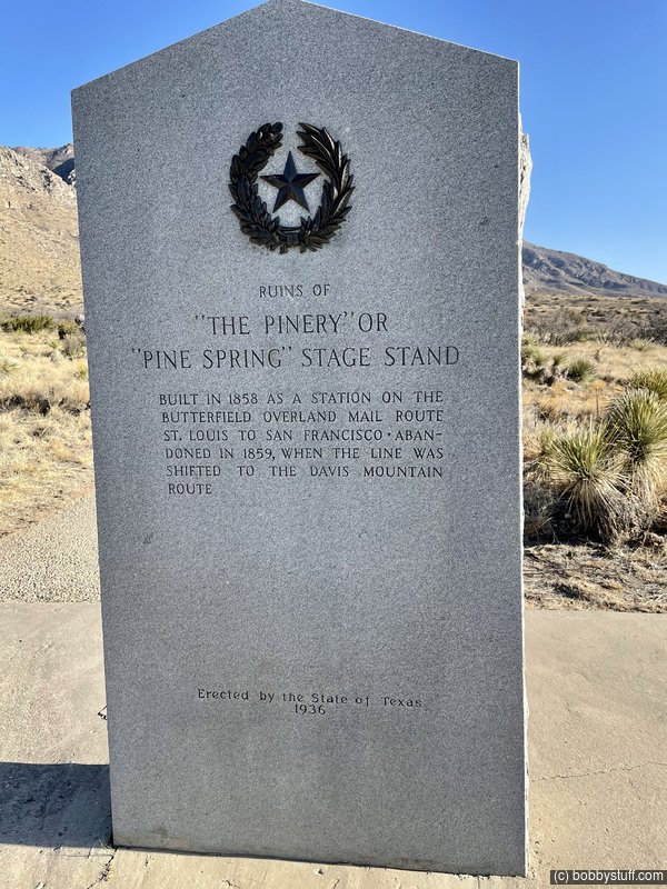
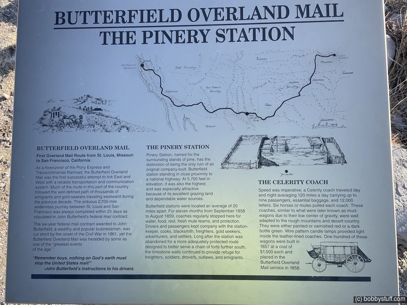
 The Pinery Butterfield Stage Station Ruins, Guadalupe Mountains National Park TX
View a list of places like this or a map.wikipedia.org
Pinery Station, or The Pinery, was built as a relay station on the Butterfield Overland Mail stagecoach route, located at the crest of Guadalupe Pass in what is now Guadalupe Mountains National Park in the U.S. state of Texas. The station, now in ruins, was built in 1858 and was abandoned the next year. It is located close by U.S. Routes 62/160 and is accessible for tourists.
The station location had been a camp for military expeditions since 1849. The station was built as a fortification with stone walls protecting a corral and a second enclosure for the three-room station house. The walls were 30 inches thick and 11 feet high, giving protection from raids by the local Mescalero Apaches. The station was located near Pine Spring and featured good grazing land nearby. The station offered fresh teams of horses and hot meals for stage crews and passengers. In 1859 the trail route was changed to pass close to Fort Davis and Fort Stockton. Even after its abandonment it was used by passers-by on the old trail.
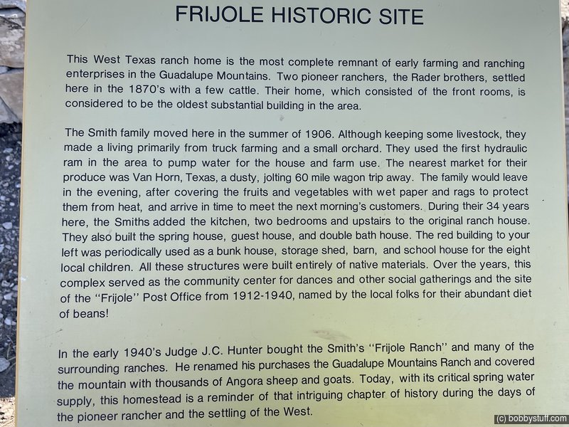
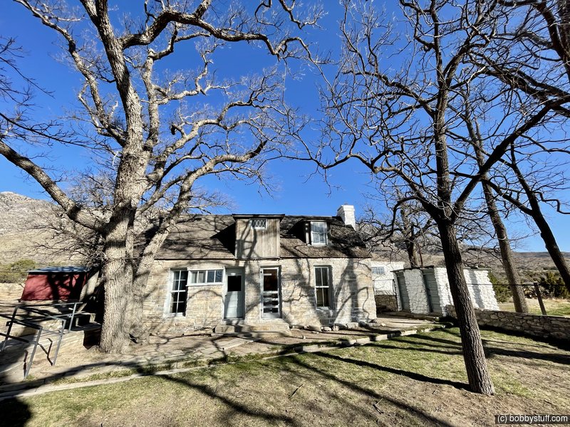
Frijole Ranch Cultural Museum, Guadalupe Mountains National Park TX
View a list of places like this or a map.nps.gov
Frijole Ranch is a delightful oasis on the edge of the dry, lower slopes of the Guadalupe escarpment which truly captures the rugged spirit of the American West. Today the Frijole Ranch History Museum occupies the old ranch headquarters, and displays the sequential human history of the Guadalupes from Native Americans and the early ranching community to the establishment of a national park. Just outside is a tiny one-room schoolhouse and spring house that was constructed for water protection and storage. The cold, spring water which is channeled through the courtyard (once essential for subsistence and farming) provides precious moisture for the large shade trees and the grass that surrounds them. Shade and water, both scarce commodities in the desert, are coveted by a variety of species that frequent the area at dawn and dusk. As you look around, imagine what life may have been like in this remote West Texas locale.
More Misc Photos
 Elevation Changes During the Day
The day started at 4,061 feet and ended at 4,301 feet. The highest altitude was 5,720 feet and the lowest altitude was 3,541 feet.