Route 66 Carthage MO North to Springfield
| Start Weather: | At 6:00 AM CDT the temperature was 66° with 96% humidity. The conditions were clear with a wind speed of 12 MPH and wind gusts of 26.7 MPH. |
| End Weather: | At 6:00 PM CDT the temperature was 77.6° with 61% humidity. The conditions were clear with a wind speed of 14.7 MPH and wind gusts of 27.2 MPH. |
| Sun Rise: | 7:34 AM CDT |
| Sun Set: | 6:32 PM CDT |
Table of Contents

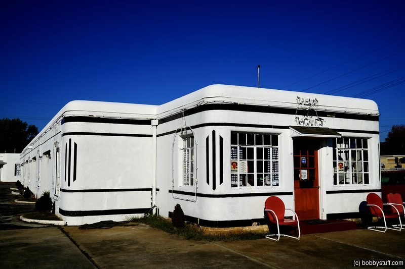
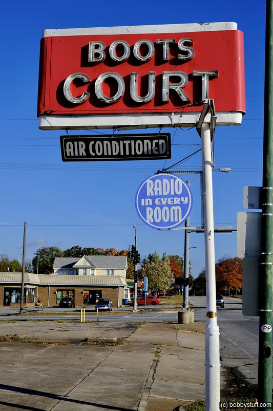
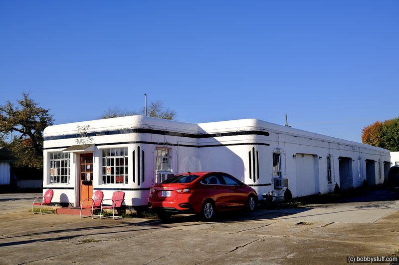
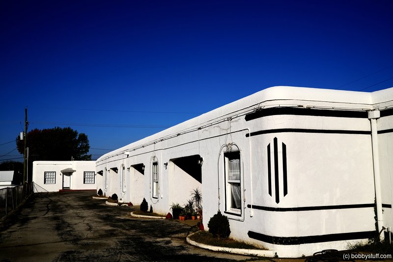
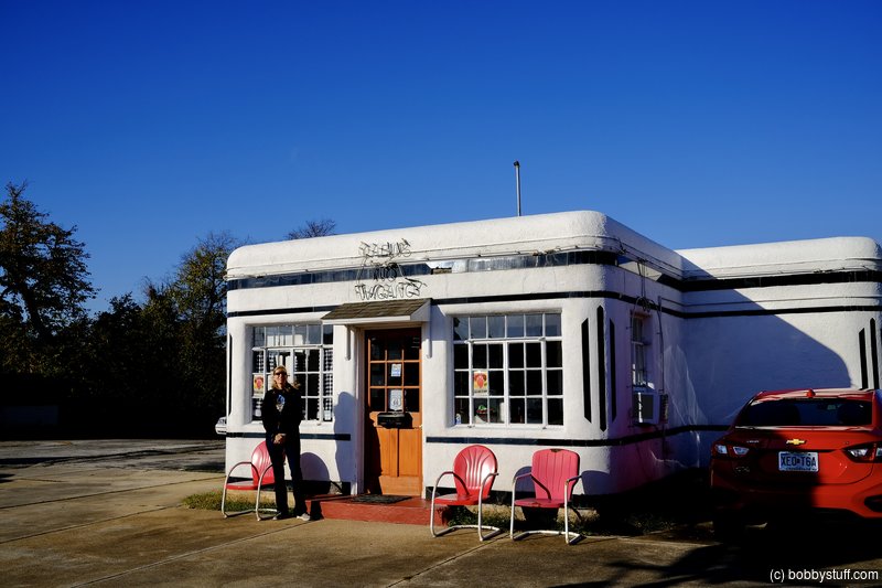
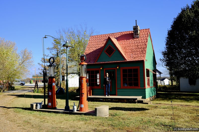
 Boots Court Motel, Carthage MO
View a list of places like this or a map.theroute-66.com
The "Boots Court" opened in 1939, with 8 rooms and "a radio in every room". It was strategically located on the "Crossroads of America" where The "Jefferson Highway" (U.S. 71) crossed Route 66. It belonged to Arthur and Ilda Boots.
Its style combines Streamline Modern with Art Deco. It had a filling station which later became the office.
The Neely's bought it in 1942 and added five rooms to it in 1946. Clark Gable stayed here twice. By the 1950s it had added TV, phones and air conditioning.
After 1990 a period of decline set in, it was almost demolished but saved by public activism. In 2011 restoration and preservation began after it was purchased by the Bledsaw sisters. And the Motel is now open and receiving guests again.
This is another Route 66 motel I had reserved for my spring motorcycle ride but then had to cancel. Maybe another year.
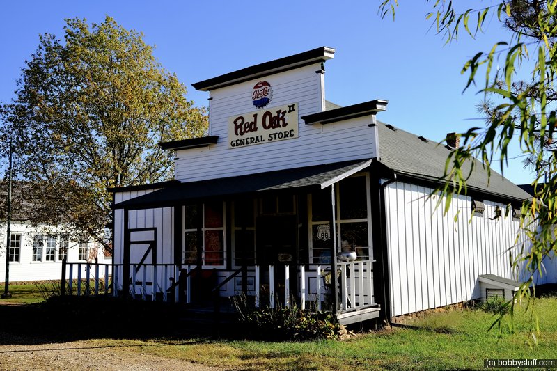
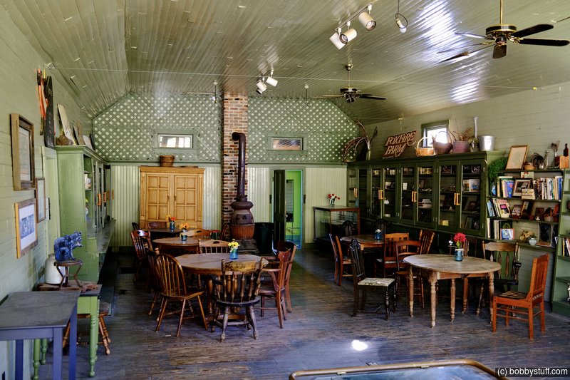
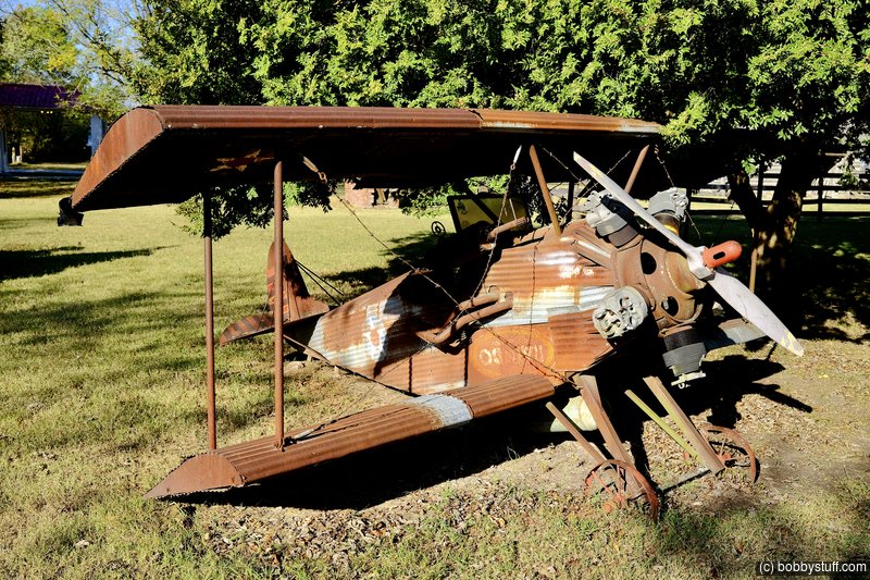
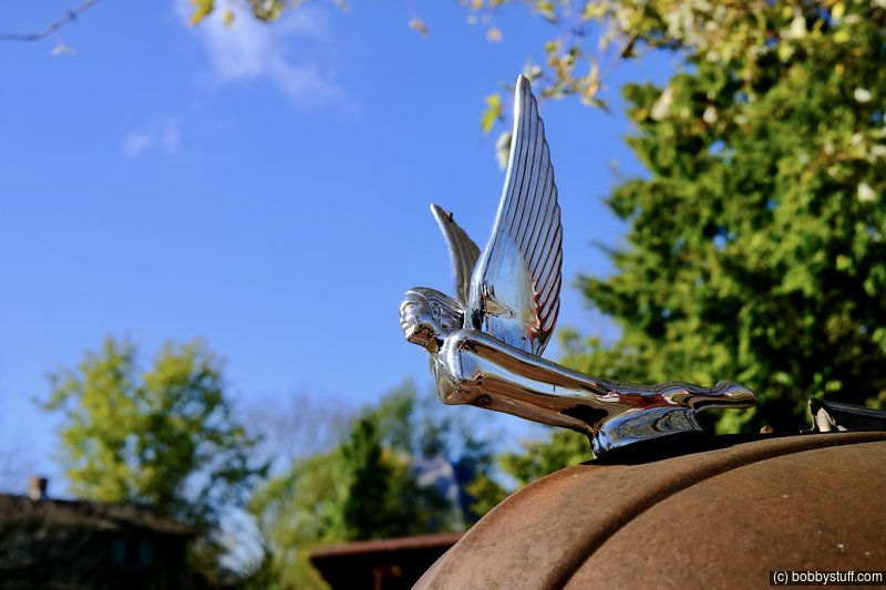
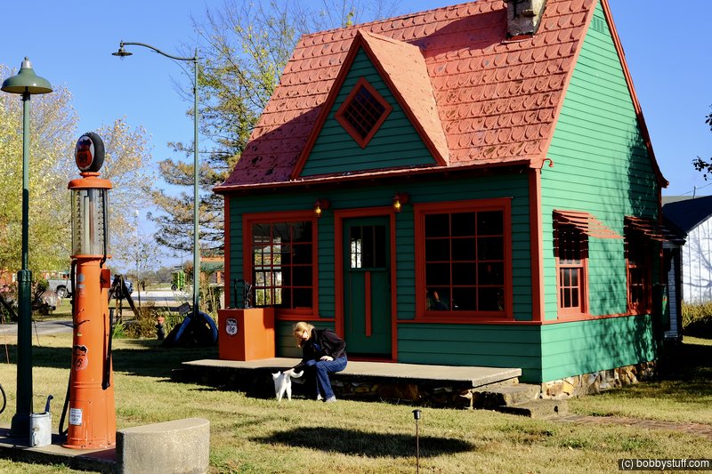
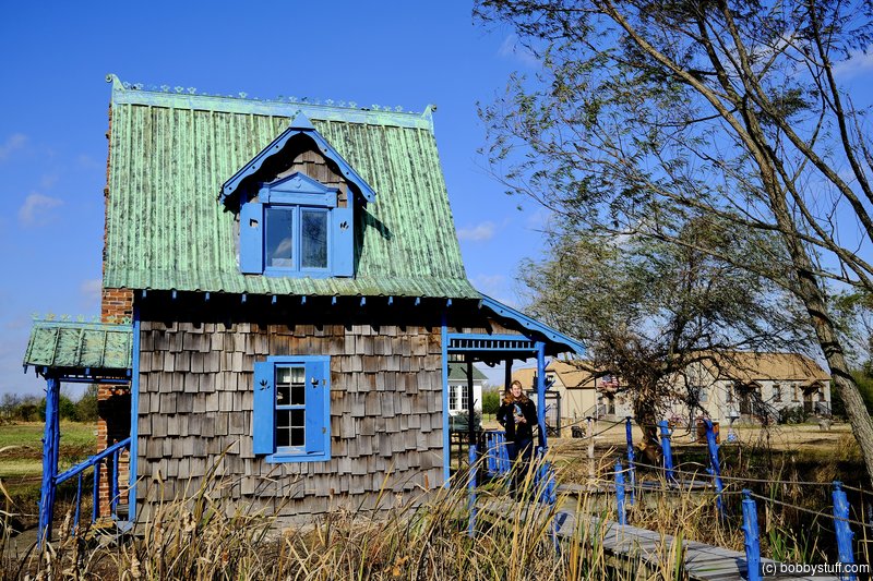
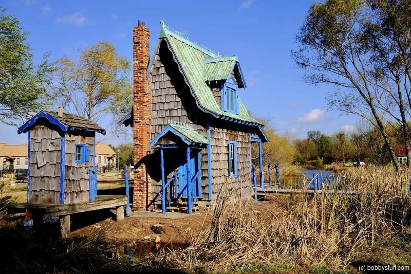
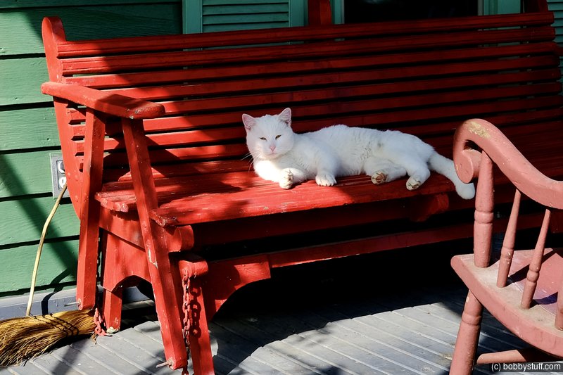
Red Oak II, Carthage MO
View a list of places like this or a map.I knew I would get some brownie points with Laurie for this stop. She loved it. From the art studio to the community white cat. She talked to the wife and she said her husband is having health issues. I fear that unless someone with a passion for the place takes over, it will begin to deteriorate.
The owner grew up in Red Oak. He moved all the buildings from other places to his farm and called it Red Oak II. Check out their website for more details.
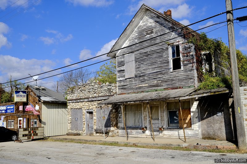
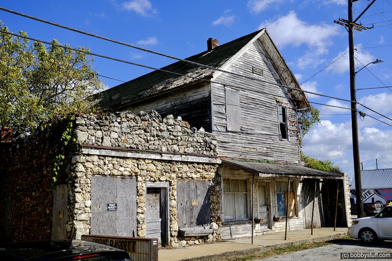
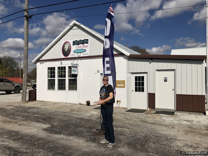
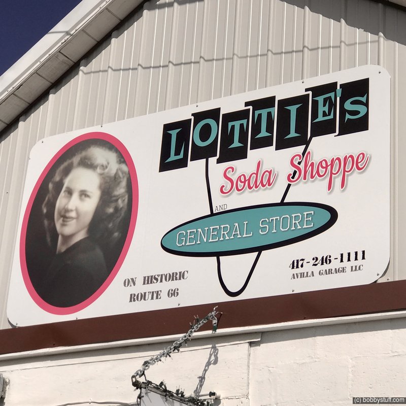
Avilla MO
View a list of places like this or a map.Ghost Towns of Route 66 by Jim Hinkley talks about the Civil War history of the town. Confederate raiders under the leadership of William T. "Bloody Bill" Anderson attacked the town on March 8, 1862. The town fought them off and escaped major damage. In late summer 1863 the Union Army took possession of the area and remained through the war.
Avilla became a boomtown at the center of postwar reconstruction. By the early 1870's, the town supported boot stores and a cobbler, several dry goods stores, grocers, livery stables, a drugstore, doctors' offices an several attorneys. The town also had a school, three churches and Odd Fellows Lodge and a Freemasons Lodge.
OnlyInOurState.com says that although Avilla has a population of 100 or so residents, it is considered one of the "living ghost towns of Historic Route 66." This rural village in Jasper County was founded in 1856, and is the fourth oldest settlement in the county.
The decline of Avilla started after World War II when people began moving to larger industrial cities for job opportunities. Then in the 1960s Route 66 was bypassed with I-44 and the town lost much of its commerce due to the diverted traffic. The remaining businesses had either failed, closed or relocated by the 1970s. Then a large fire in 1971 at the Avilla lumberyard destroyed several of the buildings including most of the lumber company. Although the lumberyard was rebuilt, the town continued to decline, and has never really rebounded completely. Now all that remains are vacant lots, abandoned buildings, and a few remaining buildings that are still being used.
The 1915 Bank of Avilla served the town for three decades. During the Great Depression, the notorious "Irish O'Malley Gang" robbed the bank and kidnapped the cashier. Although no longer a bank, the historic building has been utilized as the village US Post Office since 1952 and stands as a local cultural icon.
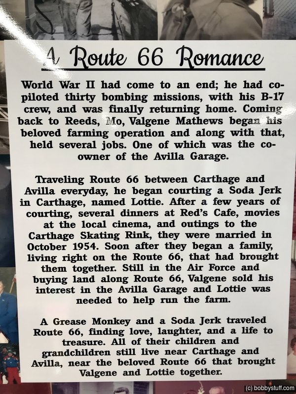
We loved this place. We stumbled into Lottie's Soda Shoppe and had a hoot. You can read about that experience here.
Laurie
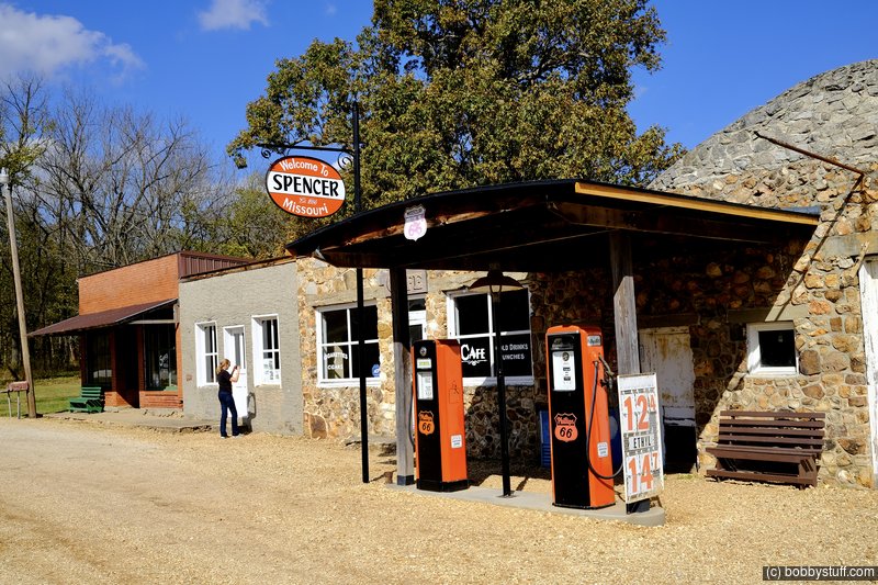
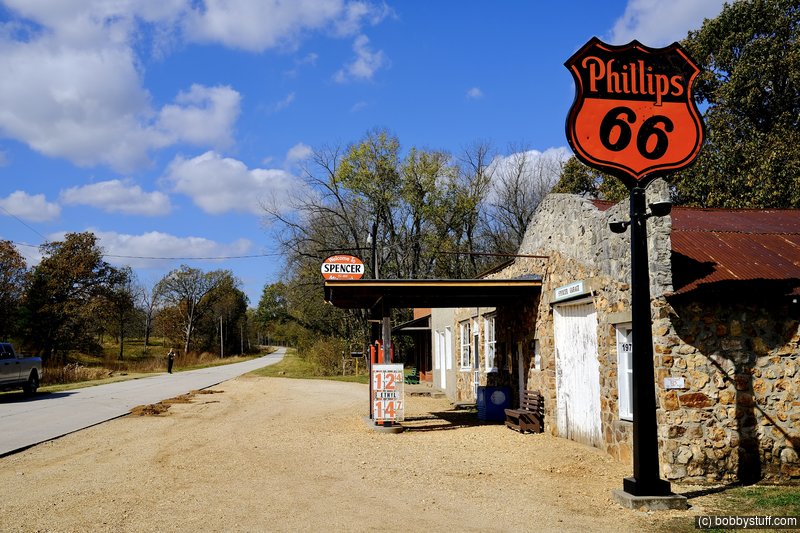
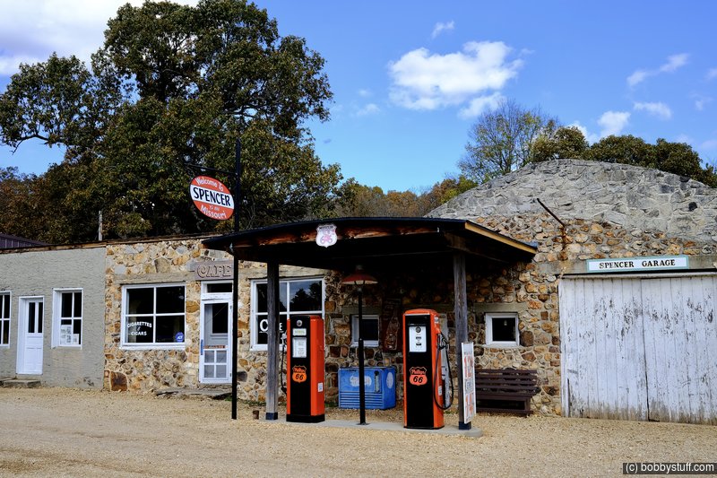
Store, Garage, Service Station, Cafe and Barbershop, Spencer MO
View a list of places like this or a map.theroute-66.com
Spencer is known for the classic 1930 Spencer Store, Spencer Garage and Service Station and Spencer Cafe & Barbershop.
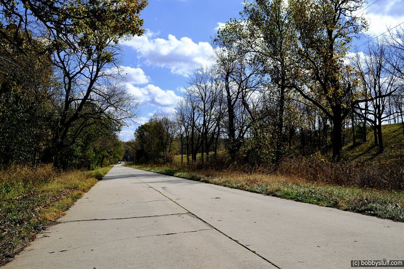
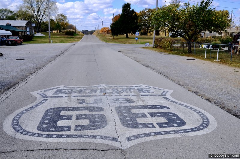
Original 1926 alignment: The concrete roadbed of US 66 which passes through Spencer is one of the few remaining segments of "original highway surface" on Route 66.
Spencer Store
This is the westernmost building of the compound. It was built around 1930 in brick, with a rectangular plan and a flat roof. It served as a grocery store ran by S.L Casey. He built it to replace the old one, which had shut down in the mid 1910s.
Spencer Cafe & Barbershop
Contiguous to the old store is the middle building of the complex. Also built ca. 1930, it has a main entrance door flanked by two windows. It has stuccoed walls.
It served as a café and barber shop, and was not ran by the Caseys, instead at one time Arthur Martin was the barber.
Spencer Garage and Service Station
This was the largest building, located at the eastern tip of the complex. It has three rooms and was built with sandstone rubble. Notice its rounded parapet (which conceals the rounded garage roof) and the double doors.
The gas station was originally a Tydol station. Later is switched over to Phillips 66.
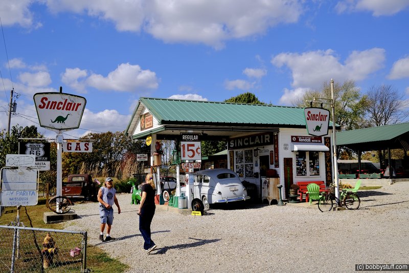
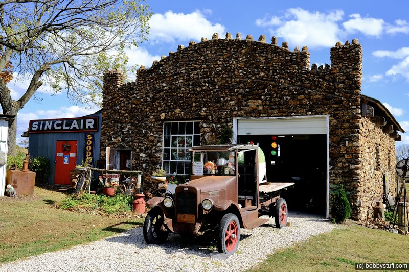
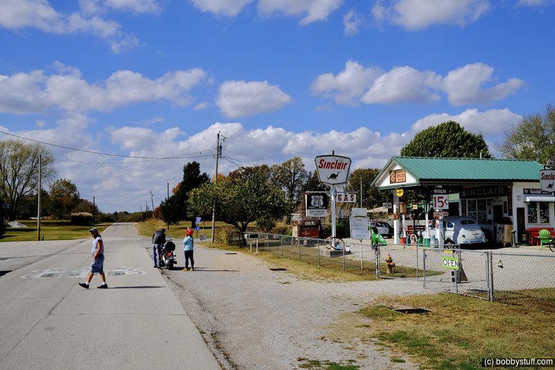
Gay Parita Service Station, Paris Springs Junction MO
View a list of places like this or a map.theroute-66.com
Also known as Gary's Gay Parita or Gay Parita Sinclair, this is one of Route's 66 major attractions in Missouri.
Gay and Fred Mason opened the service station in 1930, they also ran the Gay Parita Store.
Gay Mason died in 1953 and Fred operated it until it burned down in 1955.
Almost half a century later, Gary Turner (1944 - 2015) purchased the land when he retired and painstakingly rebuilt the gas station, re-creating in all details a 1930s service station.
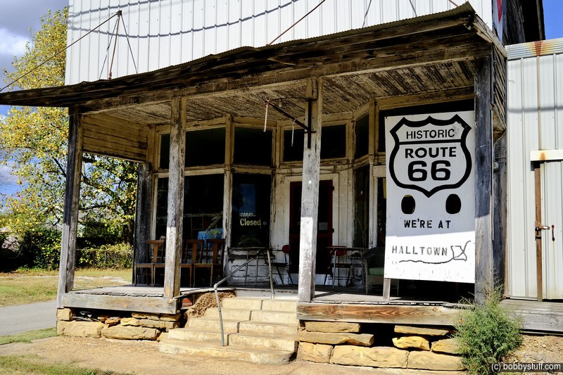
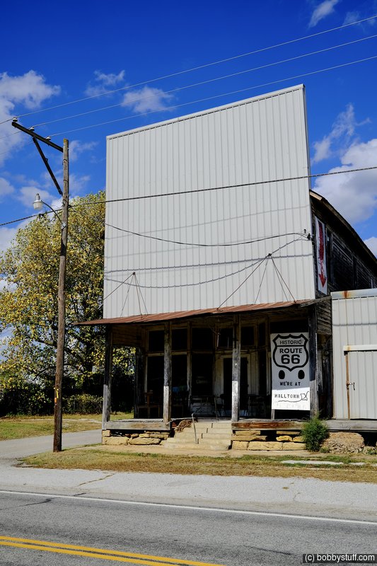
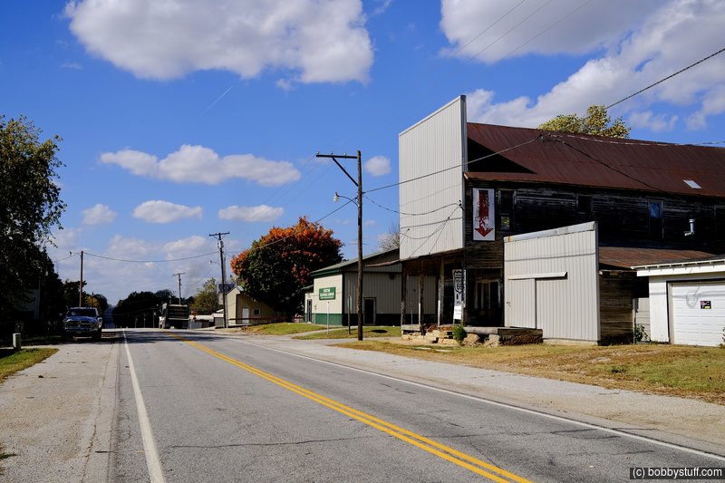
Whitehall Mercantile, Halltown MO
View a list of places like this or a map.theroute-66.com
The IOOF (Independent Order of Odd Fellows) Lodge also known now as Whitehall Mercantile, an antique shop, is a two-story wood frame building in Victorian style built ca. 1900. It has a very steep pitched roof behind a false front wall facing the street.
Originally it served as a grocery store and the IOOF lodge held its meetings on the second floor. The false front has been modernized -now sheet metal, formerly it was built in wood.
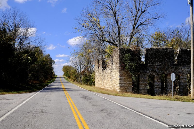
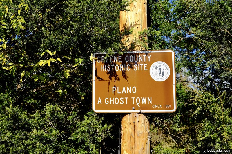
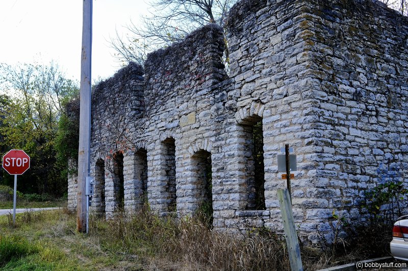
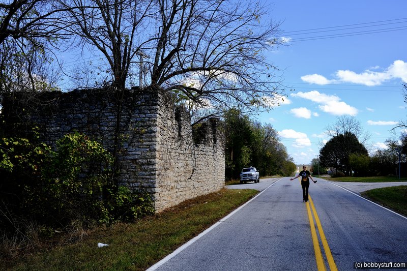
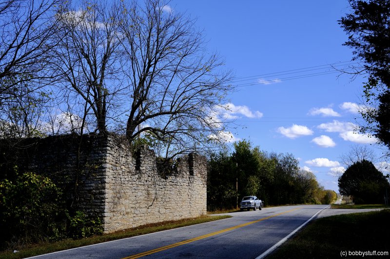
General Store, Plano MO
View a list of places like this or a map.theroute-66.com
This two story sandstone building overgrown with ivy is said to be the ruins of a casket factory or a mortuary. But, that is a myth: the place was actually a General Store.
The building dates back to 1902 and is the store owned by Alfred Jackson.
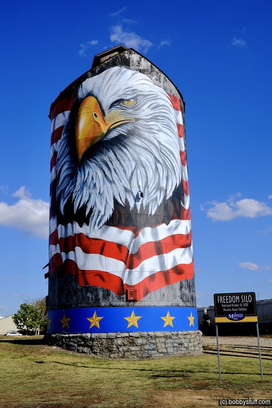
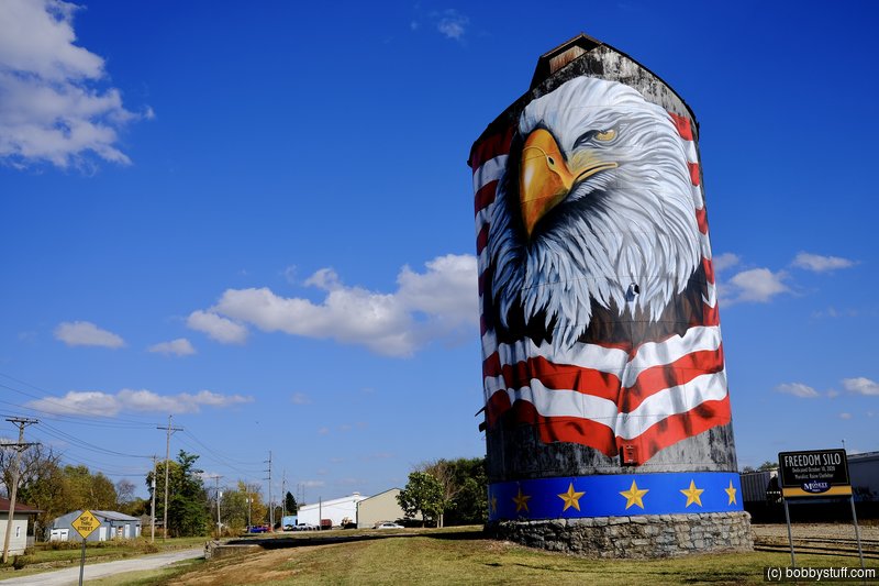
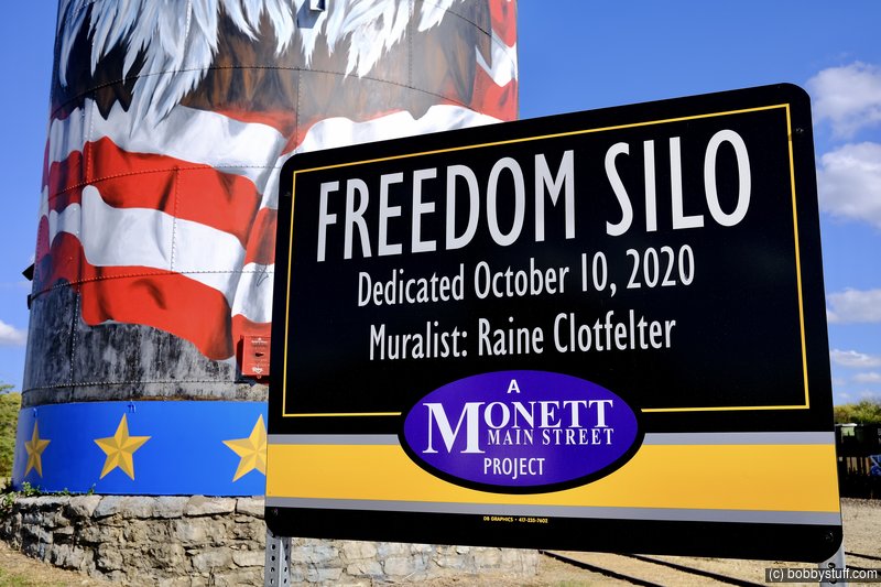
 Freedom Silo, Monett MO
View a list of places like this or a map.This was a lucky find. Laurie saw this on her Facebook page from a friend while we were driving I-44 back to the camper. I checked the GPS and the exit was just a couple of minutes ahead. What timing!
This is not a Route 66 attraction but it was awesome. The dedication was just a few days before we visited.