Route 66 Carthage MO South to Miami OK
| Start Weather: | At 6:00 AM CDT the temperature was 51.8° with 92% humidity. The conditions were rain with a wind speed of 12.8 MPH and wind gusts of 19.2 MPH. |
| End Weather: | At 6:00 PM CDT the temperature was 45.6° with 78% humidity. The conditions were mostly cloudy with a wind speed of 13.5 MPH and wind gusts of 23.3 MPH. |
| Sun Rise: | 7:35 AM CDT |
| Sun Set: | 6:31 PM CDT |
Table of Contents

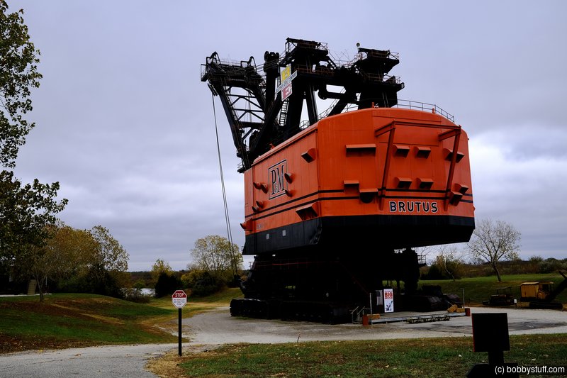
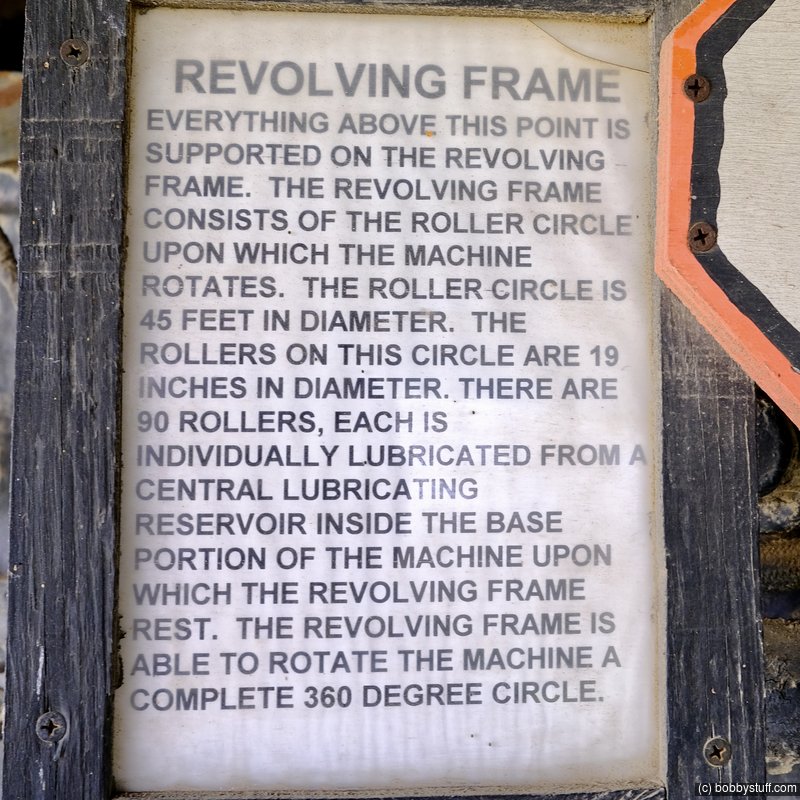
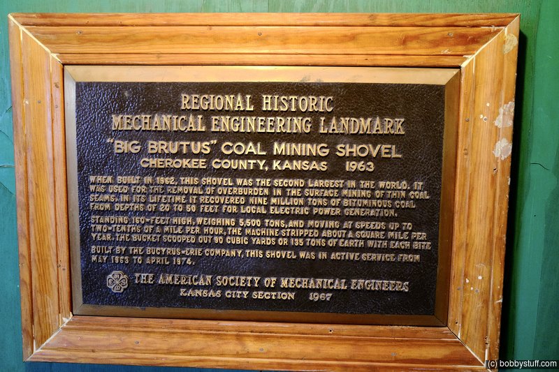
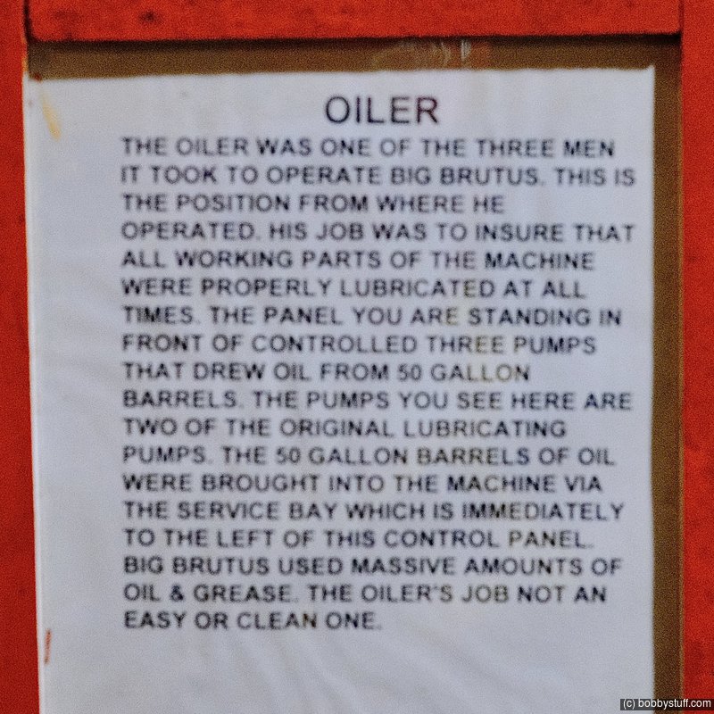
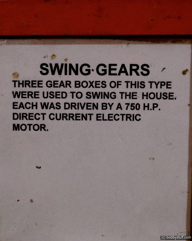
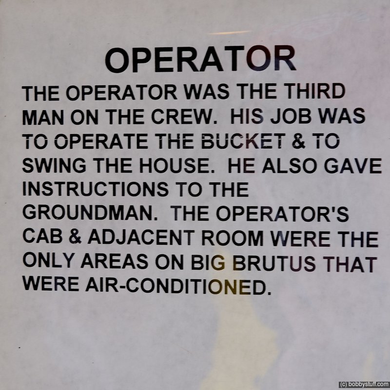
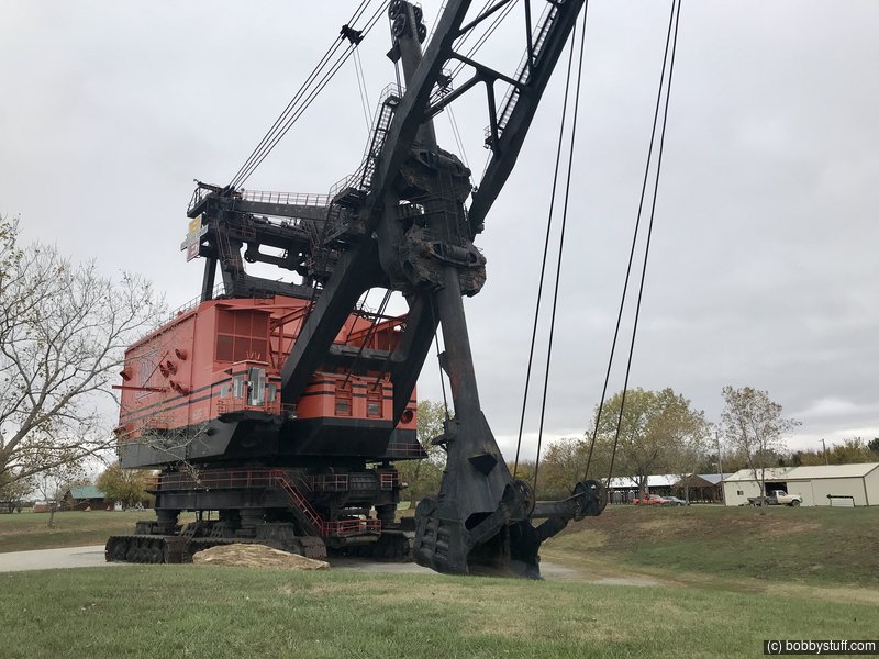
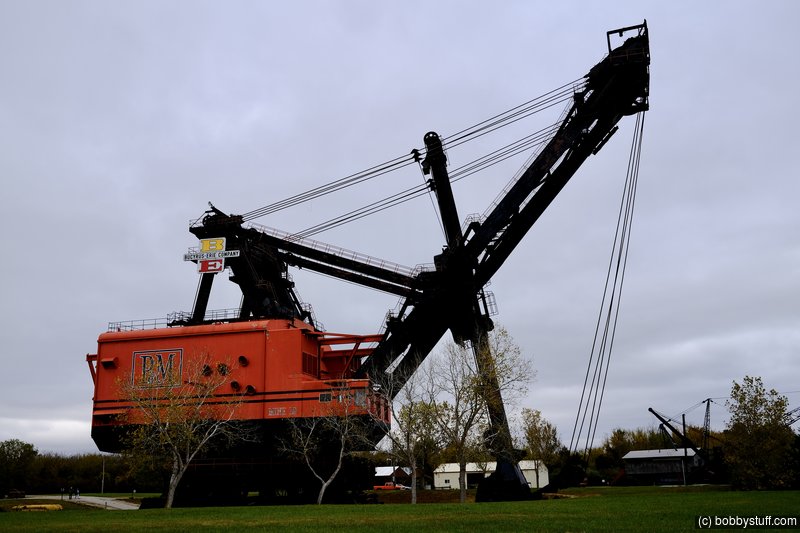
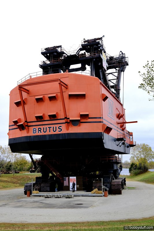
 Big Brutus, West Mineral KS
View a list of places like this or a map.bigbrutus.org
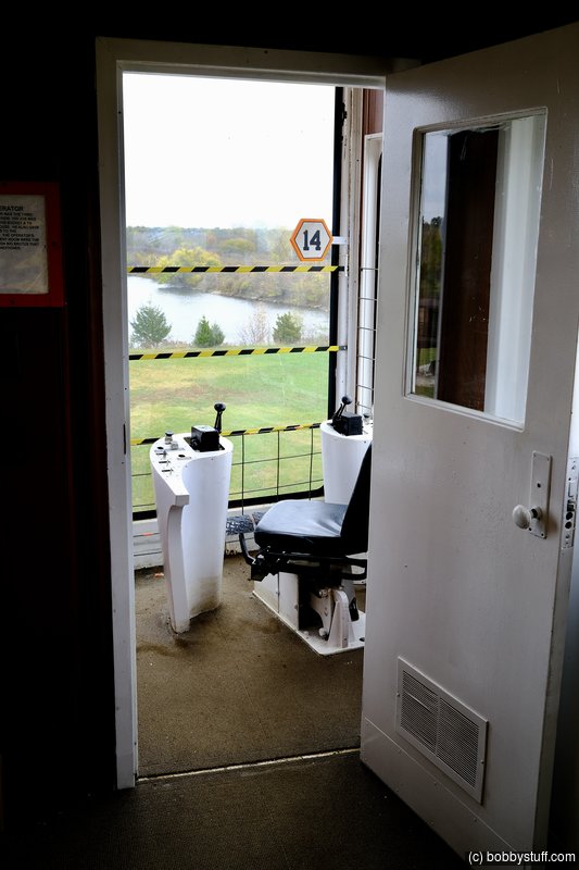
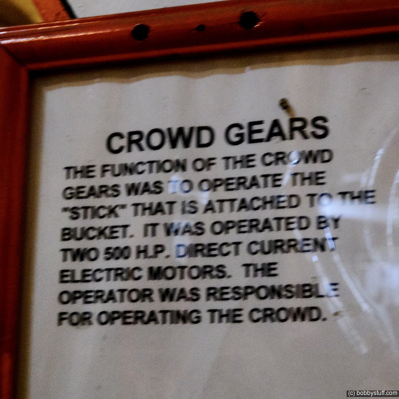
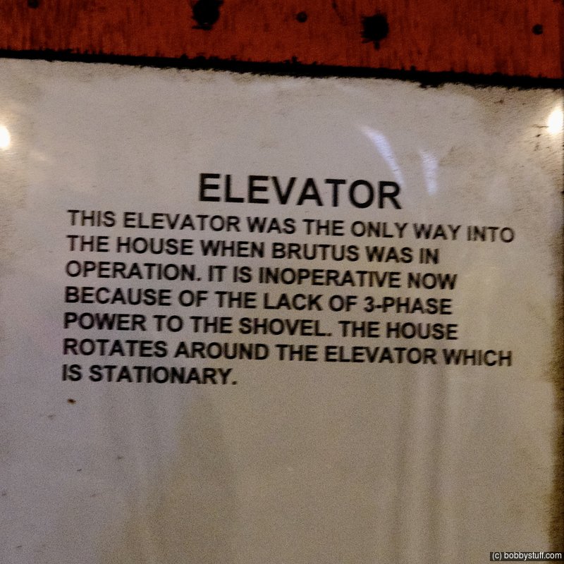
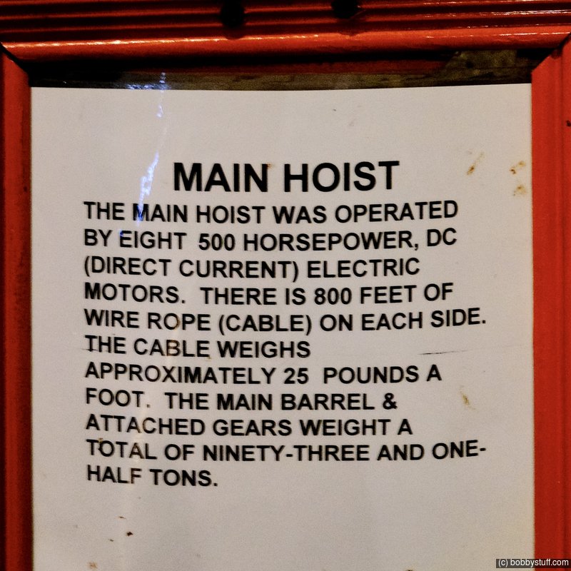
Big Brutus put the oooohs and aaahs in the backyard of the Heartlands!!! Miles before you reach this retired giant - you can see it on the horizon south of West Mineral, Kansas. Standing beside it makes one aware of how fragile he or she is.
The statistics give the hard cold picture -
Read more about Big Brutus on their website.
- Bucyrus Erie model 1850B
- largest electric shovel in the world
- 16 stories tall (160 feet)
- weight 11 million pounds
- boom 150 feet long
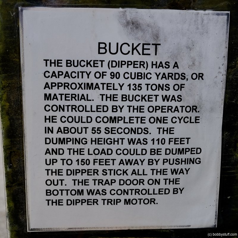
- dipper capacity 90 cu. yds (by heaping, 150 tons - enough to fill three railroad cars.)
- maximum speed .22 MPH
- cost $6.5 million (in 1962)

 Video
Video
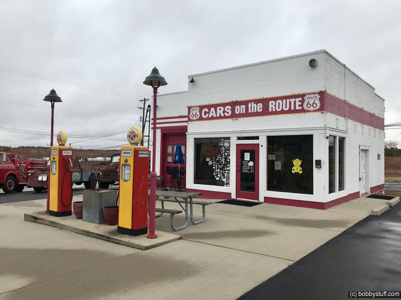
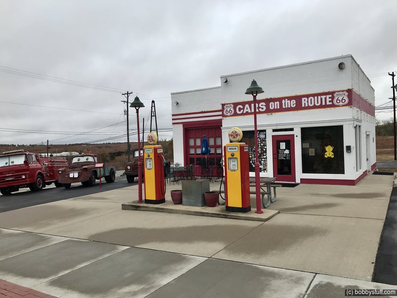
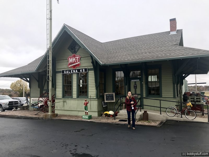
 Old Kan-O-Tex Service Station, Galena KS
View a list of places like this or a map.theroute-66.com
The service station dates back to 1934. It sold a regional brand of gasoline in the states of Kansas, Oklahoma and Texas, and this gave it its name: Kan-O-Tex. The brand's logo was a sunflower set behind a five-pointed star. The company is now defunct.
It was previously known as "Little's Service Station, "4 Women on the Route and now "Cars on the Route", due to the boom truck that inspired a character in the movie Cars.
It was built on the site of the Banks Hotel, on the Main Street in Galena (at that time it was U.S. Route 66). A few years later, a repair shop and garage were added.
The new four-lane US 66 highway moved to 7th St. in 1961, leaving the service station far from the flow of travelers. When I-44 bypassed the town (and Kansas) it went out of business until it was restored in 2007.
The restored site has a roadside café and a souvenir shop. It still has the facade and gas pumps but includes a diner which the original did not have.
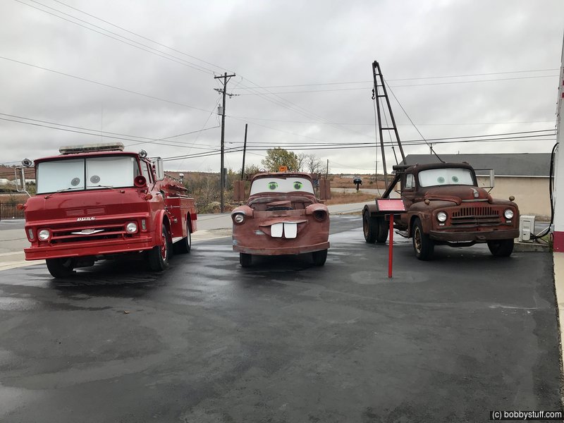
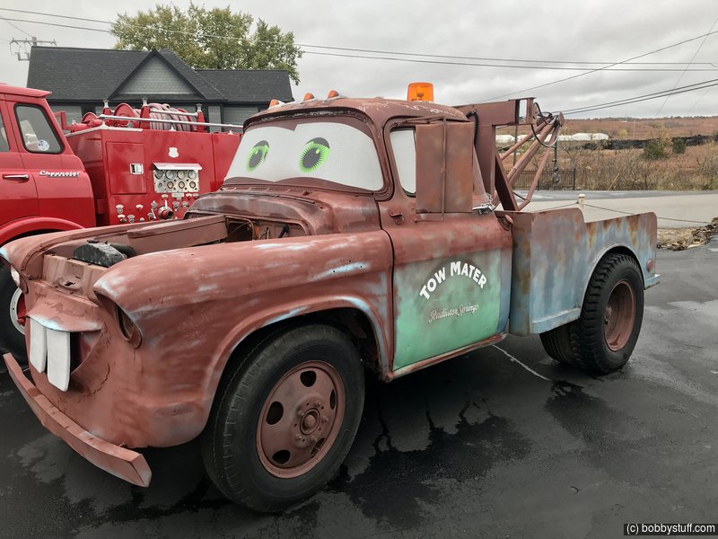
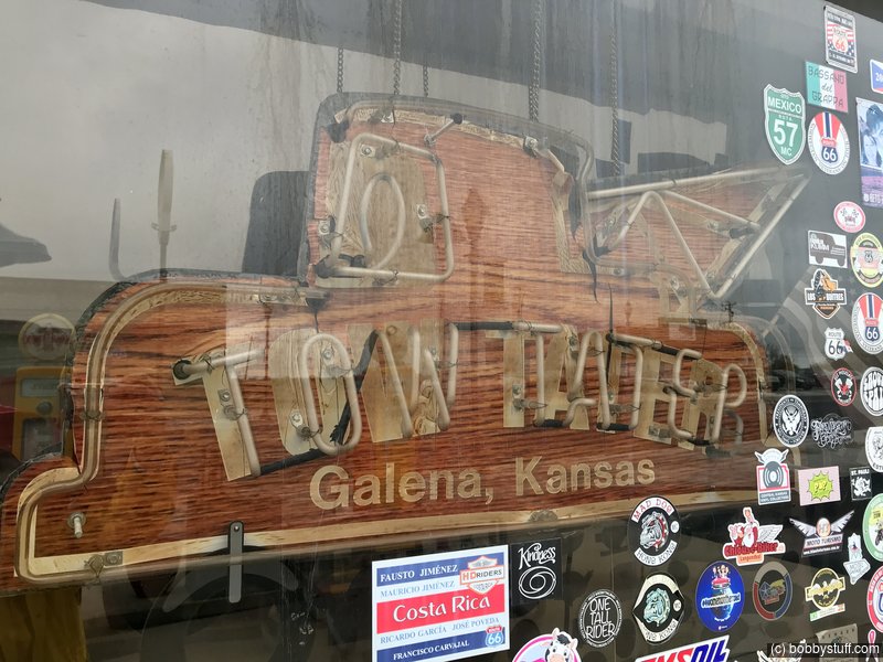
Cars Movie character "Tow Mater"
The tow truck in Pixar's animated movie Cars, "Tow Mater" was inspired by a truck which can be seen next to the service station.
The truck (a boom-truck, which was used to lift gear from the mine shafts near Galena), was an L-series International Harvester 1951 model truck.
This series of trucks was introduced in 1949 and replaced in 1952 by the R Series. To avoid infringing Disney / Pixar trademarks, the original truck is named "Tater".
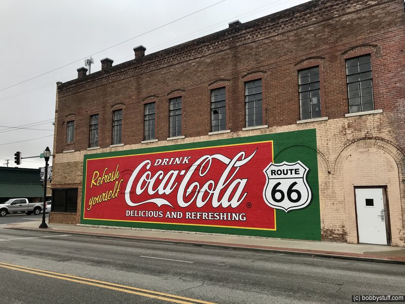
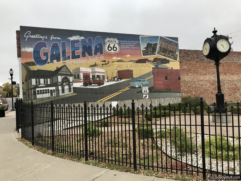
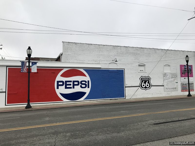
Murals in Galena KS
View a list of places like this or a map.While looking at Route 66 sites using Google Street View, I noticed something was being painted on this building in Galena Kansas. I made a note to check it out and found it was a mural. The town also has a small park with a mural.
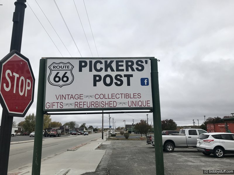
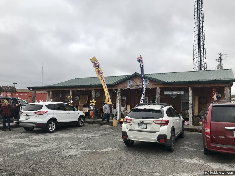
Laurie bought some things from the Pickers' Post and really enjoyed talking with the owners.
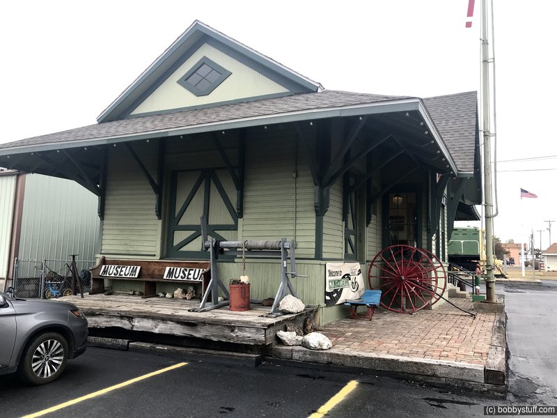
Galena Mining and Historical Museum, Galena TX
View a list of places like this or a map.galenamuseum.org
Although the Galena Mining & Historical Museum is the result of numerous individuals who assisted in preserving the history of Galena and the mining industry that supported Galena for decades, its origin came to be due to the efforts of one resident in particular, Howard "Pappy" Litch, whose expansive collection of mining tools, equipment, ore samples and hundreds of photographs became the museum's first collections.
Housed in the old Missouri-Kansas-Texas train depot, the Galena Mining & Historical Museum contains items of local history and numerous artifacts from the days of lead and zinc mining. Visitors will discover Galena's amazing comeback story -how more than 1,200 acres of mining wastes had been cleaned up by 2007 and how a series of road trips by Pixar animators led to the discovery of one their most popular and beloved characters making Galena one of the '˜must see' destinations for international Route 66 travelers.
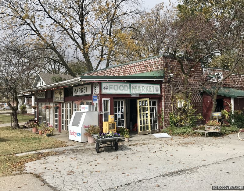
Williams' Store, Riverton KS
View a list of places like this or a map.nps.gov
Following service duty in World War I, Mr. Leo Williams and his wife, Lora, opened a small diner and garage on the eastern edge of Riverton, Kansas. Mr. Williams worked at the Empire District Electric Plant across the street while his wife served lunches and sold groceries. After a tornado destroyed the building in 1923, Mr. Williams built the current one-story vernacular building on an adjacent lot. The new Williams' Store opened in 1925 with a small apartment in the west half for the Williams family.
Like most businesses in the area, the Williams' Store catered primarily to local customers but also played an important role for travelers on Route 66. Business prospered after it was featured as an official stop on a Route 66 map series in the 1930s and 40s. Travelers would stop to enjoy a cold slice of watermelon, have a famous barbecue sandwich, use the facilities, or get directions. Patrons also bought shoes and clothes, as well as food staples such as ice, milk, eggs, bread, fresh meat, canned goods, and penny candy. Stores like this filled an important niche for travelers unable to afford café and restaurant prices.
The Williams family sold the store in 1973 to Joe and Isabell Eisler, whose nephew, Scott Nelson, now runs the business as a market, deli, general store, and Route 66 souvenir shop. The one-story red brick building has changed little over its 80 years of operation, still retaining the glass-enclosed porch, the wooden shelves, the rear deli counter, and the interior pressed-tin ceiling. It was listed in the National Register of Historic Places in 2003 and received a National Park Service Route 66 Corridor Preservation Program Cost-Share Grant award in 2005 for repairs to the roof and electrical system upgrades.
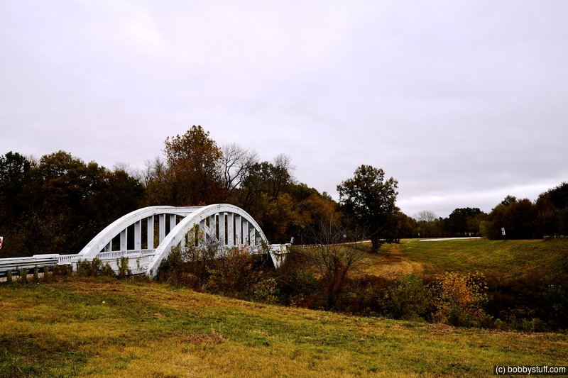
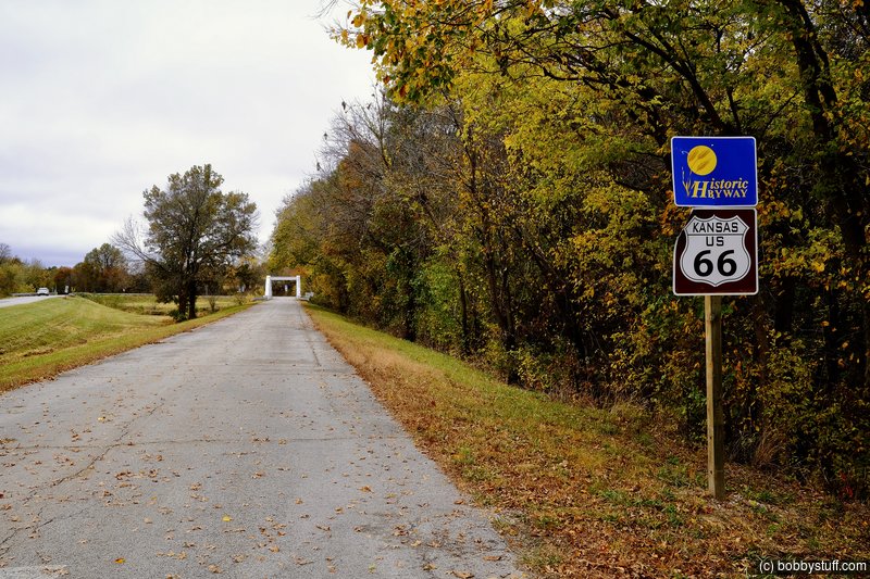
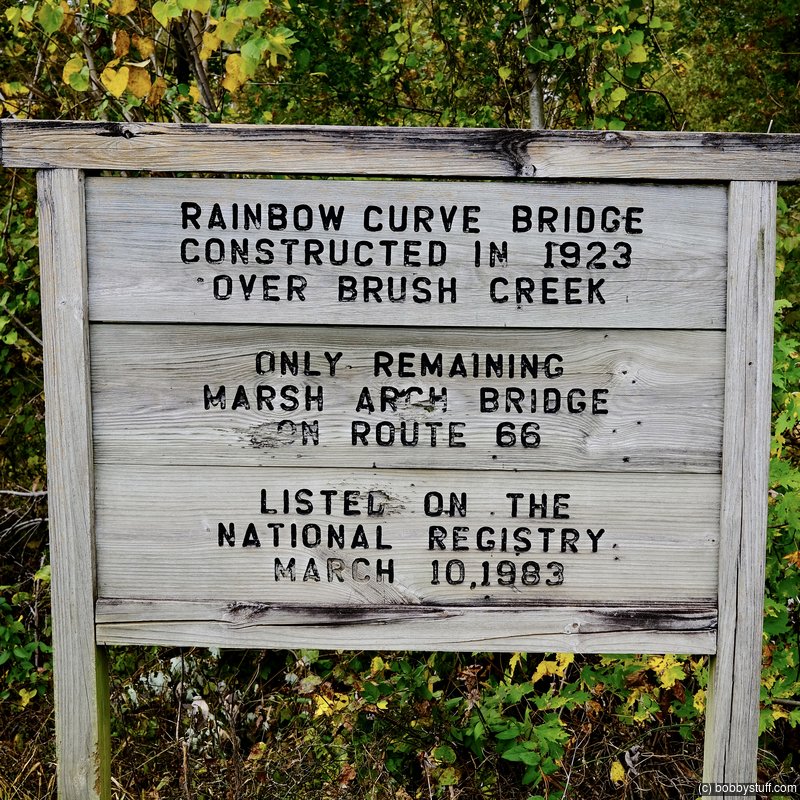
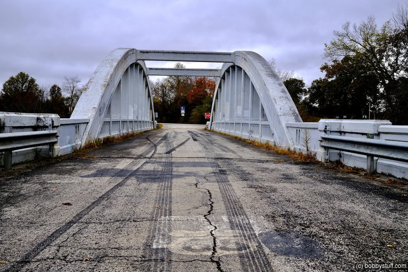
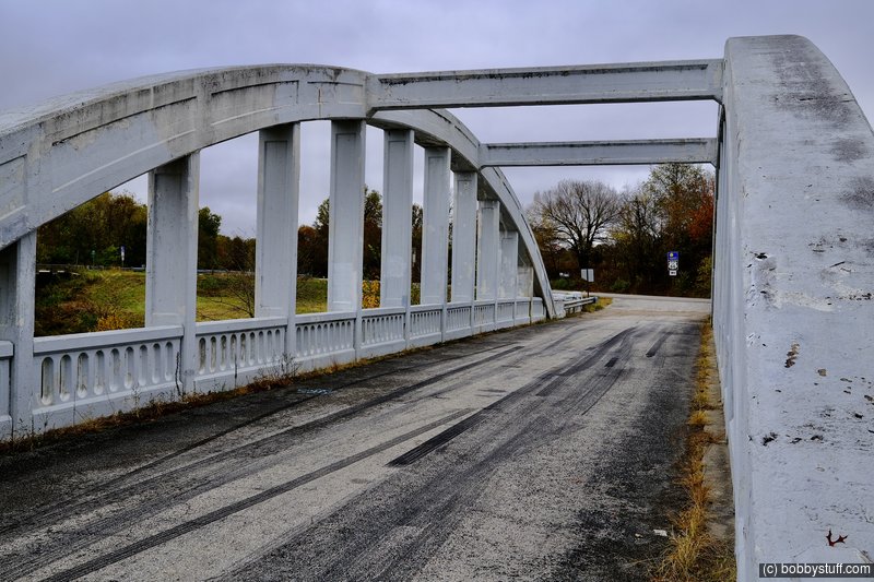
Brush Creek AKA Rainbow Bridge, Cherokee County KS
View a list of places like this or a map.nps.gov
Three and a half miles north of Baxter Springs, Kansas stands the elegant Brush Creek Bridge, the only remaining example of a fixed Marsh Rainbow Arch bridge left on Kansas Route 66. Two other examples, the Spring River and Willow Creek bridges, were dismantled in the early 1990s.
The Brush Creek Bridge, also known as the Rainbow Bridge, was part of a project in the early 1920s to connect the mining communities of Galena, Riverton, and Baxter Springs with a concrete road. The unique and graceful Rainbow Arch design was the brainchild of James Barney Marsh, a bridge designer from Iowa, who patented the concrete and steel truss design in 1912. Marsh spent the next two decades erecting approximately 70 of his Rainbow Arch bridges throughout the Midwest, most of them in Kansas, where approximately 35 still remain.
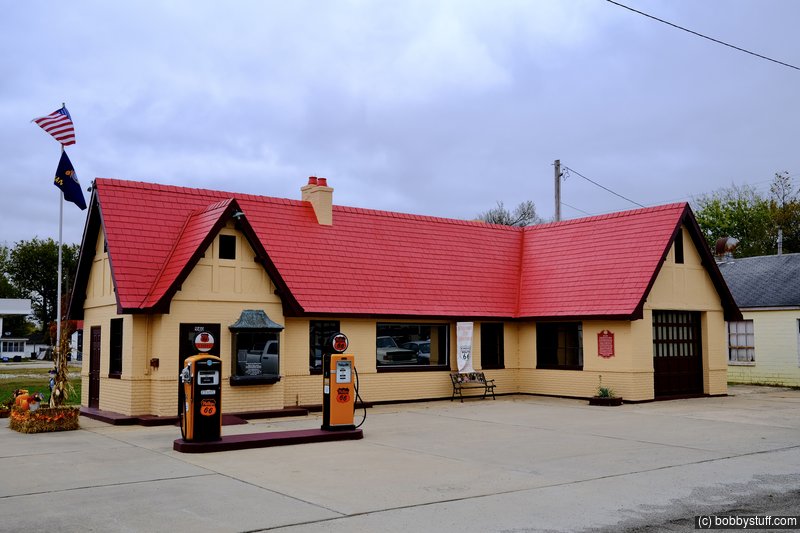
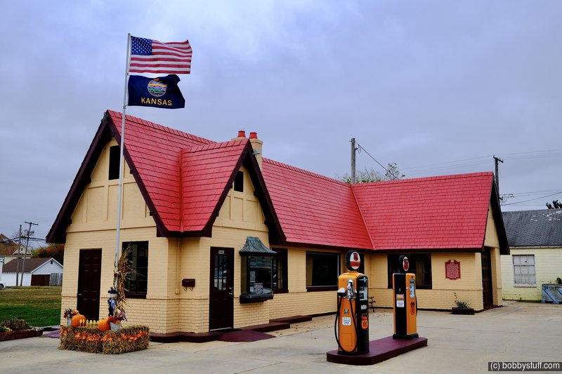
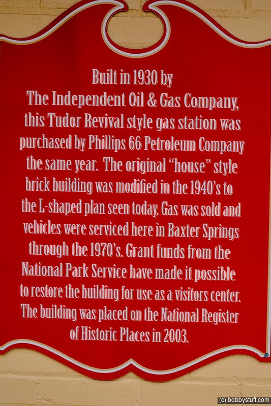
Baxter Springs Independent Oil and Gas Service Station, Baxter Springs KS
View a list of places like this or a map.nps.gov
Not even 13 miles, 12.8 miles to be exact --that's how long Route 66 is in Kansas. Despite its short length, the route passes through three towns that are rich in cowtown, mining, and route 66 history -- Galena, Riverton, and Baxter Springs. In Baxter Springs, motorists will find a bold example of its Route 66 history in the Independent Oil and Gas Service Station.
The stock market crash of 1928 and the Great Depression that followed left major oil companies in disarray. Some companies failed, and others were bought out. The survivors struggled to attract and hold customers in order to rebuild their damaged brands. In a savvy public relations move, oil companies began establishing uniform station designs that immediately identified their brand to car-driving customers. For good reason, many of these new station designs had a distinctly domestic flair. The homey, cottages designs sought to appease local customers by blending into the surrounding neighborhood and provided travelers with a sense of security and comfort during an economic era fraught with uncertainty and discomfort.
Baxter Springs has a prime example of just such an "automotive cottage." Small and square when it was built in 1930 at the north end of the Baxter Springs commercial district, the station featured brick and stucco walls, a pitched roof, a chimney, and shuttered windows. A small copper-roofed bay window was located next to the entrance, and Tudor Revival influence was apparent in the cross-timbered gables and deep eaves. In 1940, the building was enlarged without seriously disrupting the building's original plan, form, and materials. A tall, shield-shaped Phillips 66 pole sign still stands at the southwest corner of the property. The station's design clearly conveys its original use as an early service station as well as the intentional "welcome home" iconography of its owners--first Independent Oil and Gas and later Phillips Petroleum.
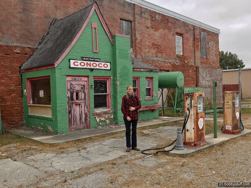
Hole in the Wall Conoco Station, Commerce OK
View a list of places like this or a map.theroute-66.com
This is a genuine relic of Route 66, a service station that was built right onto a brick wall in the late 1920s. Now known as "Allen's Conoco Fillin' Station".
It is another example of the original generation of gasoline stations that were designed to look like homes, with a cottage style: cute and homely, to reassure travelers and make them feel at home.
It was built between 1929 and 1930 by F. D. Mitchell.
The refurbished building is now a shop that sells Route 66 memorabilia and souvenirs. It was a Phillips 66 station in 1938 and was later a Beauty Shop.
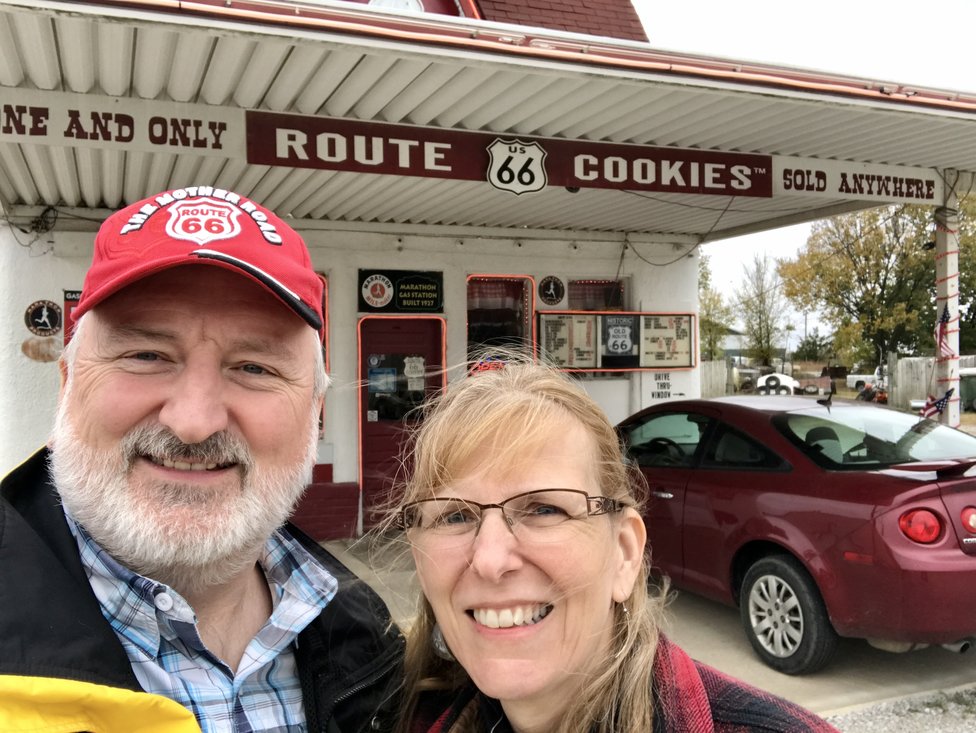
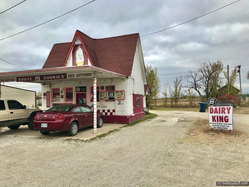
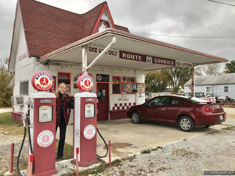
Dairy King, Commerce OK
View a list of places like this or a map.theroute-66.com
Located on the west side of Main Street, just across the road from the "Hole in the Wall" gas station.
It is a good example of a building that has been restored and converted to a new purpose while preserving its historical Route 66 vintage appearance.
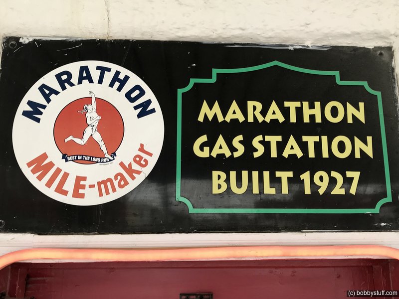
It used to be a Service Station of the Marathon Gas company. And its style is that of a cottage with a red gabled roof and a flat canopy over the area where the gas pumps once stood. A large neon light ice cream cone decorates the front sector under its roof.
It sells ice cream burgers and Route 66-shaped cookies.
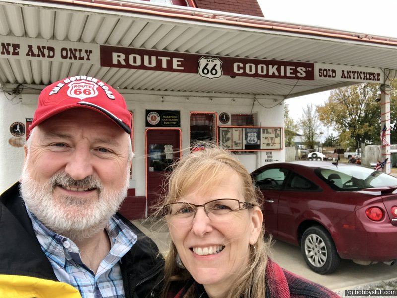
Bobby, Laurie
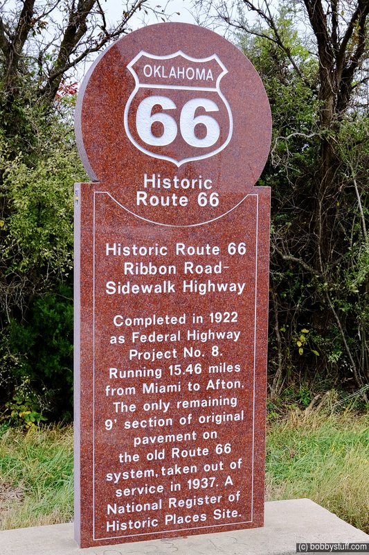
Route 66 Ribbon Road/Sidewalk Highway Landmark, Narcissa MO
View a list of places like this or a map.theroute-66.com
The famous nine-foot wide "Ribbon Road" paved between 1921 and 1922, that would become part of Route 66 in 1926 has an interesting history:
The state of Oklahoma was admitted into the United States in 1907. Its main routes of communication were the railroads. There were few roads and most of them were in poor condition.
With help and subsidies from the Federal government, Oklahoma improved its roads. Among the road building projects was one which resulted in the "Nine Foot wide Road", which originally was Oklahoma State Highway 7
It had been approved on December 8, 1918 and divided into two stages. The first one linked Miami and Narcissa, and work began in July 1919 and was completed in March 1921.
The second stage linked Narcissa to Afton and work on the roadbed began in July 1921 and was completed in February 1922.
The Committee that was organized to define the National Highway system proposed an alignment for Route 66 that incorporated pre-existing roads. The Ottawa County segment of Route66 incorporated Oklahoma State Highway 7. This was approved by the Associated Highways Association of America (AASHO) and that is how the "Sidewalk Road" became part of the brand new U.S. Highway 66 in 1926.
Only in 1935 would construction begin on a shorter and wider road between Afton and Miami. It would have gentler curves (the Ribbon-Road has six 90 ° curves) and widened shoulders. This new alignment was opened in 1937 and is still used as U.S. 60 - 59.
Legend has it that the funds were insufficient and that the engineers chose to build only one lane, nine-feet wide and pave the whole length between Miami and Afton rather than pave half the distance with a regular width road.
Actually the reasons for the unique width of this road are not clear.