
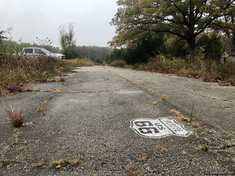
Route 66 Cuba MO to Conway MO
| Start Weather: | At 6:00 AM CDT the temperature was 44.6° with 100% humidity. The conditions were overcast with a wind speed of 4.6 MPH and wind gusts of 11.5 MPH. |
| End Weather: | At 6:00 PM CDT the temperature was 58.7° with 100% humidity. The conditions were rain with a wind speed of 6.3 MPH and wind gusts of 18.7 MPH. |
| Sun Rise: | 7:21 AM CDT |
| Sun Set: | 6:22 PM CDT |
Table of Contents
This was a 2nd day of rain and cold weather but we saw some more neat Route 66 sites in Missouri.
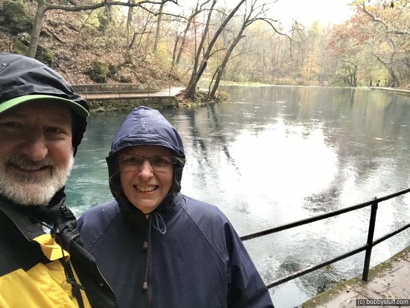
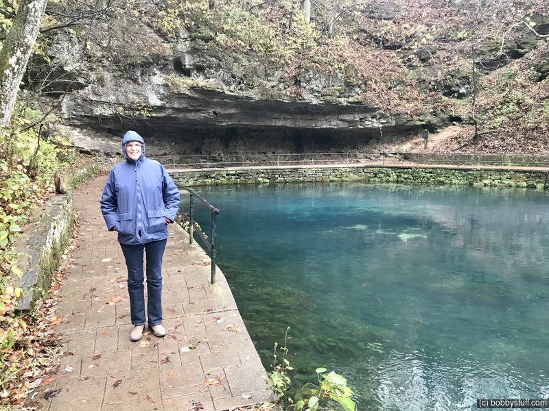
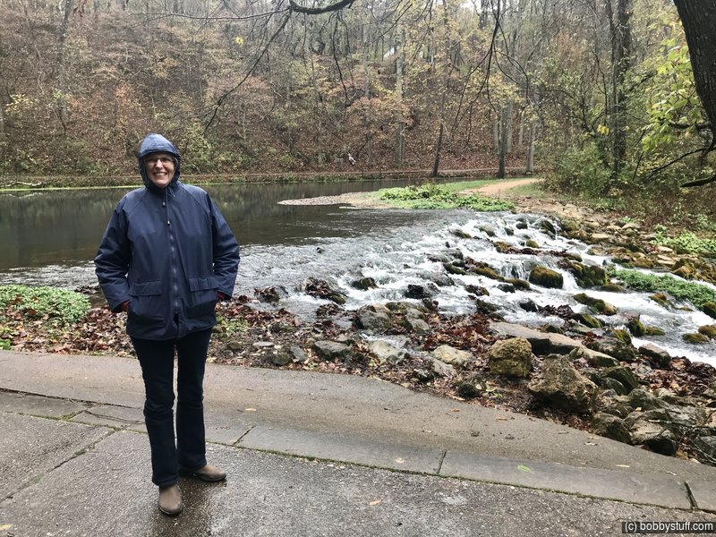
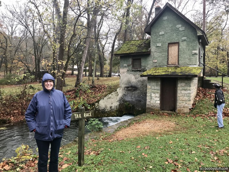
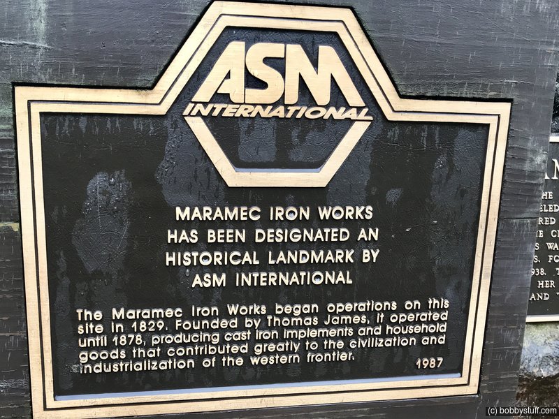
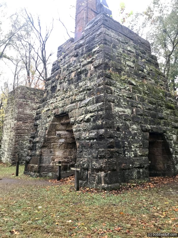
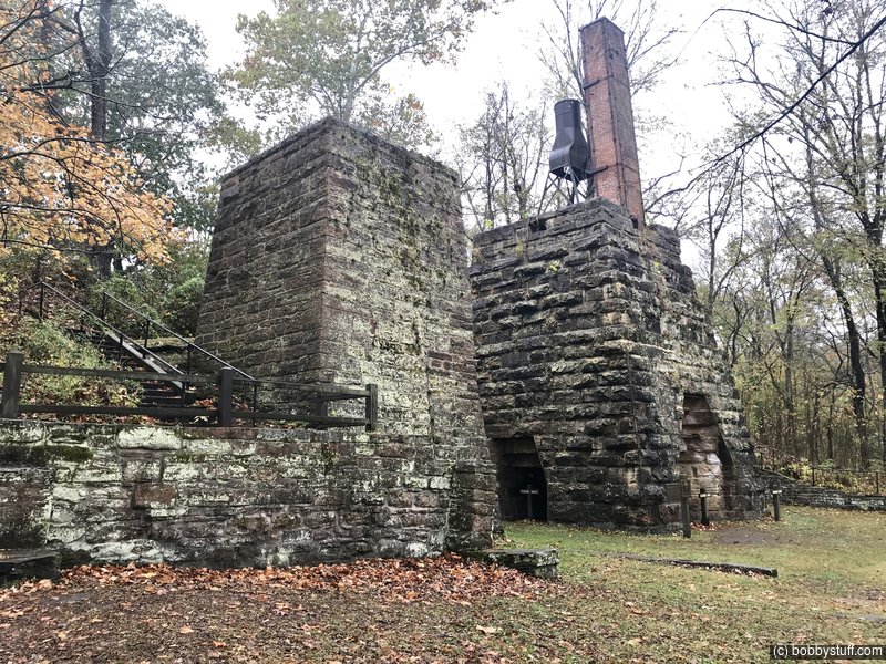
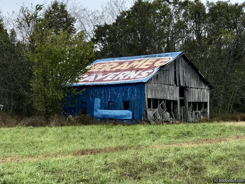
 Maramec Spring Park, St. James MO
View a list of places like this or a map.This place was nice. We would love to come back here in the summer and enjoy the cold water.
Maramec Spring Park is one of the most beautiful spots to be found in Missouri. The Park contains the fifth largest spring in the state. An average of 100 million gallons of water flows from the Spring daily. Maramec Spring Park contains 1,860 acres of forest and fields. The 200 acre public use area of the Park provides many amenities and activities for visitors such as a cafe, store, camping, wildlife viewing, fish feeding, picnicking, shelters, playgrounds and fishing. The Meramec River, a clear calm Ozark stream, flows through the park providing excellent fishing. Maramec Spring Park is privately owned and operated by The James Foundation. The James Foundation is a non-profit organization incorporated in the State of Missouri.
Bobby, Laurie
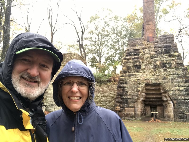
Bobby, Laurie
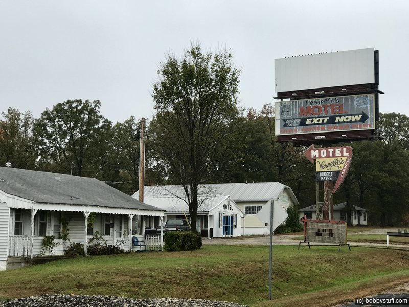
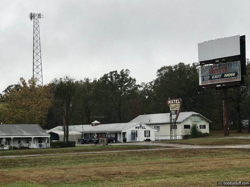
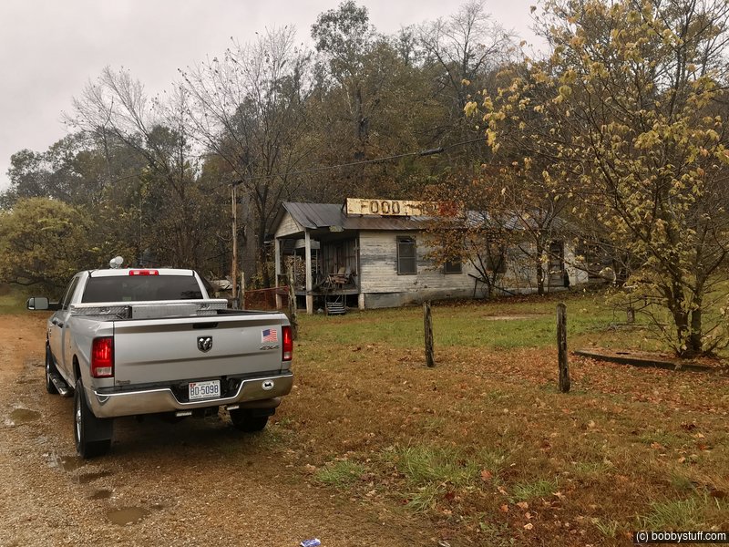
Vernelle's Motel, Newburg MO
View a list of places like this or a map.This place had no trespassing signs up so we did not get closer. The photos below are from the road.
Vernelle's was built in the late 1930s by E.P. Gasser. Originally called Gasser Tourist Court, the business -- consisting of six cabins, a filling station and a novelty shop -- changed hands in the early 1950s, when E.P. Gasser's nephew, Fred, and his wife, Vernelle, bought the property and expanded it.
The new Vernelle's, named for its proprietress, was quite a complex. Besides the motel, the property included a restaurant serving steaks, fried chicken, shrimp and other delicacies to refresh hungry travelers. At one time, there was a petting zoo on the grounds as well.
In 1957, the restaurant was torn down and the motel moved a few feet north to accommodate the widening of Route 66 to four lanes. The motel remains today, along with its original sign, which got a fresh coat of paint last year thanks to the efforts of the Route 66 preservation group Friends of the Mother Road. Next time you're in the Rolla area, keep cruising a few miles west on Route 66 to see for yourself why travelers from around the world still come to Vernelle's Motel.
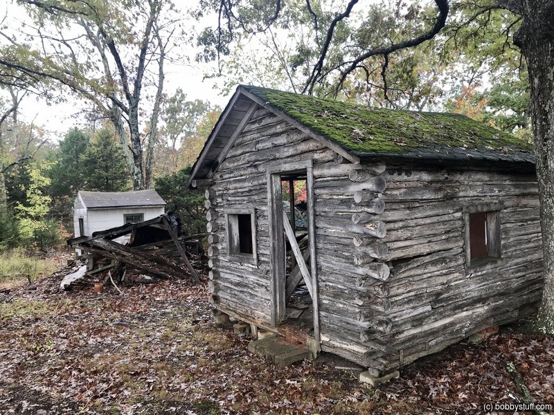
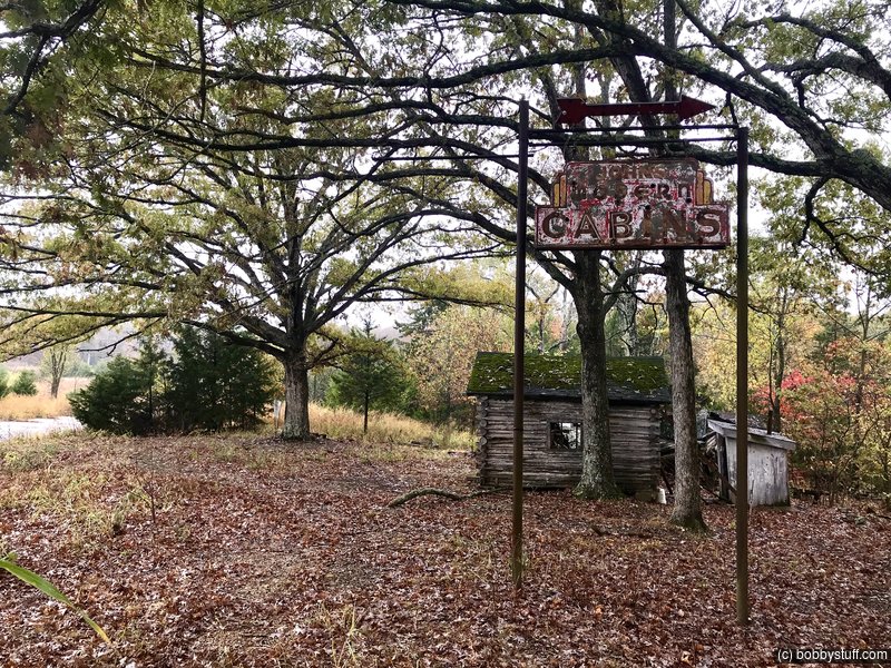
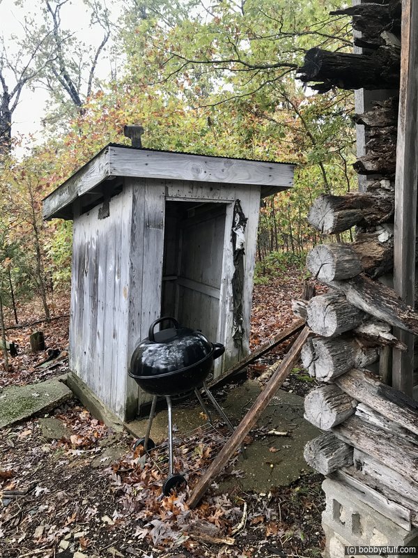
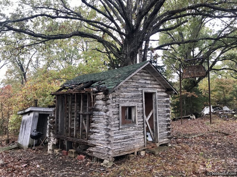
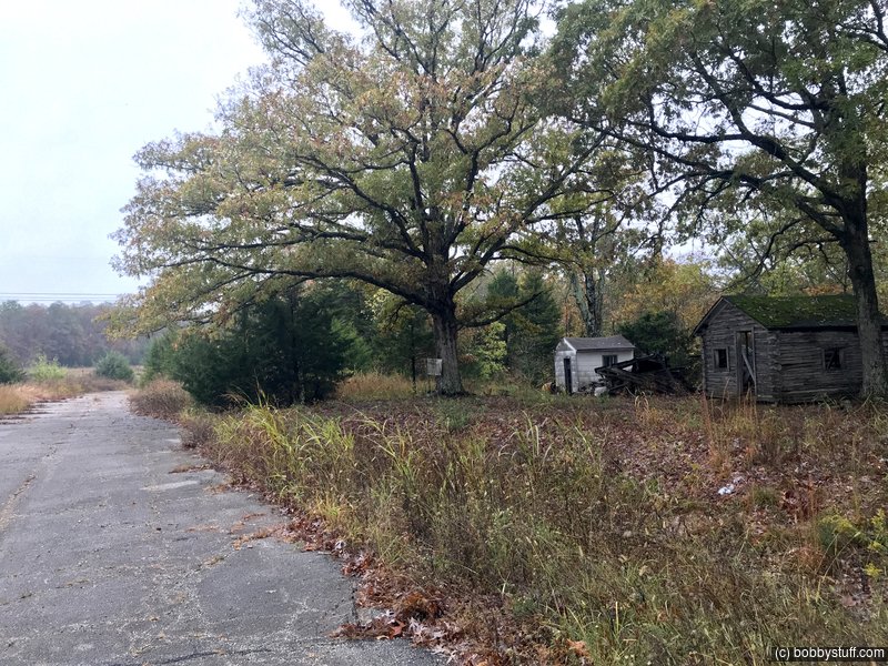
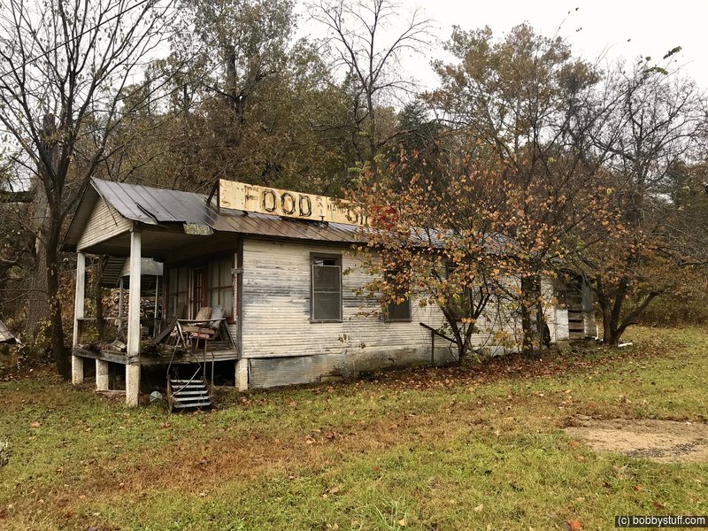
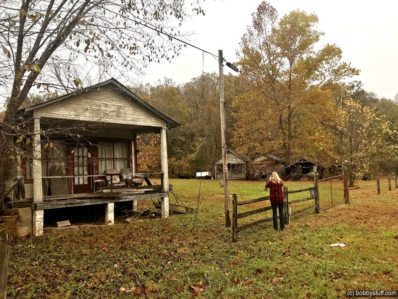
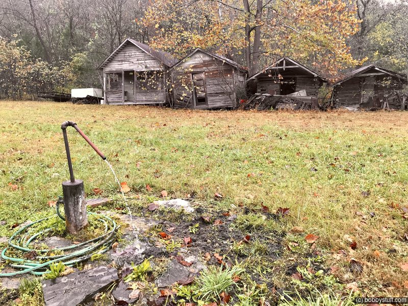
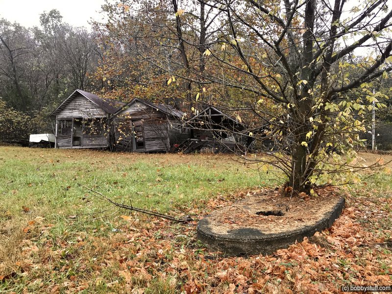
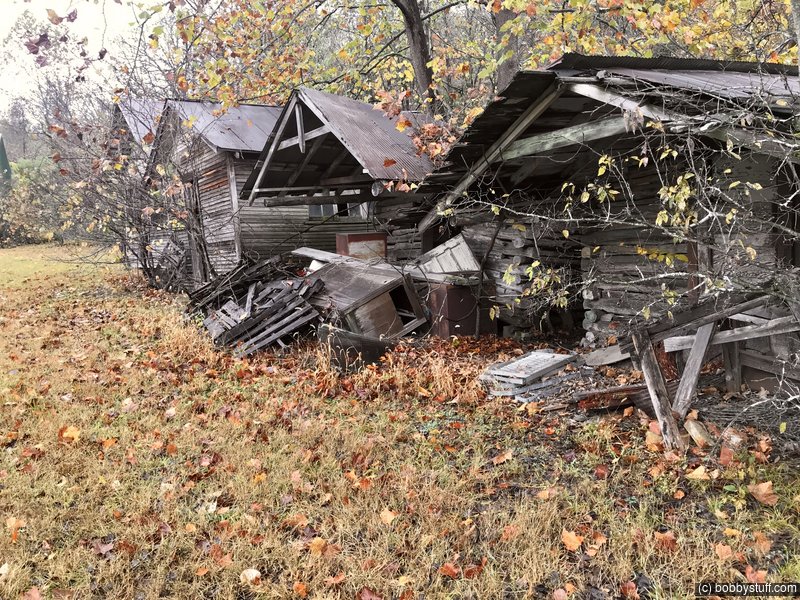
John's Modern Cabins, Newburg MO
View a list of places like this or a map.We enjoyed this place but unfortunately there will be little left in a few years.
They are private property, don't trespass. Built in 1942 it was originally known as "Bill and Bess's Tourist Camp", a primitive form of motel that predated regular motels. They sold out after WWII to John Dausch who renamed it after himself: "John's Modern Cabins" (modern but with an outhouse). The site included a store. Dausch also lost part of his land to I-44.
The cabins fell out of favor with travelers who sought better quality lodging (i.e. neighboring Vernelle's Motel), and eventually closed. Route 66 was decommissioned and I-44 replaced it, leaving the cabins on a frontage road, which became a dead end after I-44 was rerouted in 2003.
Stony Dell Resort, Jerome MO
View a list of places like this or a map.theroute-66.com
It was built next to an artesian well that provided fresh water for its pools (it was also bottled and sold at the resort's gift shop.
Apart from the swimming pool, there was dancing, tennis, and outdoor activities like fishing and boating. The site had a restaurant, service station, bus stop, and even a Justice of the Peace.
It is located on a hillside on both sides of Route 66, but only those on the western side have survived, those to the east, which included the swimming pool and park were razed when I-44 was built in 1966-67.
George Prewett and his son Vernon owned and ran the place in the 1930s, during its heyday. And from 1954 to -1967 by Fred Widener, but by the 1960s it was already ageing. Traffic still drove by, but its best days had passed. I-44's realignment in 1967 doomed it.
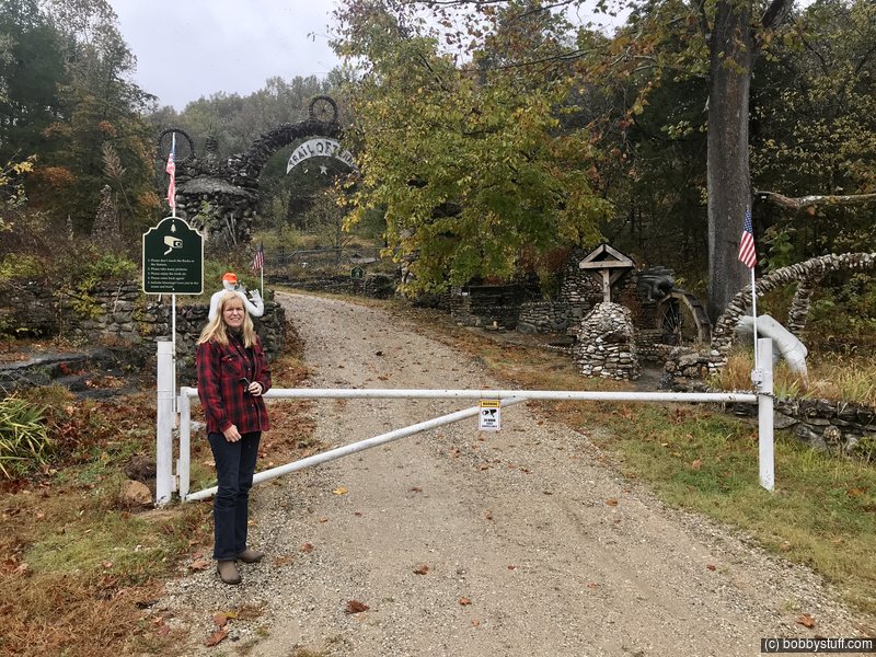
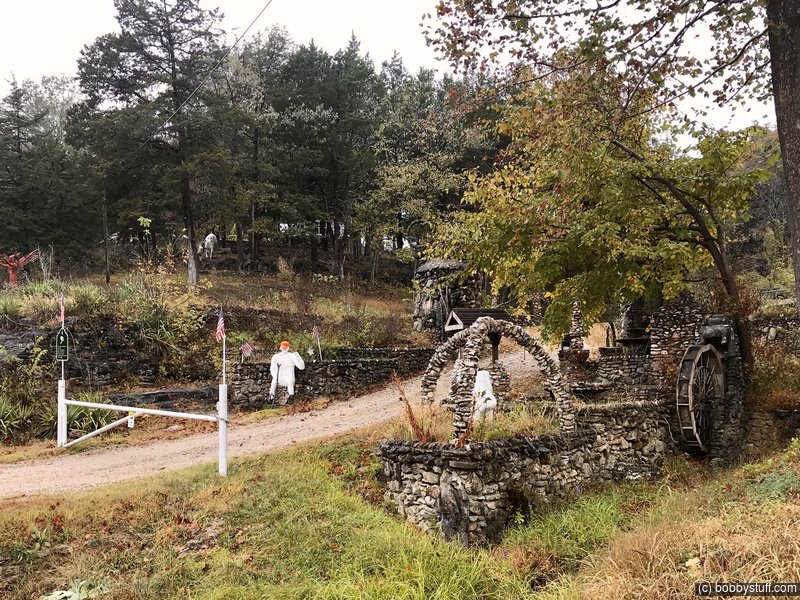
Larry Baggett's Trail of Tears Memorial, Jerome MO
View a list of places like this or a map.We wanted to walk around and see more of the memorial but a sign said it was only open on Saturday and Sunday and being private property we stayed outside the gate.
Some History on the Trail of Tears
The Indian Removal Act of 1830, signed by President Andrew Jackson defined the fate of five Indian Nations: The Seminole, Creek, Choctaw, Cherokee and Chickasaw. They were forced to relocate from their territories in the east to a new home in the "Indian Territory" (which later became Oklahoma) where they had been assigned reservations.
This forced migration with little support caused the death of thousands due to illness and starvation. The route these ill-fated Indians followed is now known as the "Trail of Tears".
The worst hit were the Cherokee who had contested the measure in court. But in 1838 they too had to march west and suffered the trek.
Larry Baggett (1925 -2003 ) purchased a plot of land on Route 66 to build a campsite but he ended up building his tribute to the Trail of Tears. There are many stone walls and rock gardens and a rough rock archway with the sign that reads "Trail of Tears",
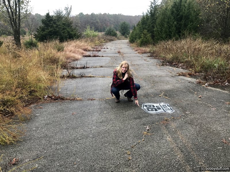
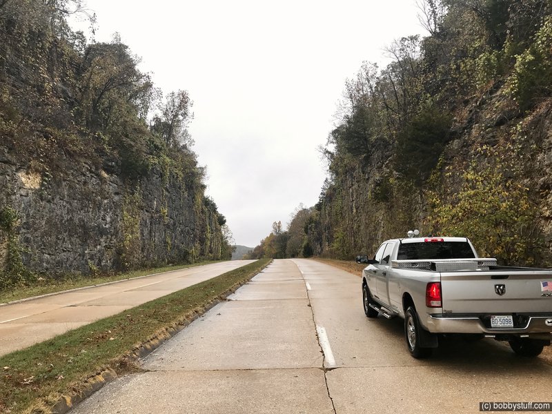
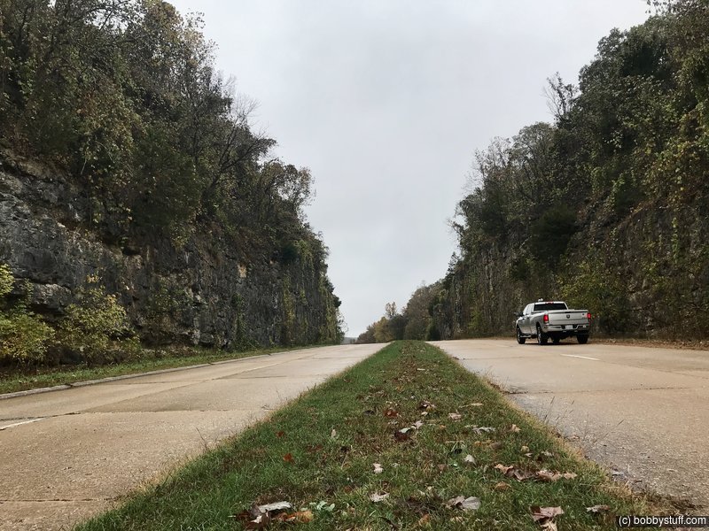
Hooker's Cut, Hooker MO
View a list of places like this or a map.takemytrip.com
This is one of the strangest sections of Old Route 66 - one that left me feeling like the last person on earth, standing on an abandoned road that was built differently than any 4-lane highway I had ever seen, through a place where two lanes would have been excessive.
Between Interstate exits 169 and 163, old US 66 mysteriously, and quite unexpectedly, transforms from two lanes to four. It still feels like the old road, after all, this section of highway was built in the early 1940's. The original concrete has curbs at the edges, just like the 2-lane sections. But here, the road has doubled.
Back when this section of highway was built, I imagine they hadn't built many multi-lane roads before. So naturally, they did everything wrong. There's a narrow median, but no turn lanes in the appropriate places. There isn't much of a shoulder at the side of the road-just an upturn in the concrete, then grass and weeds. Since just about nobody uses this road anymore, all that vegetation hangs over onto the road, making the whole area feel like a rural scene from I Am Legend, minus the dark seekers.
So I just stopped in the middle of the road. With little room on the shoulder, I didn't have much of a choice. It didn't matter; there was no traffic.
All four lanes pass through Hooker Cut, before dropping down to the Big Piney River. At the time it was completed, Hooker Cut was one of the deepest cuts made through rock of any road in the country.
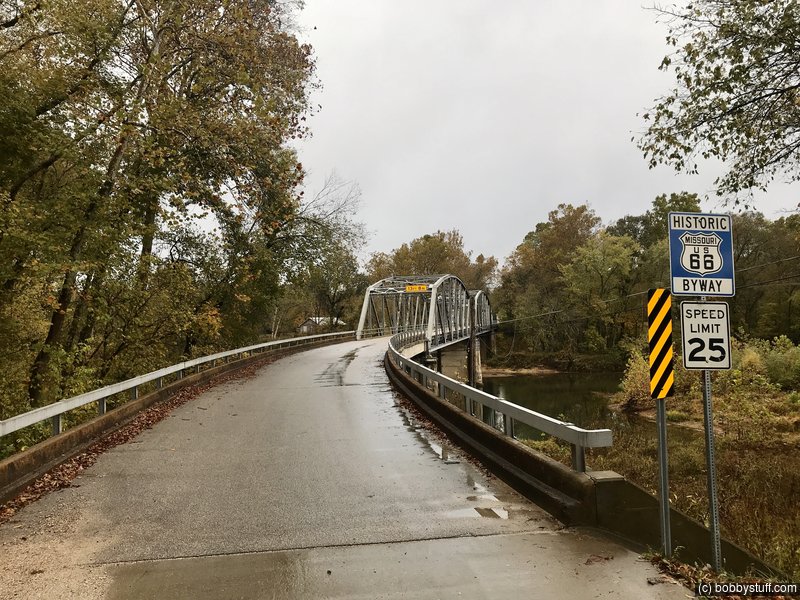
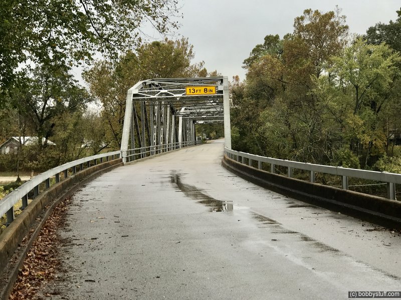
Devil's Elbow Bridge, Devils Elbow MO
View a list of places like this or a map.theroute-66.com
The first settlement was after the Civil War around 1870 as a small lumberjack settlement. The railroad bypassed it so it was relatively isolated. The village grew in the late 1910s, once State Highway 14 was built and improved in the area, linking St. Louis with Springfield. The construction of the old Bridge in 1923 promoted travel and tourism - because before that, the river had to be forded, which was complicated.
The Ozark lumberjacks sent their logs downstream on the Big Piney River but the sharp "U" shaped bend jammed the logs leading them to call that point "A devil of an elbow", the name became "Devil's Elbow".
In 1926 Route 66 was aligned along MO-14 and paved. The town grew and catered to the tourists both in-state and those travelling along US 66. A dam had been planned in the 1930s at Arlington which would have flooded the village, but it was never built. In 1940, when Fort Leonard Wood was created, traffic increased considerably and a new safer road became necessary, so Route 66 was widened to a four-lane divided highway between Hooker and Grandview, bypassing the town in 1943.
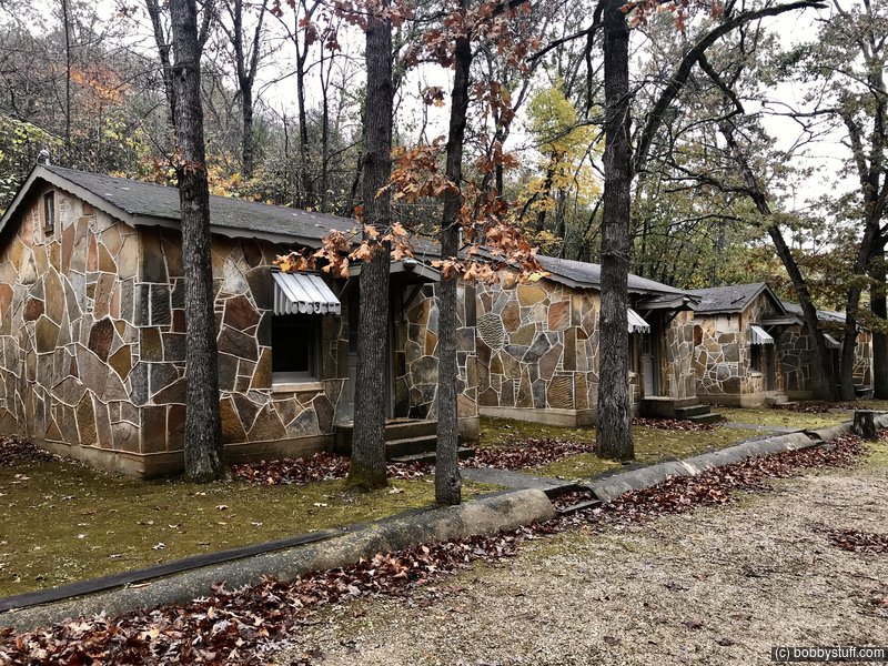
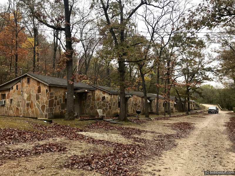
Piney Beach Cabins, Devils Elbow MO
View a list of places like this or a map.I can't find much information about this place. They have a website but it does not work. There is a sign that implies some of the cabins are for rent. A couple of them had power and drawn blinds. The others seemed to be in a state of renovation. But we still enjoyed seeing them.
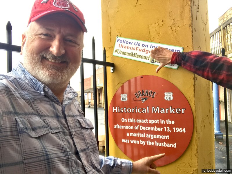
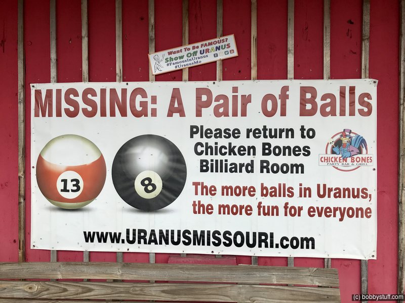
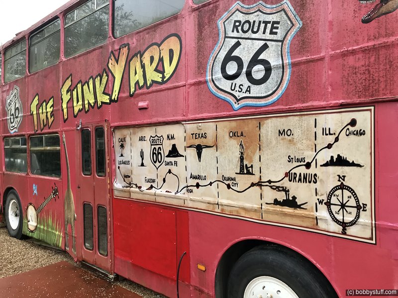
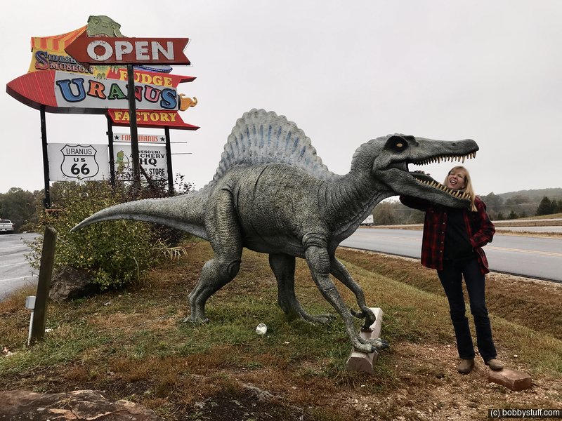
Uranus Fudge Factory, St. Robert MO
View a list of places like this or a map.This is just one big tourist trap but it was fun to visit. They know they are a tourist trap and really play it up.
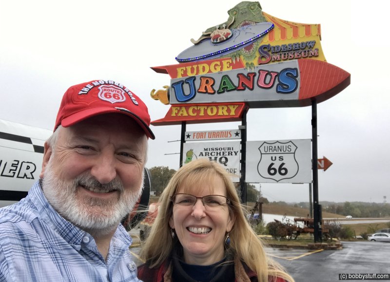
Bobby, Laurie
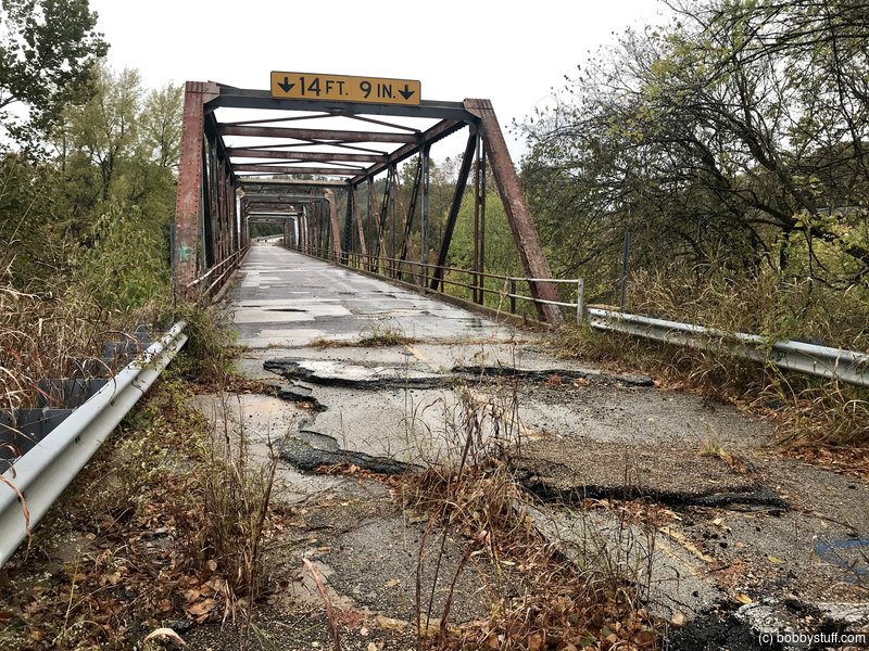
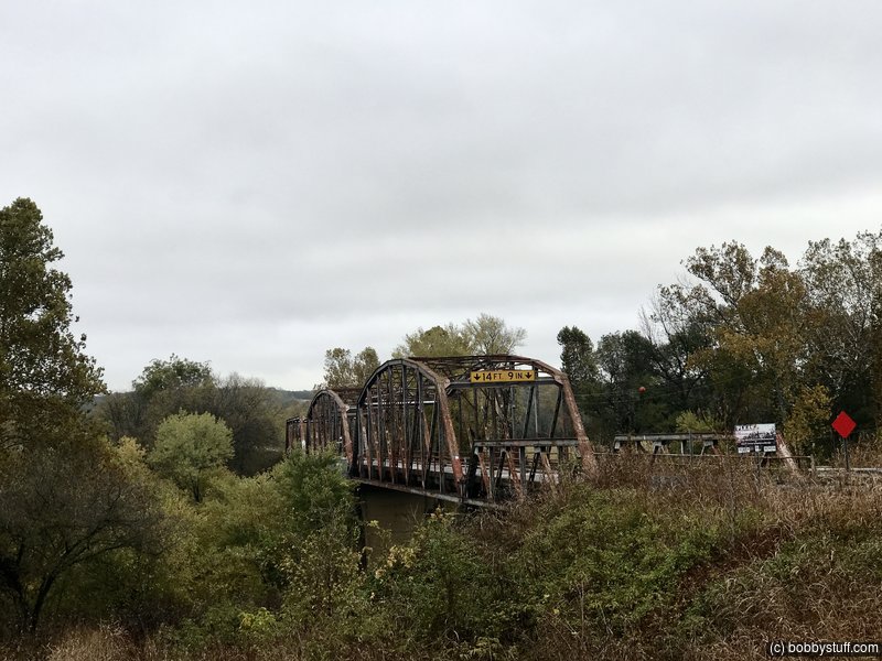
Gasconade River Bridge at Hazelbreen MO
View a list of places like this or a map.theroute-66.com
This steel through-truss bridge predates Route 66 because it was built between 1922 and 1924 (U.S. 66 was created in 1926). Originally it carried Missouri State Highway 14 and was designed by the Missouri Highway Department. It has three spans and since the opening of the four-lane highway on Route 66 in the 1950s, was neglected in maintenance and repairs, deteriorating to such an extent that in 2014 it was permanently closed to traffic.
There are plans to tear it down, but a group of Route 66 activists wants to save it (just as the bridge in Pulaski County at Devil's Elbow was restored and preserved).
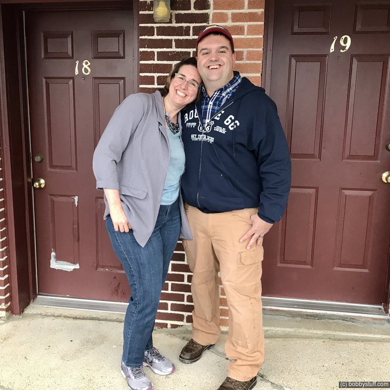
We met Tonya and Andy here from Michigan. We chatted for a while and compared photos from Route 66. They are big fans of the road also. We met them again at the Munger Moss Motel (see later photos in this blog).
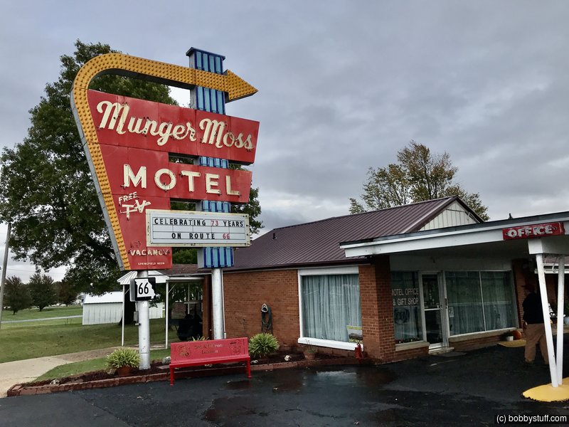
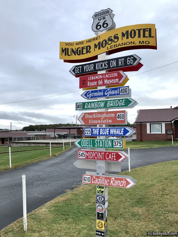
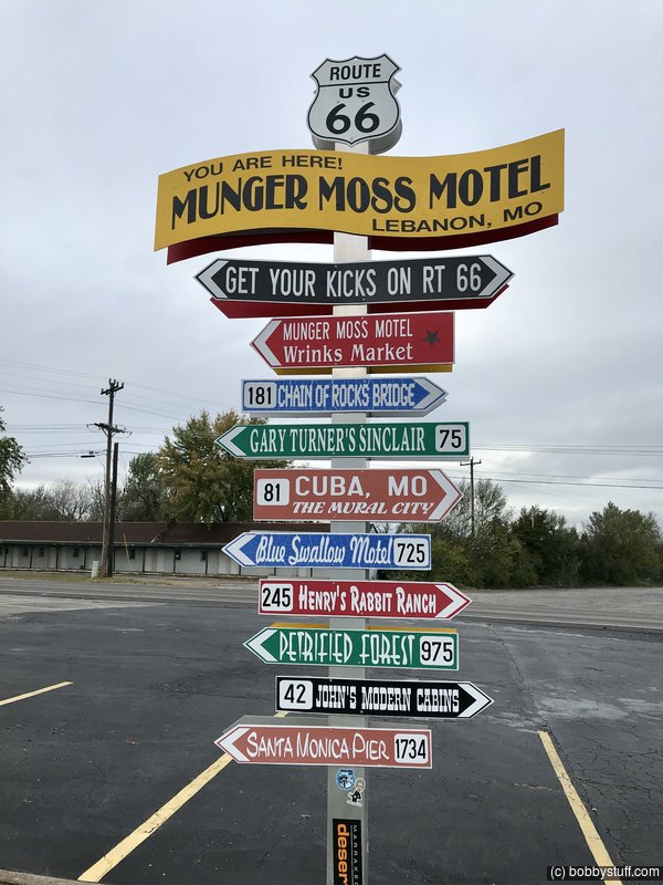
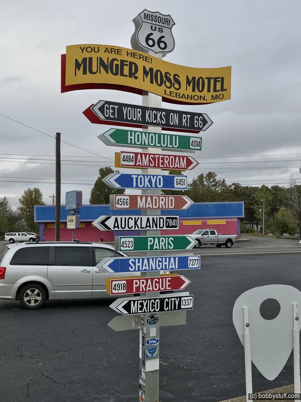
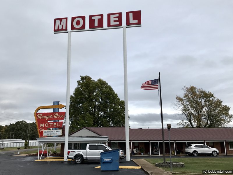
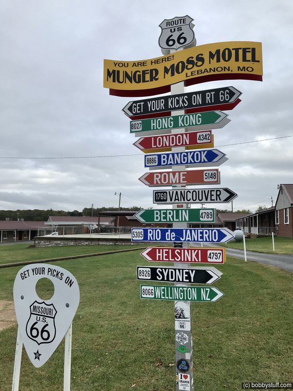
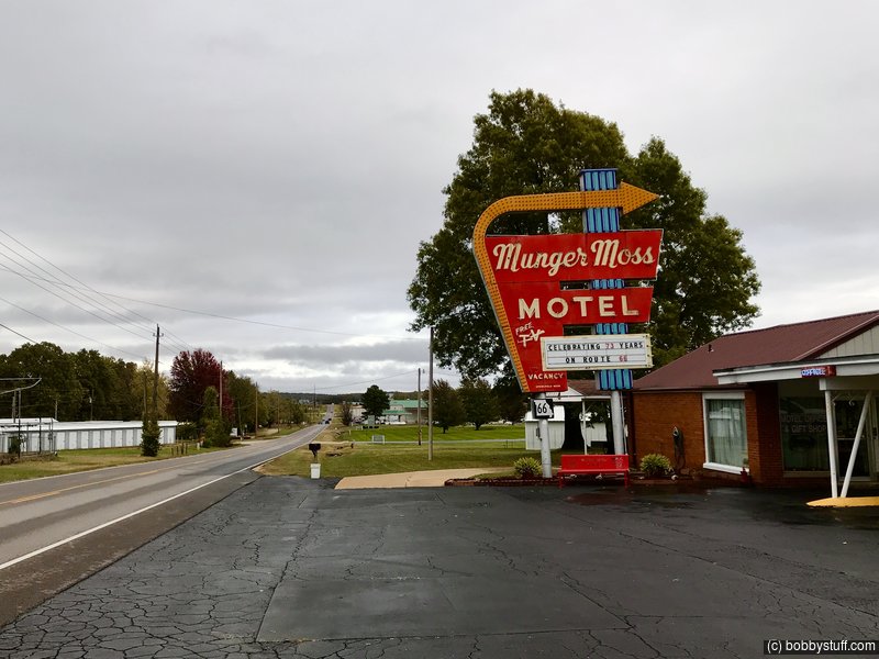
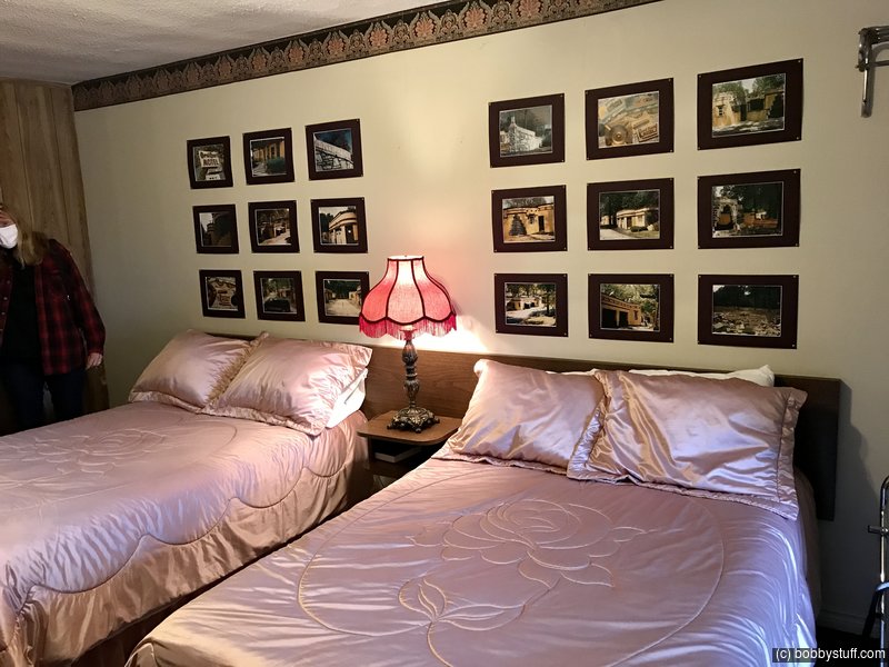
Munger Moss Motel, Lebanon MO
View a list of places like this or a map.theroute-66.com
Check out the history of the motel at their website.Old Munger-Moss Sandwich Shop opened to the north, in Devil's Elbow Missouri and was owned by the Nellie Munger and her husband Emmit Moss. When U.S. 66 was realigned in 1942 due to the heavy flow of military traffic at Ft. Leonard, they sold out to Jessie and Pete Hudson in 1945 who in turn moved to Lebanon where they opened a filling station and restaurant in 1945 and added the motel in 1946 which is still open.
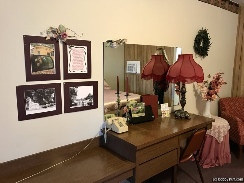
As I said we caught up with Tonya and Andy again at Munger Moss. Earlier in the day they had visited a museum which had recreated part of a room from the Coral Court Motel just south of St Louis using material from the motel (motel has been demolished). Andy is a big fan of the demolished Coral Court Motel and asked for room 18 at Munger Moss which has photos of the motel.
After getting the room, he insisted that we take a look, so we did.
We really enjoyed meeting Tonya and Andy and maybe our paths will meet again in the future.
 Google Map Track Log
| Route 66 Murals of Cuba, MO |
Topics
TagsConfederate Statues (32),Motorcycle (101),National Parks (9),Odd (1),Route 66 (33),Unemployment (6),Zombies (1)