
Day 11, Route 66 and Drone Footage of the Ghost Town of Glenrio, TX
| Miles: | 426 |
| Start Point: | Santa Rosa, NM |
| End Point: | El Reno, OK |
| Sun Rise: | 6:57 AM MDT |
| Sun Set: | 7:46 PM CDT |
Table of Contents

There are still Route 66 sites I have not seen. I planned to hit a few of them today. However, my snow storm ordeal yesterday left me an hour west of where I had planned to be. I also crossed a time zone today and lost an hour. Then in Amarillo I noticed they had applied brine to all the bridges. Checking my weather app, Amarillo should get snow tonight.
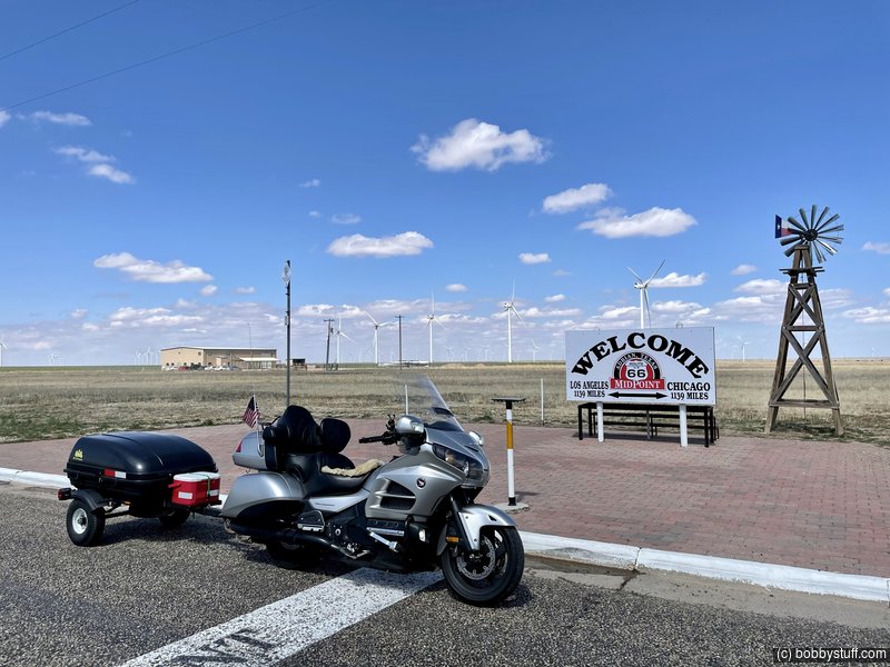
So I decided to get some miles between me and another snow storm. I did take time to swing off the road to hit a few favorite Route 66 sites. Tucumcari, ghost town of Glenrio, midpoint in Adrian. Cadillac Ranch is pretty depressing now. It feels like a garbage dump.
I got a return authorization today for my GoPro. I am still within the 30 day period for a full refund. I do have to give them credit for making the return easy. The DJI Osmo Action camera has been rock solid.
The video today has some fun drone shots.
 Video
Video
Bobby
Misc Photos


Ghost Towns of Endee and Glenrio


360 Photo !!!
Click and drag on the photo below to see a 360 view. Pinch to zoom in or out on your mobile device or use your mouse scroll wheel on your desktop. Click the box in the top left of the image to view in full screen.
Midpoint in Adrian and Cadillac Ranch


Dinner at Swadley's in El Reno

 Elevation Changes During the Day
The day started at 4,753 feet and ended at 1,398 feet. The highest altitude was 4,960 feet and the lowest altitude was 1,398 feet.