
Day 10, Where Can I Get Snow Chains for my Gold Wing
| Miles: | 174 |
| Start Point: | Moriarty, NM |
| Start Weather: | At 6:00 AM MDT, the temperature was 41.7 degrees with 37 percent humidity. The conditions were overcast. |
| End Point: | Santa Rosa, NM |
| Sun Rise: | 7:04 AM MDT |
| Sun Set: | 7:12 PM MDT |
Table of Contents

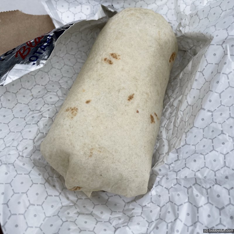
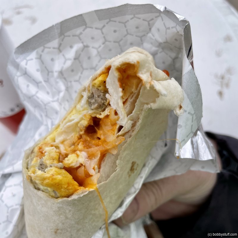
I had no idea this breakfast burrito from Whataburger would "fuel" me through this day. I wanted to see a little snow but I got more than I wanted.
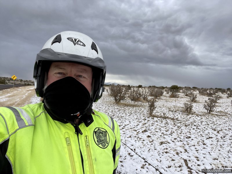
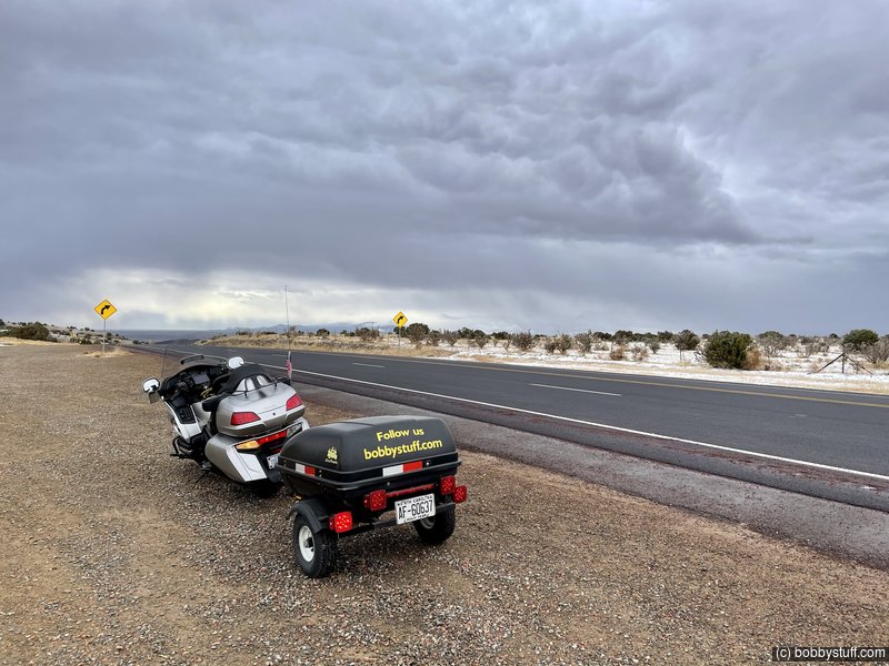
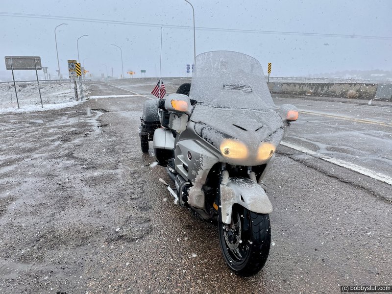
I rode north from Moriarty NM hoping to see a little snow. I have been to Santa Fe a few times so I skipped that and headed east on a local Route 66 road that parallels I-25. I planned to ride east for a while then head south and spend the night in Tucumcari. The snow kept falling. I thought it was neat.
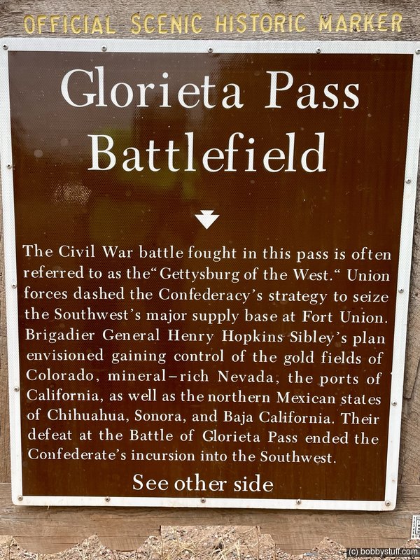
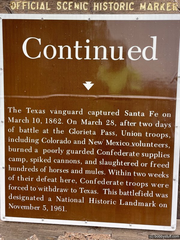
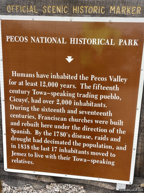
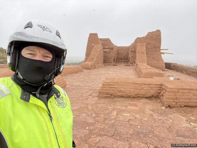
I visited a National Historic Park and got back on the road. The snow kept falling.
I got concerned. The fun was soon over. Snow was accumulating on the road. I checked Google Maps. I could stay in Las Vegas, NM in 9 miles. But the park ranger said the "big" storm would arrive on Wednesday. I am not retired yet, I have to be at work on Monday next week. I can't get stranded for a few days in a New Mexico snow storm.
I kept riding until I got to the US highway that would take me south to I-40. I was pretty sure the drop in elevation would help the road conditions. The temps kept changing between 34 and 36 degrees. A change of a couple of thousand feet in elevation at this time of year can make a big difference.
As I sat at the exit for the US highway south, a truck stopped and warned me that the US highway had ice buildup. Now what do I do?
I had my heated vest and my core temperature was good (I had stopped and put my heated jacket under my bibs). But my feet were wet and my hands were wet. I decided to head south. If the conditions got worse (they were already bad) I could backtrack and go to Las Vegas, NM.
The road got a little better, then a lot worse. I rode for 3 hours in slush and snow. I have to give Silvia credit. I never felt that she was riding up over the slush. She just cut straight through it. I could stay in the lane cleared by previous vehicles but my trailer had different plans. When its tires hit slush the bike would slow down and then speed up.
What a day! I got to I-40 and stopped on the ramp to assess my situation. A man in a jacked up pickup stopped and offered to let me warm up in his truck. I assured him I was ok with heated gear.
I soon stopped at a convenience store to warm up and reserve a room in Santa Rosa, NM. I got out my water proof heated gloves. Tonight I wanted to stay in the Blue Swallow Motel in Tucumcari NM but I was too tired and wet. That will have to wait for another day.
I phoned Laurie to let her know I was wet and cold but ok.
I could have probably made it to Tucumcari NM but stopping in Santa Rosa was the right thing to do.
In the motel I have wet clothes hanging everywhere drying out and my pizza just arrived. They included crushed red pepper seeds. Yes !!!
 Video
Video
Bobby
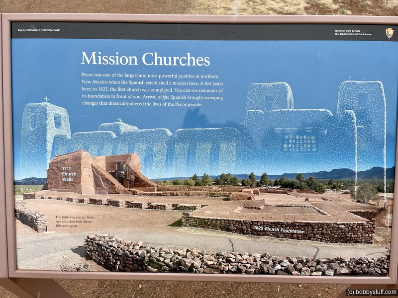
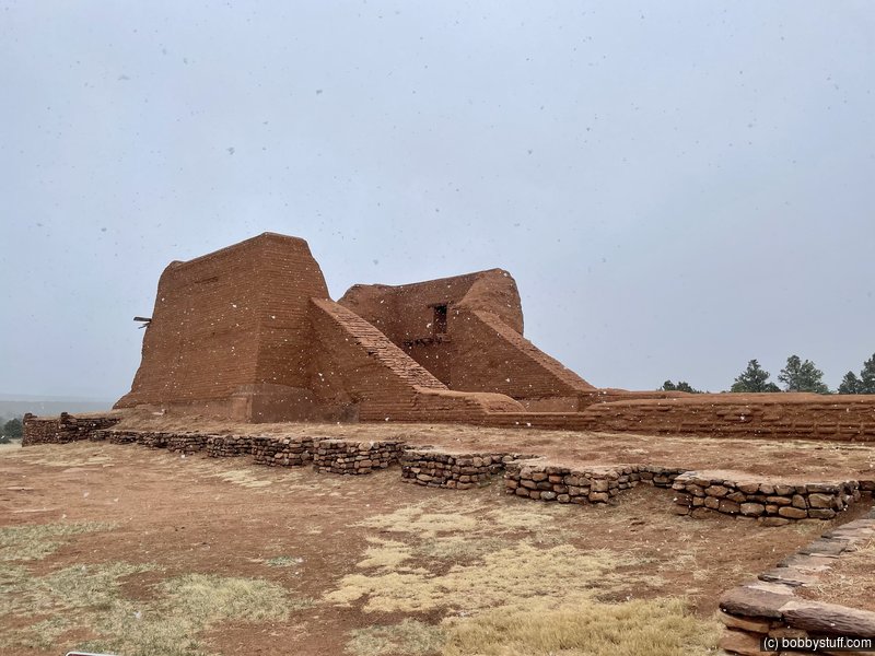
 Pecos National Historical Park, Pecos NM
View a list of places like this or a map.wikipedia.org
Pecos National Historical Park is a United States National Historical Park in San Miguel and Santa Fe Counties, New Mexico. The park, operated by the National Park Service, encompasses thousands of acres of landscape infused with historical elements from prehistoric archaeological ruins to 19th-century ranches, to a battlefield of the American Civil War. Its largest single feature is Pecos Pueblo also known as Cicuye Pueblo, a Native American community abandoned in historic times. First a state monument in 1935, it was made Pecos National Monument in 1965, and greatly enlarged and renamed in 1990. Two sites within the park, the pueblo and the Glorieta Pass Battlefield, are National Historic Landmarks.
360 Photo !!!
Click and drag on the photo below to see a 360 view. Pinch to zoom in or out on your mobile device or use your mouse scroll wheel on your desktop. Click the box in the top left of the image to view in full screen.
Pecos National Historical Park, Pecos NM
360 Photo !!!
Click and drag on the photo below to see a 360 view. Pinch to zoom in or out on your mobile device or use your mouse scroll wheel on your desktop. Click the box in the top left of the image to view in full screen.
Pecos National Historical Park, Pecos NM
Photos Just After Exiting I-25

 Elevation Changes During the Day
The day started at 6,241 feet and ended at 5,126 feet. The highest altitude was 7,581 feet and the lowest altitude was 5,126 feet.