
Day 5, Finally a Perfect Riding Day in the American West
| Miles: | 488 |
| Start Point: | Hondo, TX |
| Start Weather: | At 6:00 AM CDT, the temperature was 59.1 degrees with 58 percent humidity. The conditions were overcast with a wind speed of 17.2 and wind gusts of 26.2. |
| End Point: | Fort Stockton, TX |
| End Weather: | At 6:00 PM CDT, the temperature was 65.9 degrees with 21 percent humidity. The conditions were clear with a wind speed of 12.7 and wind gusts of 18.3. |
| Sun Rise: | 7:43 AM CDT |
| Sun Set: | 8:01 PM CDT |
Table of Contents

Today was a good day. The temperature started at 59 and remained in the low 70's most the day. I gained some elevation and there was a cool nip in the air. No traffic, wide open spaces and friendly people. Even with a few mishaps, it was a great day. Read more details along with the photos and video below.
I enjoy talking with the locals. At a connivence store there was a line. An old wiry grey bearded geezer was rummaging through his wallet and I eased past him as I was not sure he was in line. After finishing with his wallet, he looked up and I stated that I probably cut in line. With a gravely smoker's voice he said "Oh that's ok. I'm in no hurry to get home to find out what kind of trouble I'm in!"
I did not ask him about his potential home troubles and the cashier called him by name, Mike, as he asked for some cigarettes. I just grinned to myself and headed out.
Video for the Day
I am having fun with my Go Pro camera and trying out a few things. Please leave comments on what you like or don't like. I try to keep them from being boring
 Video
Video
Bobby
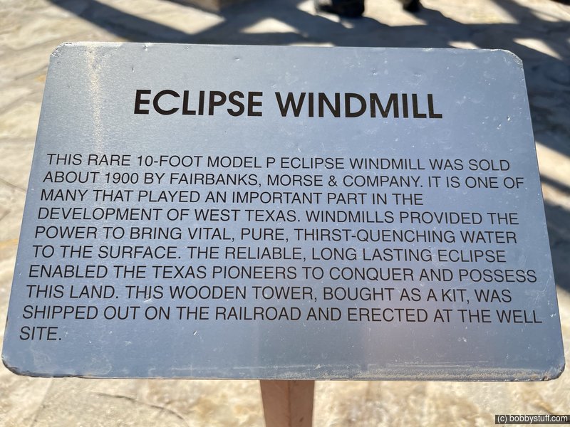
I am a sucker for Historical Markers and Texas has plenty of them. They are usually about Indians or forts or cowboys and I find them interesting.


 The Twisted Sisters, Leakey TX
View a list of places like this or a map.ridetexas.com
This 100-mile loop is, without a doubt, among the best, most challenging motorcycle roads in the state. The route follows canyons and climbs jagged, steep hills; the roads offer many tight, twisty curves with shear drop offs alongside and not much in the way of guardrails. In one 15-mile section, there are approximately 65 curves! Experienced riders bliss out on this ride. Beginners are cautioned to focus on the road—even when a panoramic vista pops up along the way. Don't forget to top off the gas tank before heading out.
I enjoyed this ride very much. The road had a chip and seal surface (AKA grits and gravy) so it had some loose gravel. Which was fine. I was riding for the view and experience, not for speed. I have a couple of photos below, but the video gives you a better idea about the ride..


Lunch
This was a good stop. I will not need to be fed again for a couple of days.


Mishaps and Changes of Plan
I have a new Go Pro camera. I love and hate the thing. When it works, it does amazing things. But it gets cranky and I never know when it will lock up. Today I pulled over to remove the battery to reset it. The battery door comes off easily and I have been careful to not lose it. Today I pressed the release and that thing jumped up under the dash someplace. I looked for a few minutes and never found it. It is made of aluminum with sharp edges so I was concerned it could rub against a radiator or wiring.
But there was nothing I could do now, so I pulled out and headed west. After a couple of hundred yards I felt something very faintly hit my boot. I thought, no, no way. The door is about 1/2 x 1 1/2 inches and weighs almost nothing. But I did a u turn back to my starting place and rode slow. There it was laying in the double yellow line. What are the odds?
The next mishap was at one of those Historical Markers. I parked headed slightly downhill. The wind was blowing against the trailer from the rear and I may have drug my foot across the seat. You fellow Gold Wingers know where this is heading. Silvia started leaning to the right against me. We all know there is a point where you just have to let the bike fall and then do the butt/leg maneuver to get her back on her feet.
But you have to try to stop the fall. So I grabbed the handle bars and pushed hard with my body and amazingly she was easy to keep upright. I caught it early. But in my rush to grab the handle bars I broke my Go Pro mount.
I carry various tools to handle minor problems such as these. One of those tools is a combination metric/SAE set of vice grips. Most of you will probably get that joke. A few minutes had my problem solved and me back on the road.
Shortly after that mishap, I started to think. The motel I plan to stay in tonight is probably the only one in town and what if it is full. I never thought to call ahead. Too late now, I am committed.
Yep, no vacancy and there are more people walking around downtown than I have seen all day. The next town is Alpine, 33 miles further west. I have internet access and an iPad so I check Alpine. Lots of motels but they are all $200+ and none have vacancies.
I zoom out on the map and I-10 is north of me. Most interstate exits have descent priced motels. I quickly find a Super 8 for $53 and book a room online. A data plan with an I-device is a great thing to have when traveling. Also you should sign up for all the motel rewards programs, get an account and let them store your credit card information. I keep all my passwords in a password manager, so in a couple of moments I had secured a room for the night.
Google maps said my motel was in Fort Stockton, 59 miles to the north. I could not do the math in my head, but 59 miles at 80 MPH sounded like significantly under an hour of travel.
This turned out to be one of the best parts of the day. I love the late day golden light with long dark shadows. Please check out the video near the end. You will like it.
I may cancel my plans to visit Big Bend. Their website indicates this may be the busiest month of the year. I want open spaces, not people and traffic.
Even with these minor mishaps and setbacks, it was a great day.


Judge Roy Bean Museum and Visitor Center, Langtry, Texas
View a list of places like this or a map.texaspecostrail.com
Folklore legend Judge Roy Bean arrived in Texas during the Civil War, showing up in San Antonio after troubles booted him out of Chihuahua, Mexico, then California (both San Diego and San Gabriel), and finally Mesilla, New Mexico. Bean spent a number of years on South Flores Street in the Alamo City, earning the location the nickname "Beanville", and avoiding both creditors and the law, and all the while annoying his business competitors.
An escape across the Pecos River landed him at the heart of the railroad construction boom where tracks from the east were moving at a furious pace (courtesy of Chinese labor) to meet tracks arriving from the west. Ever the opportunist, Bean established his Jersey Lilly saloon, helping to stir an already roiling pot of lawlessness, before capturing the position of justice of the peace, permanently securing his place in Texas folklore.
Today, the Jersey Lilly and the opera house Bean built in honor of his long-distance, unrequited (and one-sided) romance with English singer Lillian Langtry, combine to create the Judge Roy Bean Visitor Center, a Texas Department of Transportation rest stop for heritage and curious travels tackling the long stretch of Highway 90 between Del Rio and Sanderson.


 Elevation Changes During the Day
The day started at 1,059 feet and ended at 3,060 feet. The highest altitude was 4,495 feet and the lowest altitude was 880 feet.