
Day 9, Springerville AZ to Phoenix
| Miles: | 321 |
| Start Point: | Springerville, AZ |
| Start Weather: | At 6:00 AM MST the temperature was 40.8 ° with 38% humidity. The conditions were clear with a wind speed of 0.6 MPH and wind gusts of 11.5 MPH. |
| End Point: | Deer Valley, AZ |
| End Weather: | At 6:00 PM MST the temperature was 83.2 ° with 11% humidity. The conditions were clear with a wind speed of 6.6 MPH and wind gusts of 12.9 MPH. |
| Sun Rise: | 6:04 AM MST |
| Sun Set: | 6:50 PM MST |
Table of Contents

Previous 40 to Phoenix Rides
This is my 3rd 40 to Phoenix ride. I have visited just about all the Route 66 sites I want to see and have written about them in previous years. To read about this day and see photos from previous years, please see
Day 8, 2017
and
Day 9, 2018.
In 2017 we had one day to get from Moriarty NM to Phoenix AZ. We now take two days.
Today
I really love the Rode Inn plus they have gravy and biscuits for breakfast. We could hear the ceiling squeaking as folks walked around above us and someone was snoring pretty loudly in the adjacent room, but the place has charm. Laurie even liked it. They have a very nice lobby and dinning area. Be sure to check out the 360 photo of the lobby below. The front desk said they really decorate the place for Christmas.
Laurie had some severe neck and headache issues during the night and I was beginning to think her journey might be coming to an end. But with some high powered drugs and a mule like stubbornness we made it to Phoenix and it's looking like she will make it to Chula Vista.
We have 400 miles to Chula Vista from Phoenix. With the abbreviated GWRRA schedule at head quarters we decided to cancel our 2nd night in Phoenix and leave about noon on Wednesday. That allows us to do the 400 miles to Chula Vista in two days and gives us plenty of time in Borrego Springs, CA which has some neat outdoor metal sculptures.
Laurie really wanted to go through Winslow (Standin' on the Corner) instead of a more direct route to Phoenix so we headed north west from Springerville. From there it was on to Flagstaff and then the ride through Oak Creek Canyon into Sedona. The views there are great. Be sure to watch the video.
We have met many, many great people on this ride. Everyone wishes us safe travels. But we met our first rude person in Sedona. We pulled into a "scenic view" area to take a quick break. Before we got our helmets off, some kind of park ranger rushed over and checked to see if we had a parking permit and told us we had to leave. I said we just needed a couple of minutes for a quick break. Nope, we had to leave IMMEDIATELY. Really ticked us off.
But later near Phoenix, a car was drifting into us. I gave him a 3 second blast with my air horns and blew him over a lane. Later he drove beside us, with his right window down, leaning over waving and yelling he was sorry. So I guess that cancels out the rudeness of Sedona.
We hope to say good bye to everyone before we leave today but if we miss you, we'll say goodbye here. It's been great meeting old friends and making new ones. Be sure to see the Winslow photos below. I have photos from 4 different stops there over 17 years.
360 Photo !!!
Click and drag on the photo below to see a 360 view. Pinch to zoom in or out on your mobile device or use your mouse scroll wheel on your desktop. Click the box in the top left of the image to view in full screen.
Rode Inn, Springerville AZ
 Video
Video
Laurie

Rode Inn, Springerville, AZ
Bobby

 Wigwam Motel, Holbrook AZ
View a list of places like this or a map.nps.gov
In the arid Arizona desert, the Wigwam Village Motel in Holbrook still provides Route 66 aficionados the opportunity to "Sleep in a Wigwam!"
While passing through Cave City, Kentucky in 1938, Chester E. Lewis was impressed by the distinctive design of the original Wigwam Village constructed in 1937 by architect Frank Redford. An astute observer may notice that the Wigwam Village is not composed of wigwams but of teepees. Mr. Redford, who patented the wigwam village design in 1936, disliked the word 'teepee' and used 'wigwam' instead.
Mr. Lewis purchased copies of the plans and the right to use the Wigwam Village name. The purchase included a royalty agreement in which Mr. Lewis would install coin operated radios, and every dime inserted for 30 minutes of play would be sent to Mr. Redford as payment. Seven Wigwam Villages were constructed between 1936 and the 1950s. Finished in 1950, Mr. Lewis' village was the sixth, thus its designation as Wigwam Village #6.


Bobby, Laurie


Holbrook, AZ
Laurie

Holbrook, AZ

Holbrook, AZ

Holbrook, AZ
Laurie
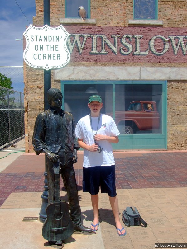
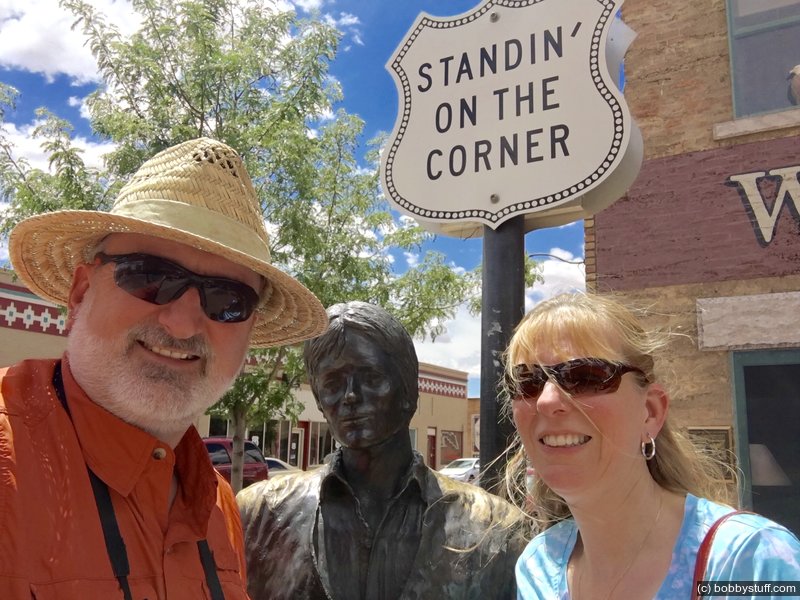
Standin' on the Corner Over the Years
Look at the dates on the photos. They span from 2002 to 2019

"Standin' on the corner in Winslow, Arizona" http://www.standinonthecorner.com/
Bobby

Winslow, Arizona.
Bobby
Winslow, Arizona.
Bradley Taylor

Winslow, Arizona.
Tucker Riley, Bradley Taylor
Day trip to Winslow, AZ to get Dodge truck parts for Gallup dealer.
Bobby, Laurie

Bobby, Laurie

Bobby, Laurie
360 Photo !!!
Click and drag on the photo below to see a 360 view. Pinch to zoom in or out on your mobile device or use your mouse scroll wheel on your desktop. Click the box in the top left of the image to view in full screen.
Standin' on The Corner, Winslow AZ
 Elevation Changes During the Day
The day started at 7,008 feet and ended at 1,347 feet. The highest altitude was 7,008 feet and the lowest altitude was 1,347 feet.