
Day 13 - Beatty NV to Lee Vining CA
| Miles for the Day: | 309 |
| Total Trip Miles: | 3917 |
| Start Point: | Beatty, NV |
| Start Weather: | At 6:00 AM PDT, the temperature was 63.9 degrees with 12 percent humidity. The conditions were clear. |
| End Point: | June Lake, CA |
| End Weather: | At 6:00 PM PDT, the temperature was 65.6 degrees with 16 percent humidity. The conditions were clear with a wind speed of 11.7 and wind gusts of 27.6. |
| Sun Rise: | 6:22 AM PDT |
| Sun Set: | 7:26 PM PDT |
Table of Contents
 Google Map Track Log
 YouTube Video
 Harmony Borax Works, Death Valley CA
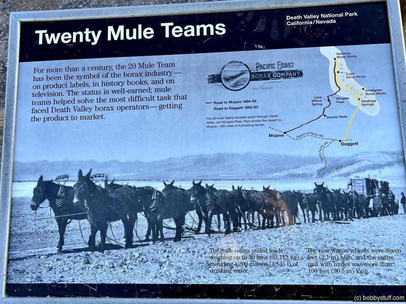
View a list of places like this or a map.Wander between the rusting remains of buildings, machinery, tanks, and piping at Harmony Borax Works, a mining operation that dates back more than 120 years. After prospectors found borax in 1881, William Tell Coleman built the Harmony plant and began to process ore in late 1883 or early 1884.
Operating at capacity, the Harmony Borax Works employed 40 men who produced three tons of borax daily. Learn how early miners used those famed 20-mule teams to haul borax 165 miles to the railroad town of Mojave. The teams averaged two miles an hour and required about 30 days to complete a round trip.
The Harmony plant went out of operation in 1888, after only five years of production, when Coleman's financial empire collapsed.

Bobby

Bobby
Mesquite Flat Sand Dunes, Death Valley CA
View a list of places like this or a map.nps.gov
While sand exists throughout the park, there are very few locations where large dune fields are created. In order to create sand dunes, there must be a source of sand (in this case, the eroding mountains to the north), wind to move that sand, and a barrier to prevent the sand from being blown farther (the mountains to the south). The conditions at Mesquite Flat Sand Dunes are perfect for the creation of dunes, and while individual grains move, and ripples form, the dune field remains.
These dunes are named for the mesquite tree which grows in abundance in the area. The trees must twist and grow to avoid being buried, and leafless brown trunks are often exposed by the shifting sands. The arrival of spring brings forth a burst of bright green leaves and yellow flowers from the trees' upper branches. Mesquite bean pods are a traditional food of the Timbisha Shoshone, and the flour from these pods can be purchased in specialty food stores today.
The Mesquite Dunes are known for dramatic shadows at sunrise and sunset, as ripples and edges in the dunes stand out in greater contrast. They are also a great place to observe Death Valley's famous dark night skies.


 Scenic pull off CA 136 where I have taken the same photo over the years
View a list of places like this or a map.This is simply a pull off on the western side outside of Death Valley. I have stopped here three times to take a photo of the mountains.

Going to Death Valley from Lone Pine, California. It is 5:50 local time. We wanted to get through most of Death Valley before the temperature got so hot.
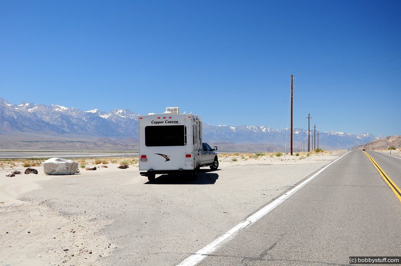
These mountains had no snow when we were here in 2007.

Manzanar National Historic Site, Independence CA
View a list of places like this or a map.nps.gov
In 1942, the United States government ordered more than 110,000 men, women, and children to leave their homes and detained them in remote, military-style camps. Manzanar War Relocation Center was one of ten camps where the US government incarcerated Japanese immigrants ineligible for citizenship and Japanese American citizens during World War II.

Bobby


Bobby
 Elevation Changes During the Day
The day started at 3,329 feet and ended at 6,821 feet. The highest altitude was 8,855 feet and the lowest altitude was 7 feet.
| Day 12 - Death Valley |
Topics
TagsConfederate Statues (32),Motorcycle (100),National Parks (9),Odd (1),Route 66 (33),Unemployment (6),Zombies (1)