
Route 66 North East Oklahoma
| Start Weather: | At 6:00 AM CDT the temperature was 35.2° with 90% humidity. The conditions were mostly cloudy with a wind speed of 9 MPH and wind gusts of 18.3 MPH. |
| End Weather: | At 6:00 PM CDT the temperature was 49.4° with 71% humidity. The conditions were mostly cloudy with a wind speed of 6.6 MPH and wind gusts of 13.1 MPH. |
| Sun Rise: | 7:36 AM CDT |
| Sun Set: | 6:30 PM CDT |
Table of Contents
We originally planned to travel on to El Reno just west of Oklahoma City and decide what to see from there. Laurie checked the weather forecast which immediately changed our plans.
An arctic blast was headed for the mid section of the country and there would soon be sub freezing temperatures with freezing rain and snow in the Oklahoma City area. We decided to stay in Carthage MO for one more day and catch some Route 66 sights in north eastern Oklahoma on Saturday.
Sunday morning we pulled out for home and arrived on Monday afternoon. We thought about stopping in the Blue Ridge mountains for a couple of days or even going to the Abingdon Virginia area. But everyplace was the same. By the time we could get there, rain from hurricane Zeta was scheduled to arrive.
So our great autumn Route 66 vacation of 2020 was cut short.
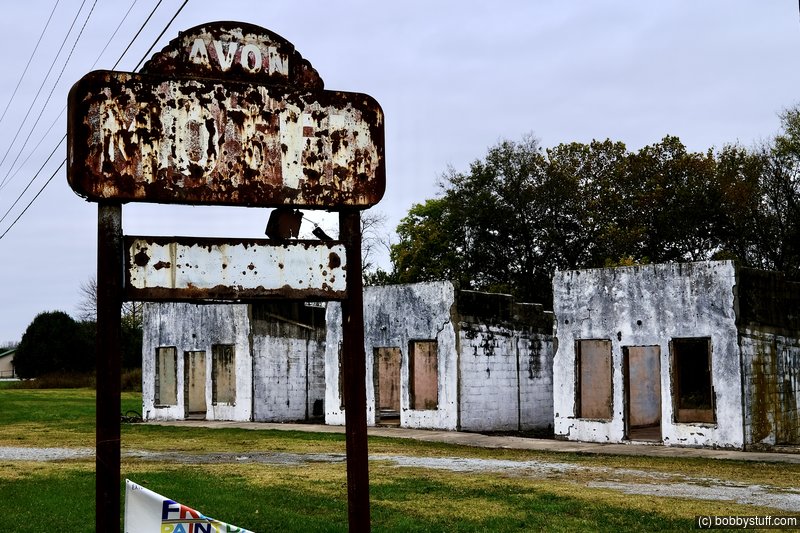
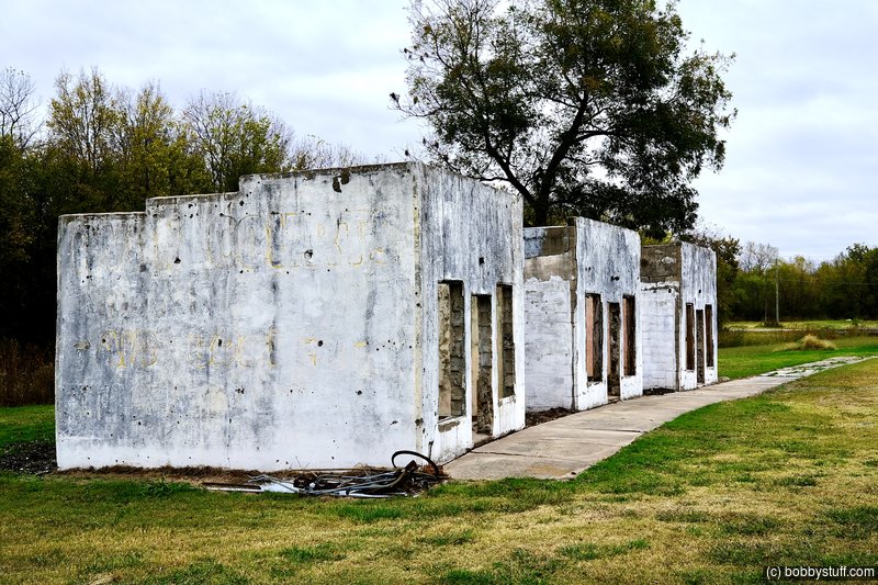
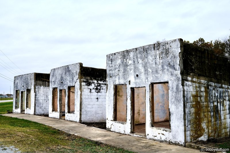
 Avon Court, Afton MO
View a list of places like this or a map.theroute-66.com
John Foley opened Avon Court in 1936 it has seven units each of them with a covered carport. It was operated by W.R. Trebilcock between 1951 and 1955. Harry Glover ran it until 1958.
Many online sources make the mistake of saying that the Avon and the Acme were the different names for the same place, this is not true. They were different businesses.
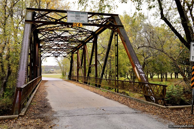
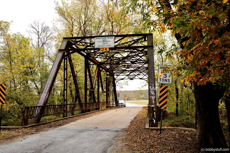
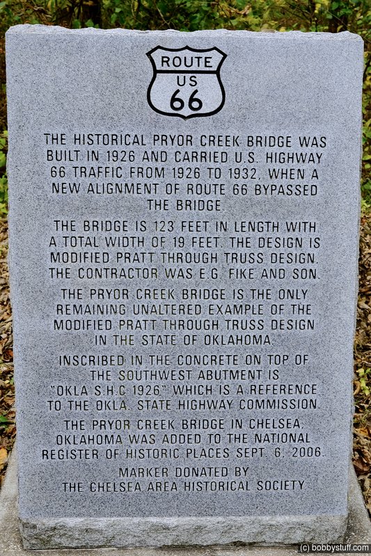
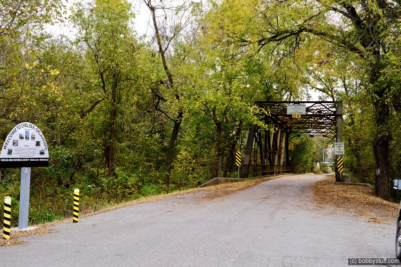
Pryor Creek Bridge, Chelsea OK
View a list of places like this or a map.theroute-66.com
It was built in 1926, and spans the Pryor Creek carrying Historic Route 66 across it.
It has one single span, a modified Pratt Through Truss bridge (a bridge that has beams bracing it above the roadway). It is 123 ft. long and 19 feet wide.
It was on the original Route 66 alignment (1926) and carried traffic until the route took its current course further north, in 1932.
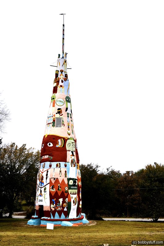
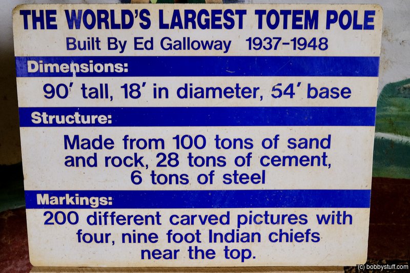
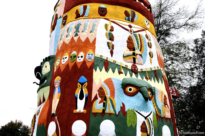
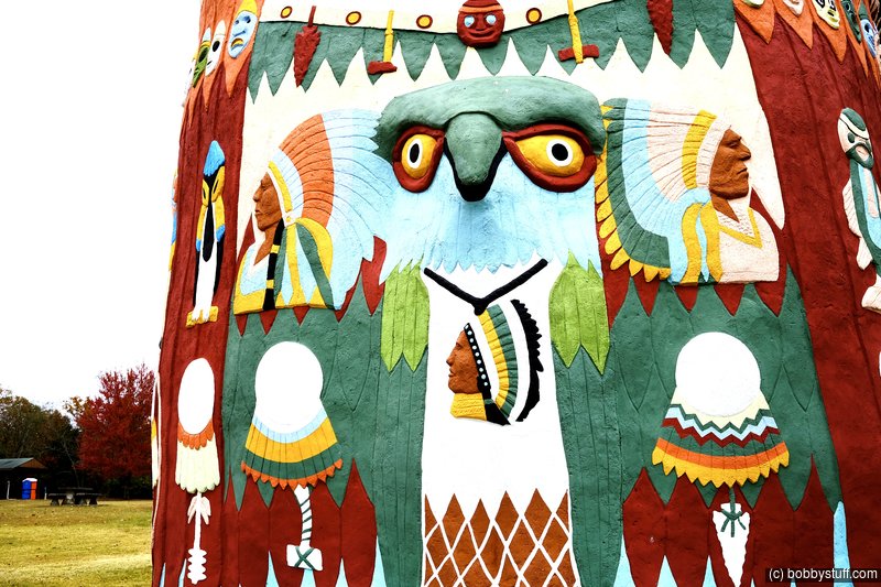
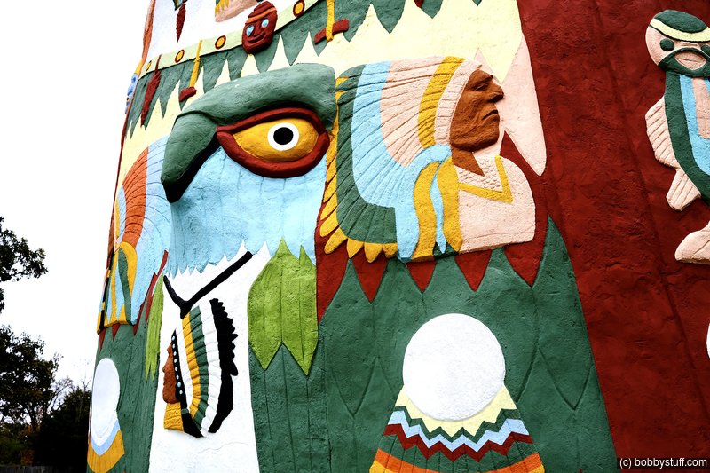
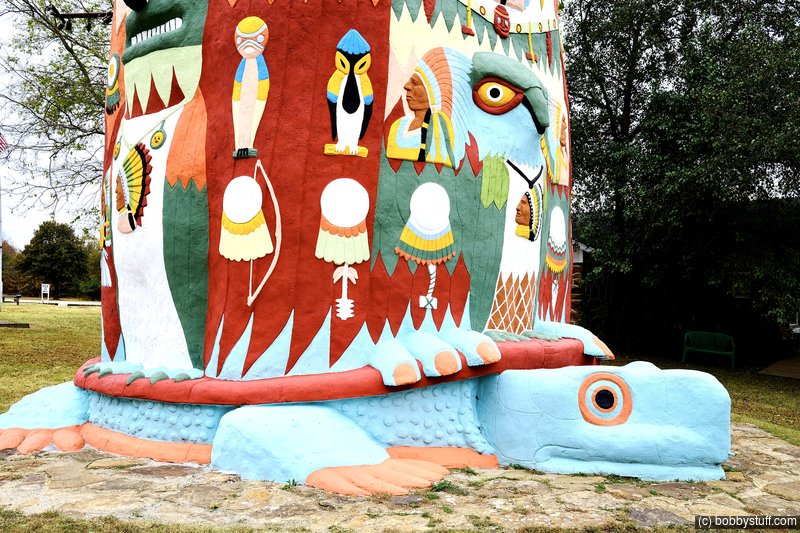
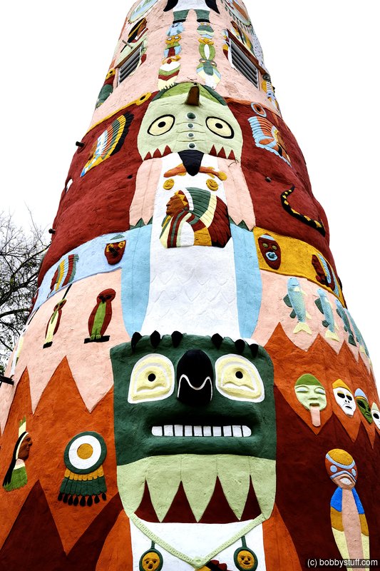
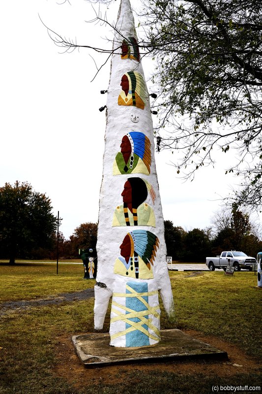
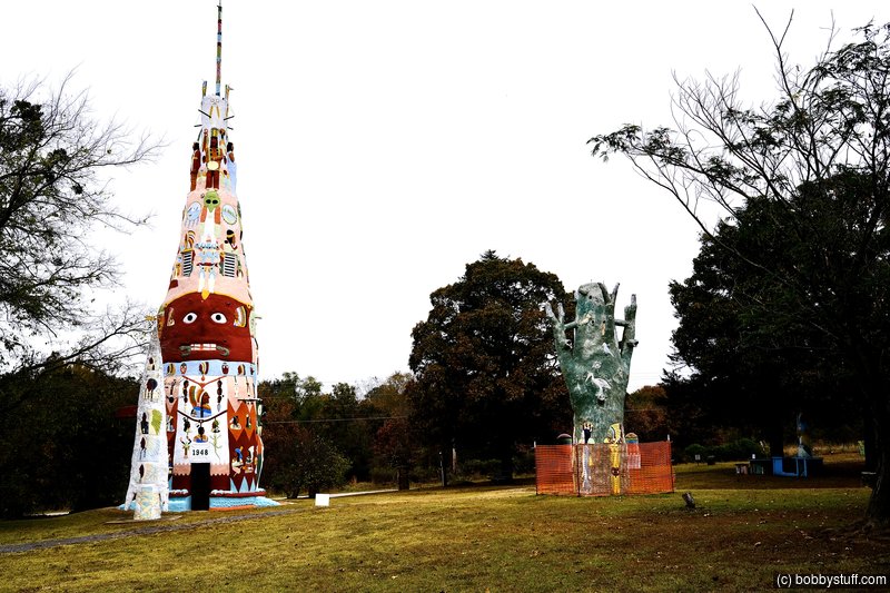
Ed Galloway's Totem Pole Park, Foyil OK
View a list of places like this or a map.nps.gov
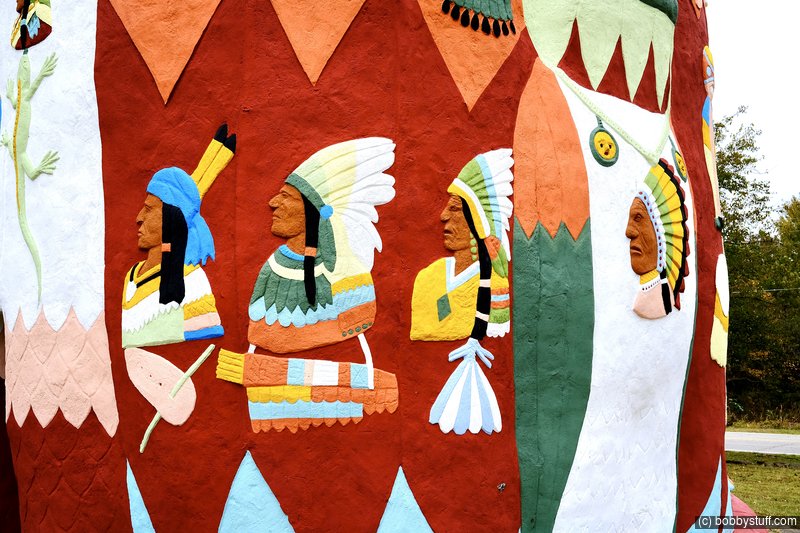
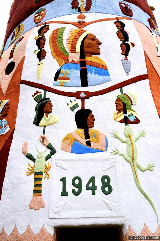
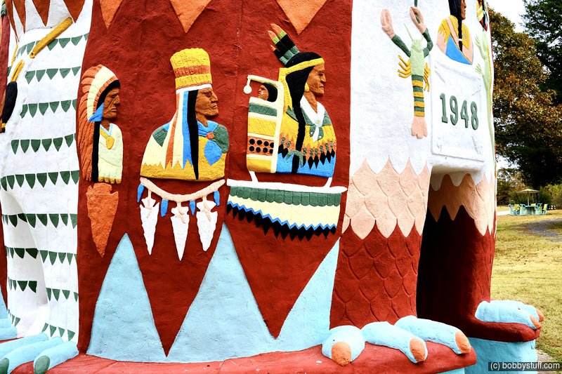
Ed Galloway's Totem Pole Park is the oldest and largest example of a folk art environment in Oklahoma; its construction lasting from 1937 to 1961. Totem Pole Park contains the original, highly decorated creations of Galloway, one of Oklahoma's premier folk artists and significant in the "visionary art" movement. The park is located just 3.5 miles off the Mother Road. All of the art objects are made of stone or concrete, reinforced with steel rebar and wood. Galloway incised and carved the objects in bas-relief and applied paint to decorations that generally include representational and figurative images of birds and Native Americans of Northwest Coast/Alaska and Plains cultures arranged facing the four cardinal directions.
Nathan Edward Galloway was born in 1880 in Springfield, Missouri and began wood carving as a boy. He became proficient in woodworking and blacksmithing and obtained employment at Sand Springs Home, teaching manual arts to orphan boys. In 1937, he retired to live on the property now known as the Totem Pole Park. He constructed a vernacular Craftsman residence, a smokehouse, and a workshop (which no longer exists). He began to make violins, furniture, and decorative wall art. Galloway became interested in Native Americans and found inspiration in post cards and National Geographic magazines to construct totem poles in the park.
Between 1937 and 1948, he created a 90-foot tall main totem pole heavily carved with bas-relief designs, the largest art object on the property. This totem pole is made of red sandstone framed with steel and wood with a thick concrete skin and sits on a large three-dimensional turtle. The turtle forms the base and is carved from a broad, flat outcrop of sandstone in place on the site. The totem pole is hollow and ascends nine "floors," with the ground floor measuring nine feet in diameter. The plastered interior depicts painted murals of mountain-and-lake scenes and bird totems. Native American shields and arrow points line the tops of the murals. At the very top, the cone is open to the sky.
Other totems include a pre-1955 Arrowhead Totem, a c.1955 Birdbath Totem, and a Tree Totem dating c. 1955-1961. The park also includes two sets of concrete totem picnic tables with seats, a concrete totem barbeque/fireplace, small bird gateposts, as well as the Fish-Arch gates designed by Galloway to look like a gar-like fish with bird images facing east and west.
You can also read about the Totem Pole Park on the Rogers County Historical Society website.

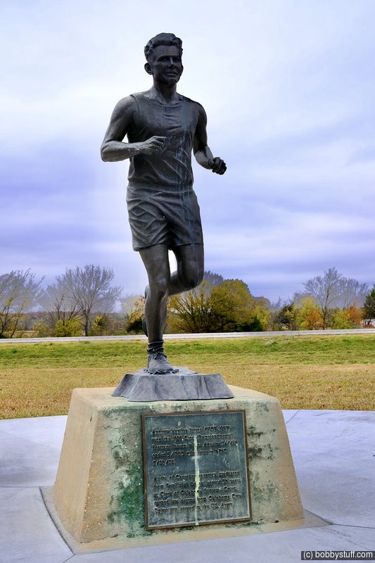
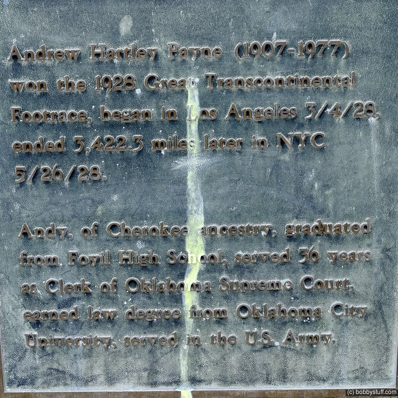
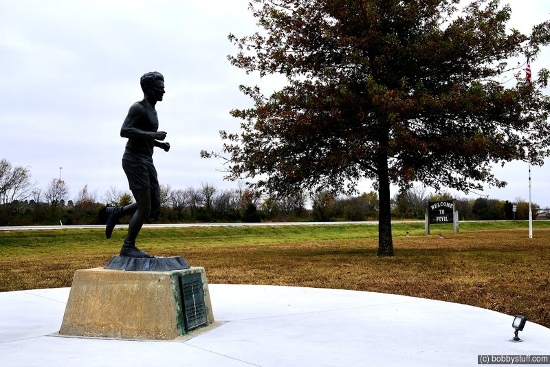
Andy Payne Monument, Foyil OK
View a list of places like this or a map.theroute-66.com
He was a member of the Cherokee tribe, he was raised in Foyil, Oklahoma. During the 1928 Trans-America Footrace, which he won, he passed through the town.
He loved running, and practiced every day running the 5 miles that separated his family's farm from Foyil school.
He won the first Trans-America Footrace in 1928 and the $ 25,000 prize.
The footrace (also known as the "Bunion Derby") was part of a plan by Charles C. Pyle to promote Route 66 which had been created two years before (1926). The first prize was $25,000 (which is equivalent to $350,000 today).
Most of the race took place along Route 66.
The event began in Los Angeles on March 24, 1928 and ended on May 26, 1928 in New York. Payne's total running time was 23 days, at an average speed of 6 miles per hour.
He ran all the way from Los Angeles to New York, covering a distance of 3,423.5 mile (5.509 km) in 573 hours, 4 minutes and 34 seconds.
Only one in four of the original runners made it to the Madison Square Garden's finish line (over 275 had started out in Los Angeles but half of them had dropped out by the fourth day).
Payne used the prize money to pay off the mortgage on his father's farm.
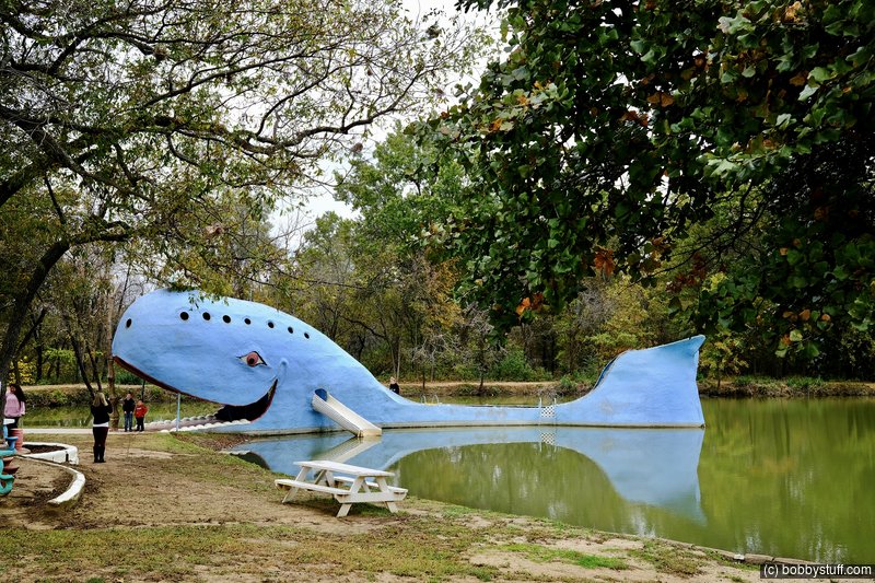
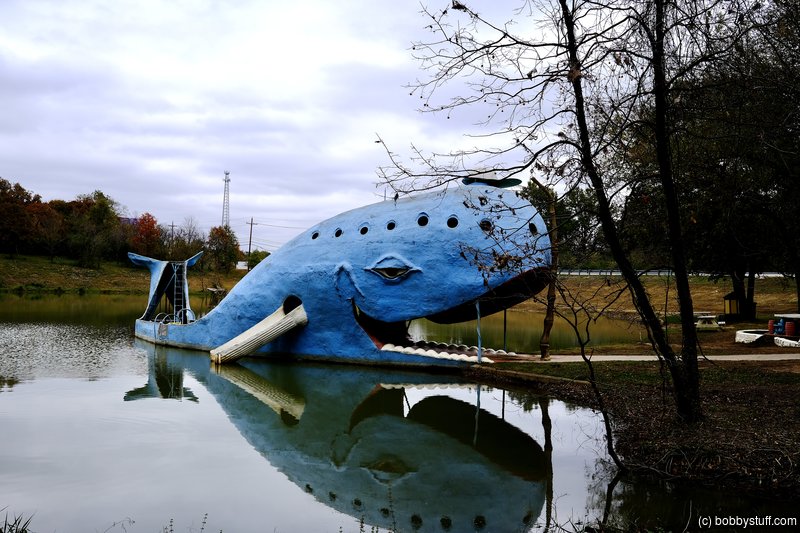
Blue Whale of Catoosa MO
View a list of places like this or a map.theroute-66.com
The Blue Whale was built by Hugh S. Davis. And is the most famous landmark along Route 66 in Catoosa. His property had a pond where, after his retirement, he decided to build a "fish". The fish became a whale and it was a big one too.He made an iron framework for the body, 80 ft. long and 20 ft. tall and covered it with cement. The making of the whale took 2 years, and was completed in July 1972. People would come and swim in the pond and slide off the whale's tail.
The Blue Whale closed in 1988 and Davis passed away in 1990. It is now owned by Dee Dee (Davis) Belt and her husband. And was refurbished in 1997 by the Catoosa Chamber of Commerce.
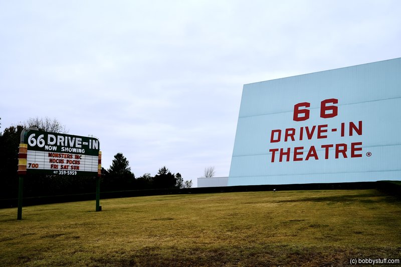
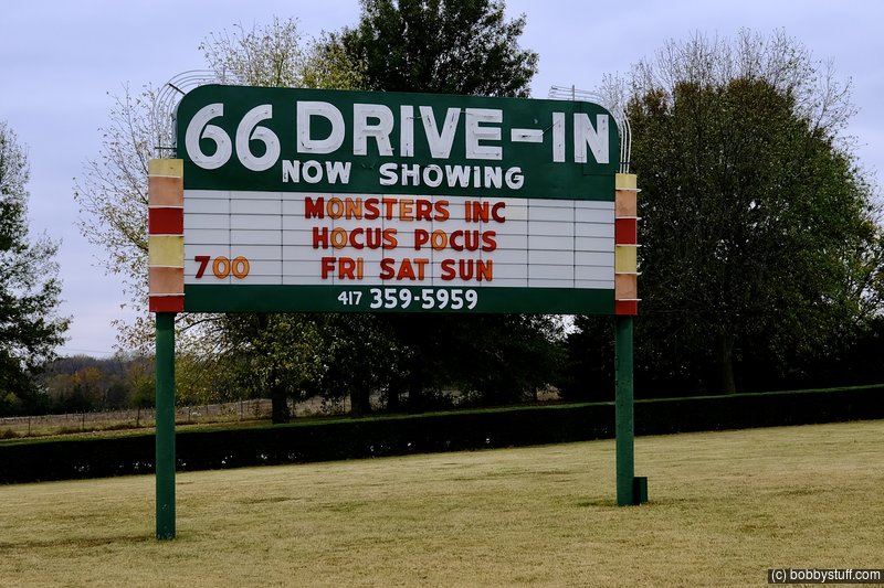
Route 66 Drive In, Carthage MO
View a list of places like this or a map.theroute-66.com
The historic Drive-in dates back to 1949. Its screen was widened in the early 1950s. Finally, overtaken by home videos, it closed in 1985. However it reopened in 1998 and shows films every weekend.
 Google Map Track Log
| Don't I Look Like a Tourist |
Topics
TagsConfederate Statues (32),Motorcycle (101),National Parks (9),Odd (1),Route 66 (33),Unemployment (6),Zombies (1)