Route 66 St Louis to Cuba MO, Day 1
| Start Weather: | At 6:00 AM CDT the temperature was 51.6° with 80% humidity. The conditions were partly cloudy with a wind speed of 4.7 MPH and wind gusts of 12.5 MPH. |
| End Weather: | At 6:00 PM CDT the temperature was 49.3° with 100% humidity. The conditions were rain with a wind speed of 8.3 MPH and wind gusts of 19.8 MPH. |
| Sun Rise: | 7:19 AM CDT |
| Sun Set: | 6:25 PM CDT |
Table of Contents

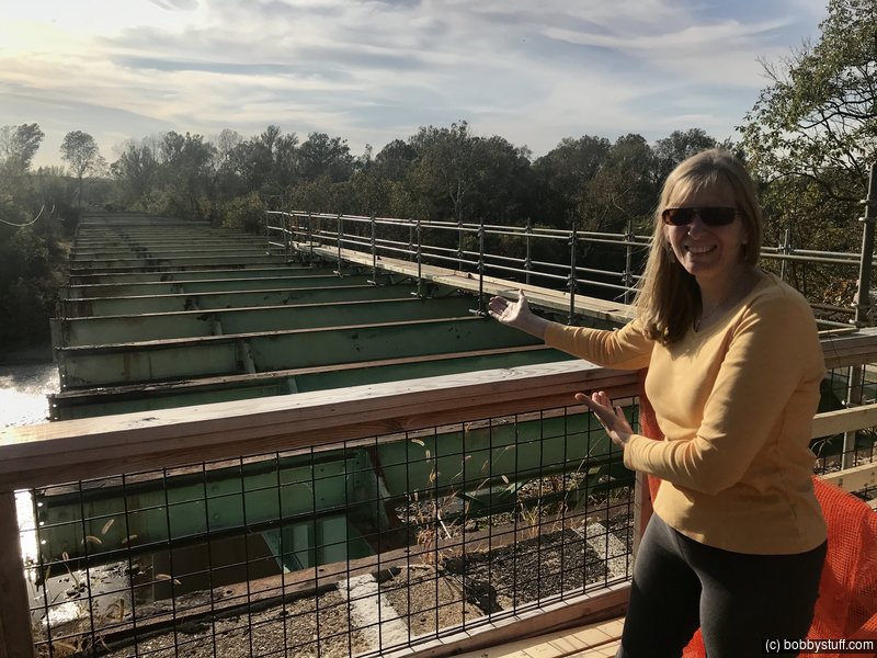
 Route 66 Visitor Center and Bridge over Meramec River, Eureka, MO
View a list of places like this or a map.nps.gov:
There is more info at Save This Bridge.Route 66 was rerouted from Gravois Road to Chippewa in southern St. Louis in 1931, requiring a Meramec River crossing. The Meramec River U.S. 66 Bridge that resulted is a 1009-foot-long 30-foot-wide steel structure, and the Bureau of Bridge engineers employed a Warren deck truss type in its design. Truss bridges use a triangular placement of beams to stiffen and strengthen the roadbed. Horizontal "chords" at the top and bottom of the bridge's sides are connected by vertical posts and diagonals. Abutments are used to provide additional support. Truss patterns work very well with metal materials, and the type became popular in the middle of the 1800s, when iron was commonly used in bridge construction. James Warren and Theobald Manzani patented the Warren truss, defined by its placement of the chords to create equilateral triangles, in 1848. The bridge's type makes it a rarity in Missouri, whose flat rivers often provide insufficient clearance for this type of structure. Most of Missouri's few deck truss bridges were constructed in the 1920s and 1930s and all were designed by the state highway department. Only four rigid-connected Warren deck truss bridges remain in the state, including the Meramec River U.S. 66 Bridge, which builders completed in 1932.
The bridge supported subsequent development of the area. During the Depression, Times Beach transitioned into a permanent community because of the relative affordability of its small homes. In the 1940s, as commuting supported by the bridge became a popular option and river-based recreation developed further, more people moved to this section of shoreline. Times Beach incorporated in 1954, and the state added an auxiliary bridge for eastbound traffic two years later. By the late 1960s, construction of Interstate 44 had begun and traffic was permanently rerouted to the 1956 bridge relegating the Meramec River U.S. 66 Bridge to local traffic. By 1985 Route 66 was entirely decommissioned in the state. Interest in the road remained, however, and sparked Missouri's 1999 creation of the Route 66 State Park. The 419-acre park interprets and showcases the surrounding environment and portions of Route 66 within its boundary, including the Meramec River U.S. 66 Bridge. Although listed on the National Register of Historic Places in 2009, the bridge was recently closed to all traffic due to advanced deterioration. The future of the bridge remains uncertain.
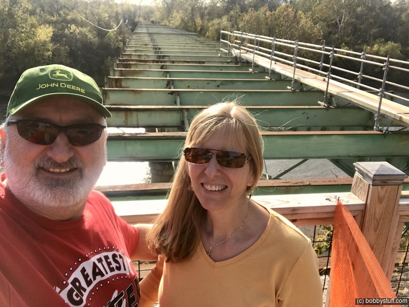
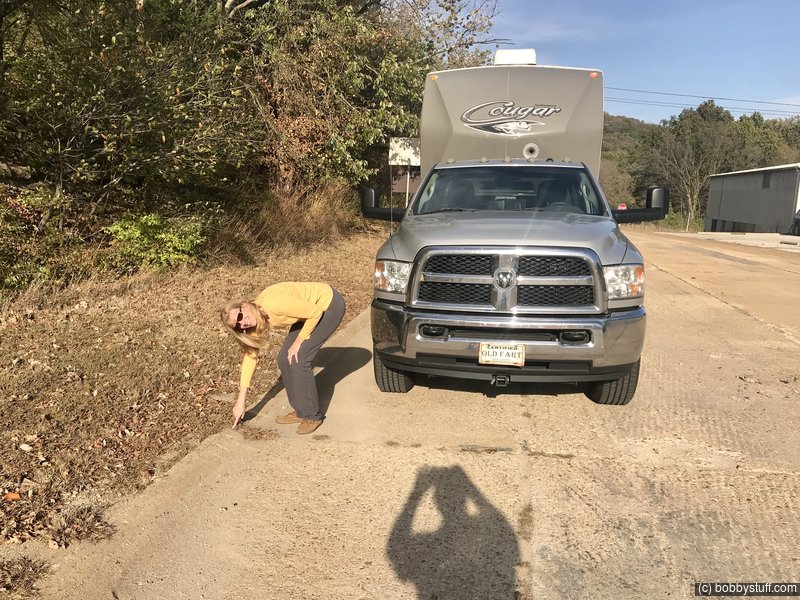
Bobby, Laurie
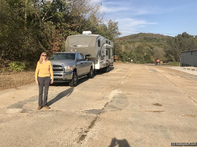
Laurie is pointing out the upturned edge on the concrete roadbed which is common with the original Route 66 road.
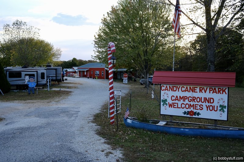
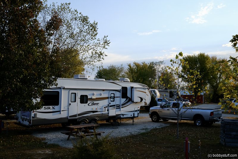
Candy Cane RV Park Steelville, MO
Usually we only stay one night in a campground and move on. For this trip we decided to spend 3 or 4 nights in one campground and explore the area. Then we will move a couple of hundred miles down the road and set up camp again and then explore some more. Our first campground is a place called Candy Cane RV Park near Steelville MO. We enjoyed our stay there and I want to include some text from his website:
My name is Bill Siems and I was born with Cerebral Palsy. The Doctors told my parents that I would never walk. Thanks to God, my Dad & my Mom, I am not only walking, I am living my dream of owning my own business! The Cerebral Palsy does affect my speech and I walk with a limp, but this does not affect my ability to run & maintain my business.
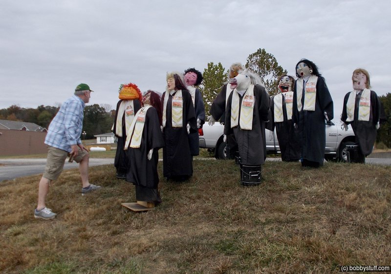
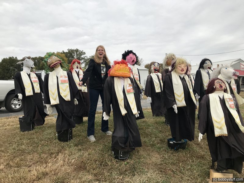
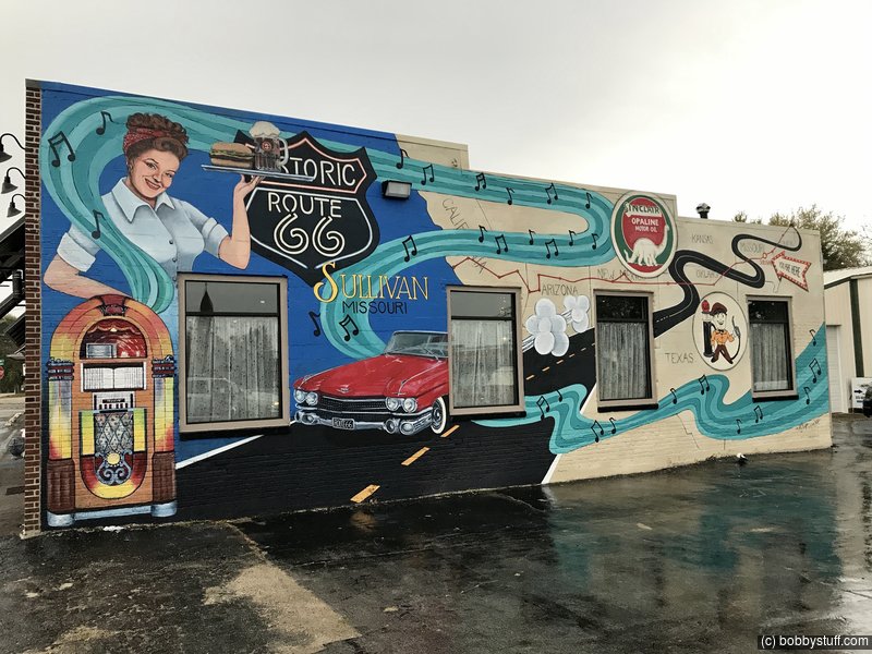
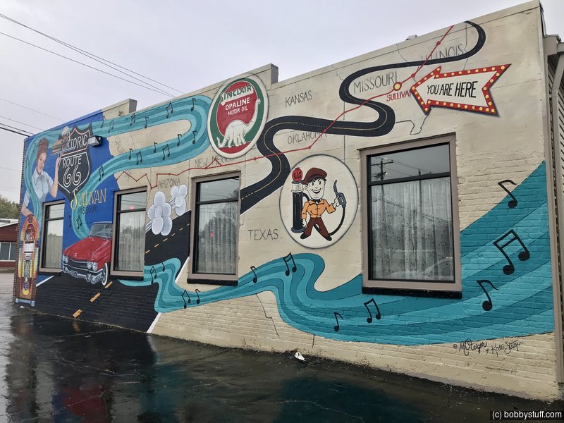
Halloween Fun in Eureka, MO
The town of Eureka MO was having some kind of scarecrow competition and many businesses were participating. We had some fun.
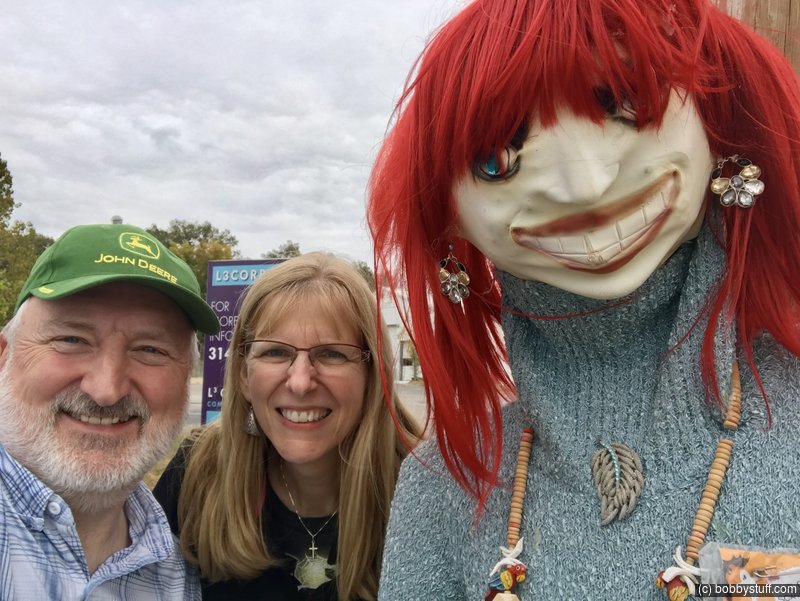
Bobby, Laurie
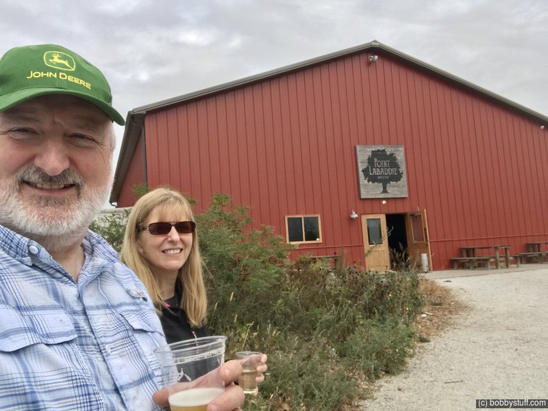
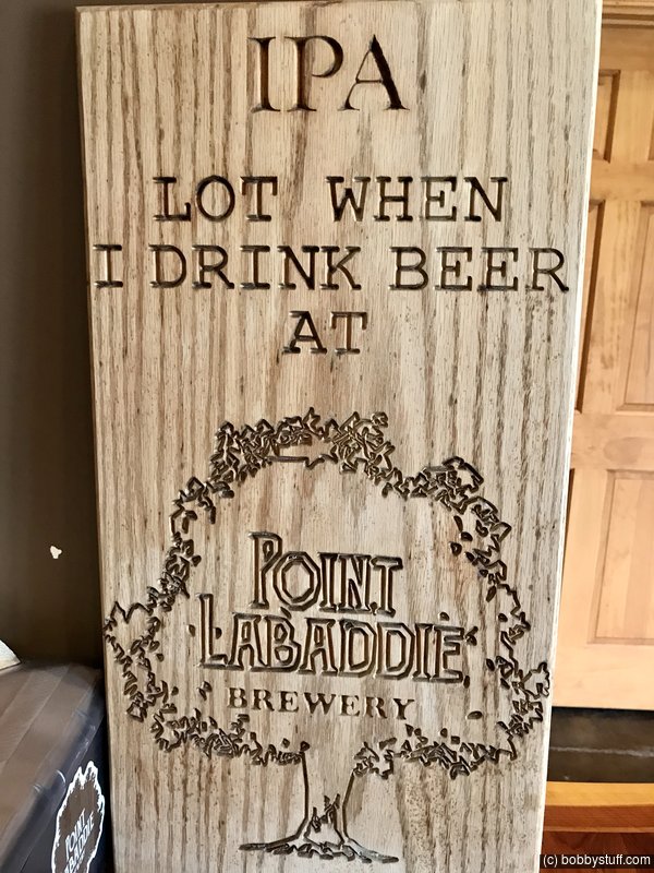
Point Labaddie Brewery
Driving through the country side on Route 66 we came upon Point Labaddie Brewery so we had to stop and have a sample.
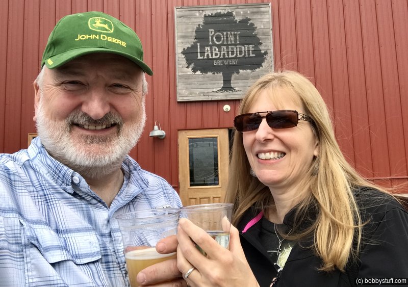
Bobby, Laurie
Bobby, Laurie
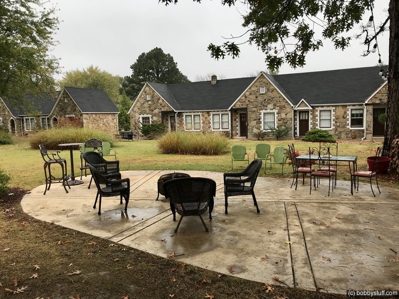
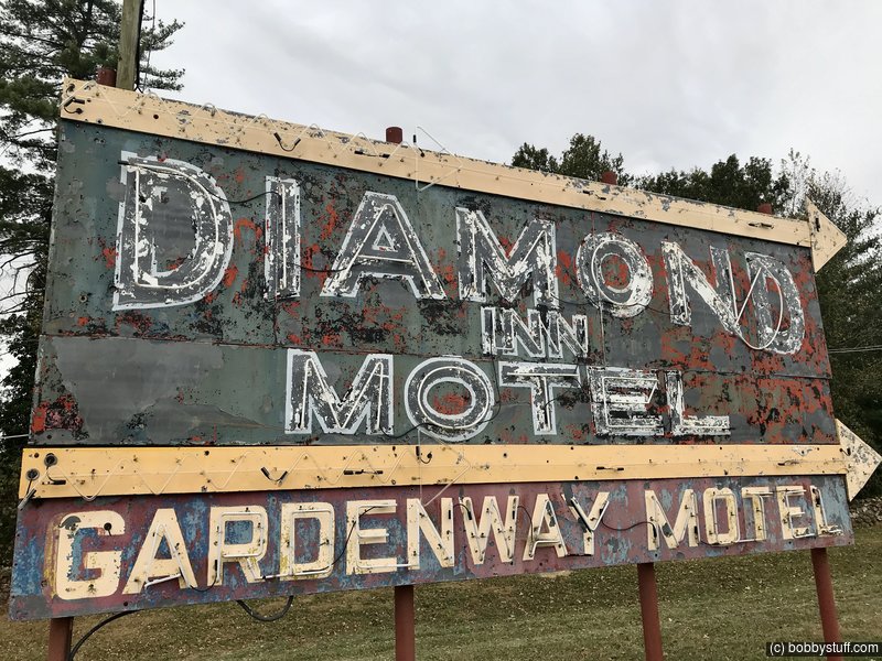
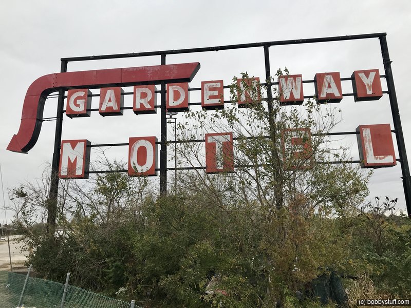
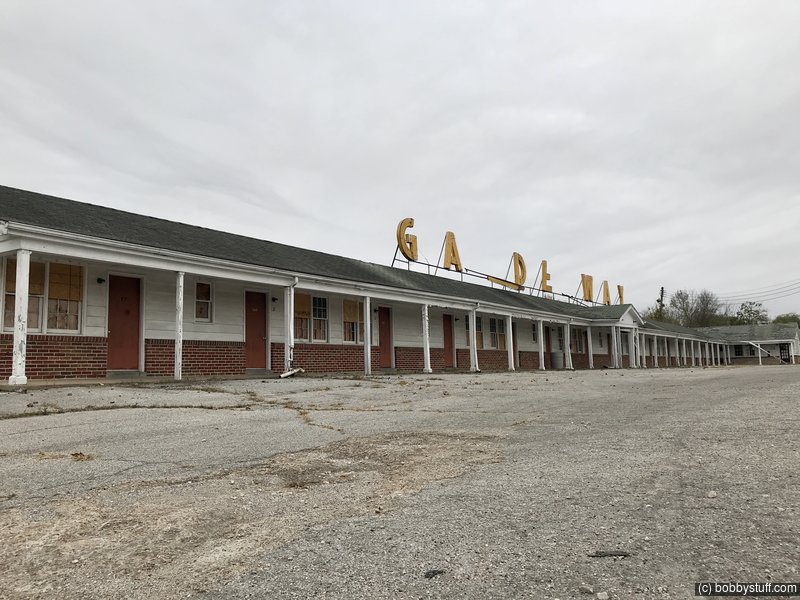
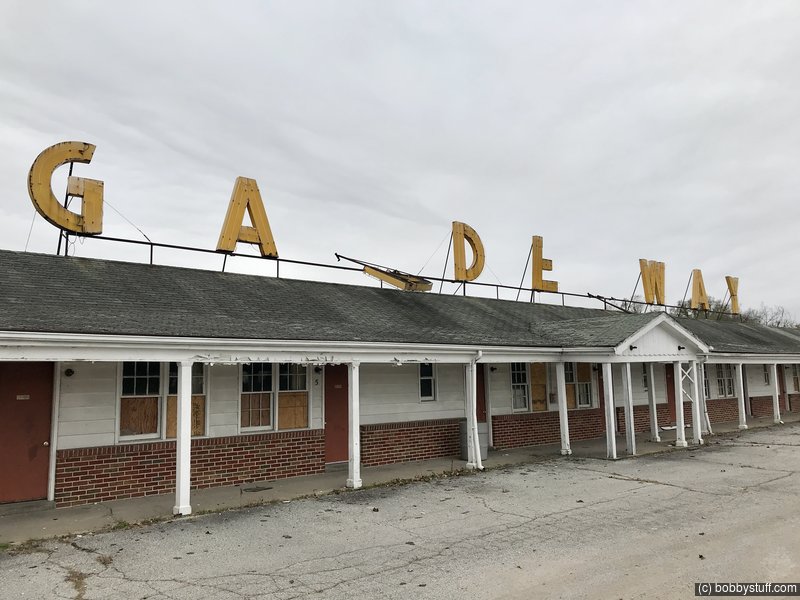
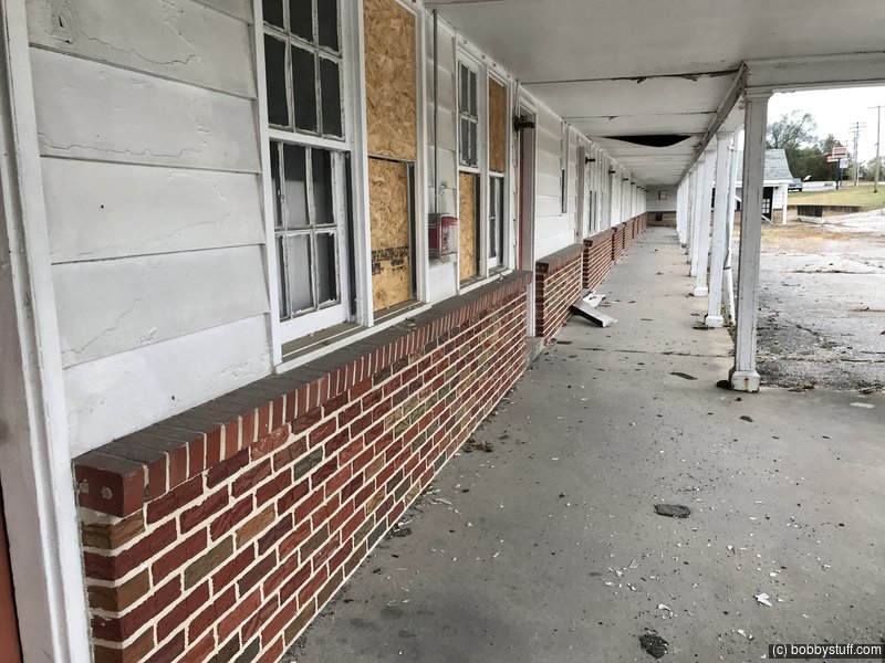
Gardenway Motel, Gray Summit MO
View a list of places like this or a map.theroute-66.com
Louis Eckelkamp built part of the present motel complex a short distance from his family's home in 1945; the second part was constructed in 1953. It consists of two linear units parallel to Old US 66 one behind the other. It had 41 units. It was built in Georgian Revival Style popular at that time, its name is a reference to the neighboring Henry Shaw Gardenway.
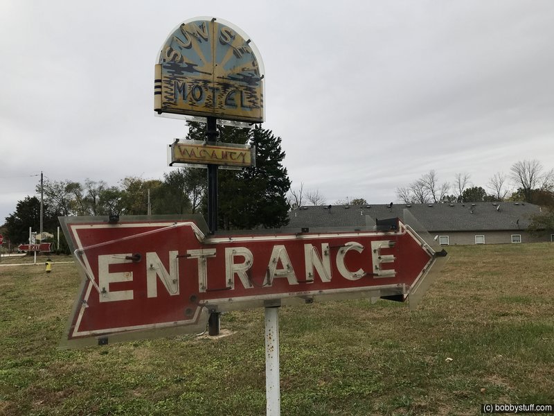
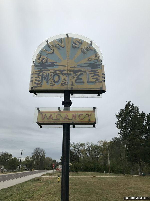
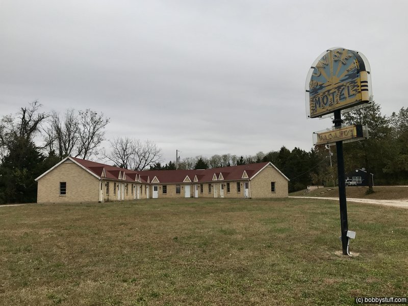
Sunset Motel, Villa Ridge MO
View a list of places like this or a map.theroute-66.com
Opened by the Lovelace family in 1947 it was bought by Oliver and Loleta Krueger in 1971, it is still in the family but now as weekly rentals. The motel has 12 units with a "V-shaped" single story layout, brick walls and gabled roof; it advertised itself in the 50s as: "12 Units - 12 Baths - Panel Ray Heat - Beautyrest Mattresses - Air-Conditioned - Quiet".
Its neon sign was restored in 2009. Don't miss it: it has a distinct red arrow showing the "Entrance" and the classic "Vacancy" sigh. The setting sun on a sea completes the sign with the motel's name on it.
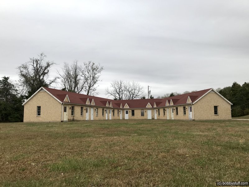
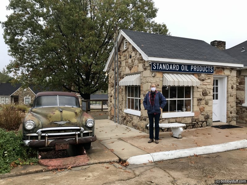
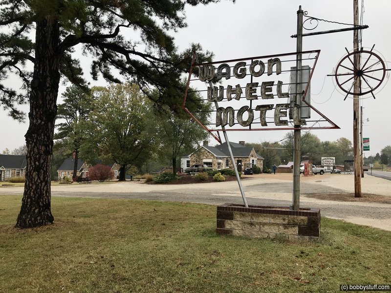
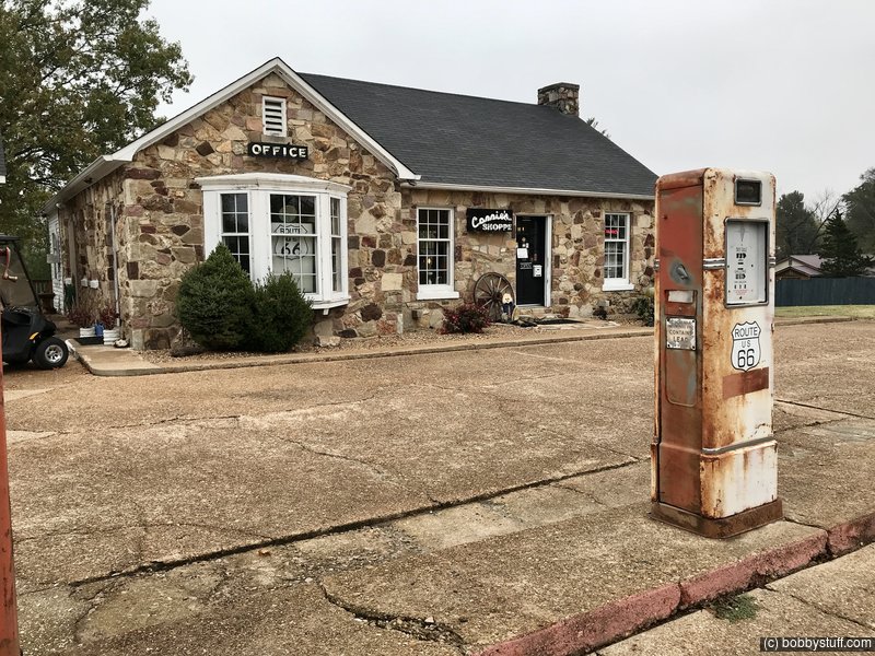
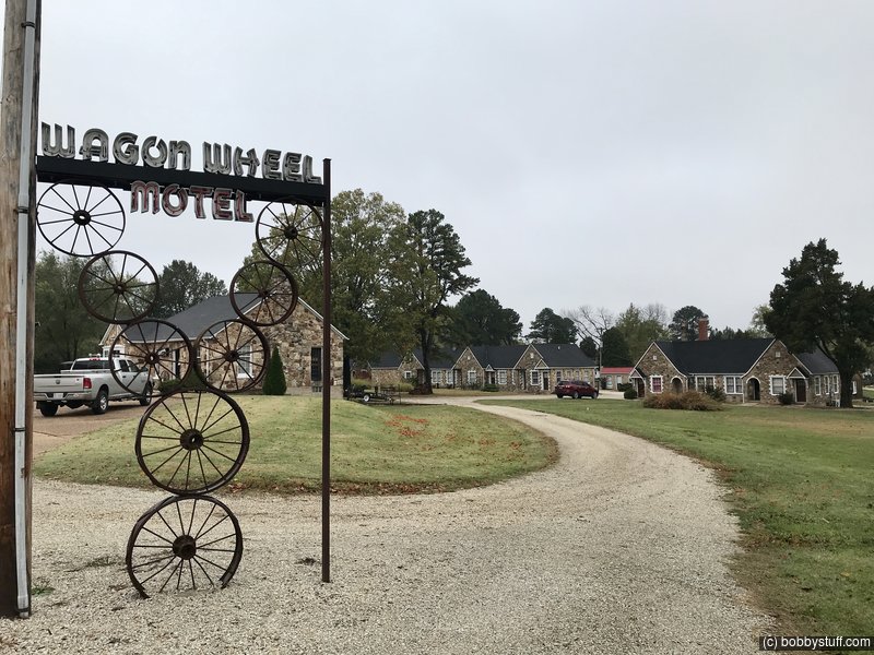
Wagon Wheel Motel, Cuba MO
View a list of places like this or a map.wagonwheel66cuba.com
The Wagon Wheel Cabins, Cafe & Station were built in the chaotic times of 1935 when the nation was barely out of the depression and the dust bowl had destroyed millions of acres.
Robert W. & Margaret Martin where the first owners of the Wagon Wheel Cabins, purchasing the land in 1934. The Martins hired Leo Friesenhan to do the building. Records show they worked on all the buildings at the same time and the local farmers carried the stone to him. Leo's combination of stone, design, and nearly indestructible mortar recipe has endured for over 75 years, giving the Wagon Wheel its spot on the National Registry of Historic Places.
In 1941 Robert had 14 cabins,12 car shelters, and 2 locked garages. Due to the increasing length of autos, tourism trade, and military traffic the garages in the buildings were converted into units.
After World War II in 1946 the property was split: the cabins sold to a partnership and the cafe and station to another couple, with the station being leased to The Standard Oil Co. This only lasted one year when John & Winifred Mathis purchased the cabins and William & the notorious "Sadie Mae Pratt" took over the cafe.
Most important, John designed the famous Wagon Wheel Neon Sign at his kitchen table changing the name to Wagon Wheel Motel instead of cabins. He added the block building containing 4 units, the laundry and storage and also built a good reputation along Rte 66.
In 1963 Pauline and Hallie Roberts purchased the motel and immediately opened "Ye Old Coffee Shoppe" which closed in 1980 when Hallie died. Pauline later married Harold Armstrong and continued to run the motel for a total of 40 years when she passed away in 2003. Harold followed in 2008.
Connie Echols purchased the motel from Harolds' son in Sept 2009. Updates and restoration have been non-stop on some of the most unique buildings left on Rte 66 today. The Cafe houses Connie's Shoppe and also serves as the motel office where the same check-in cards and desk are still used today.
This was to be my first Route 66 motel during my spring 2020 motorcycle ride. However I had to cancel because of Covid-19. It was nice to see what I missed.