Day 3, Dickson, TN
| Miles: | 407 |
| Start Point: | West Liberty, KY |
| Sun Rise: | 7:02 AM EDT |
| Start Weather: | At 6:00 AM EDT the temperature was 53.1 ° with 48% humidity. The conditions were partly cloudy with a wind speed of 4.4 MPH and wind gusts of 8.5 MPH. |
| End Point: | Burns, TN |
| Sun Set: | 7:21 PM CDT |
| End Weather: | At 6:00 PM CDT the temperature was 79.3 ° with 27% humidity. The conditions were clear with a wind speed of 4.6 MPH and wind gusts of 14.3 MPH. |
Table of Contents
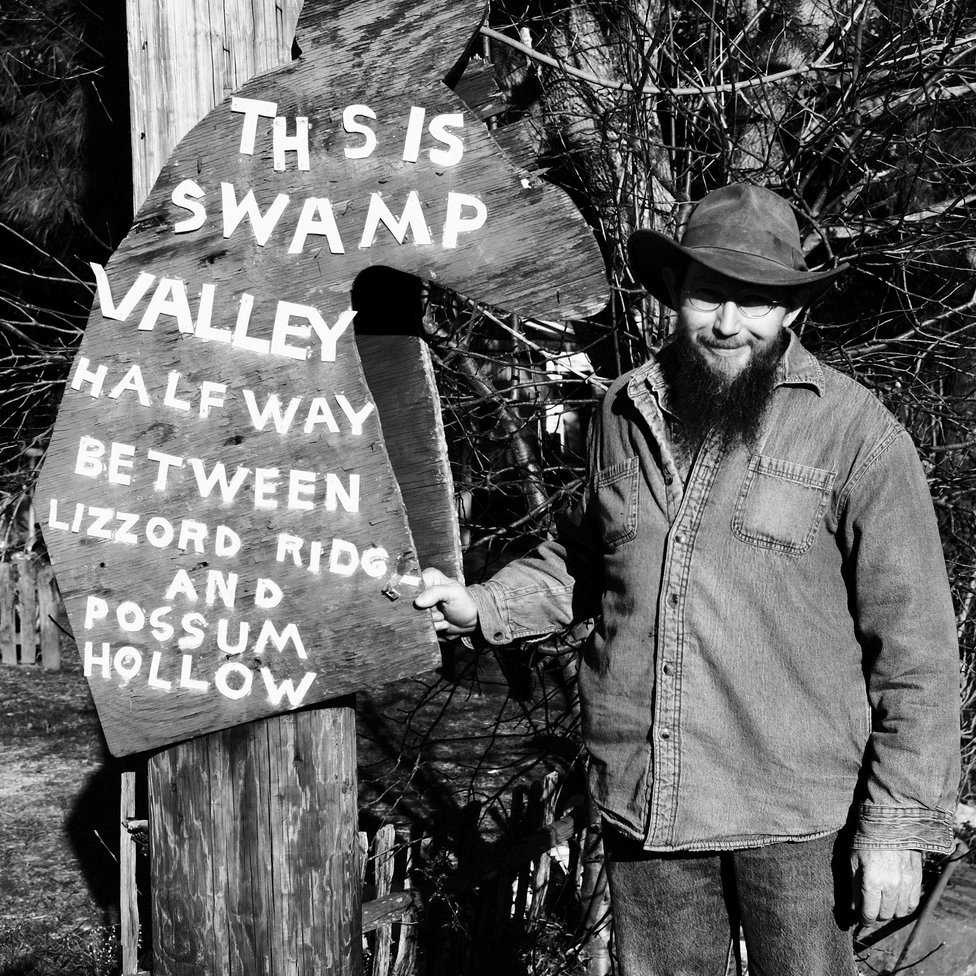
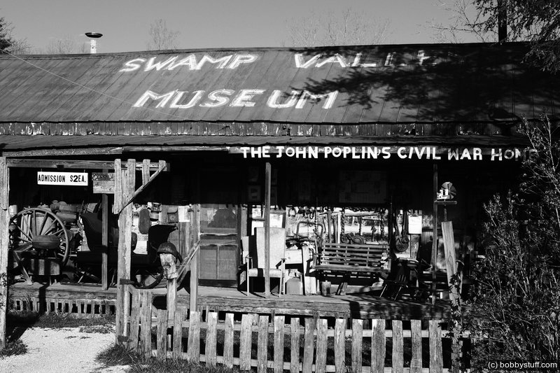
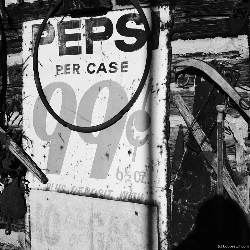
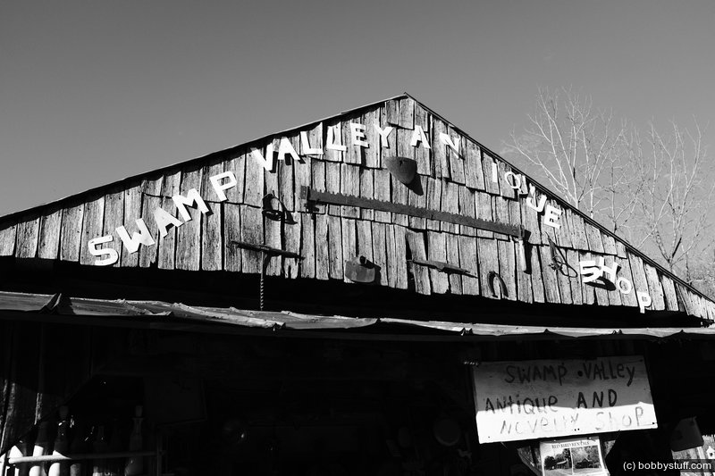
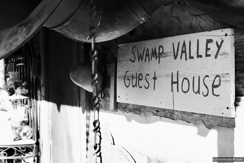
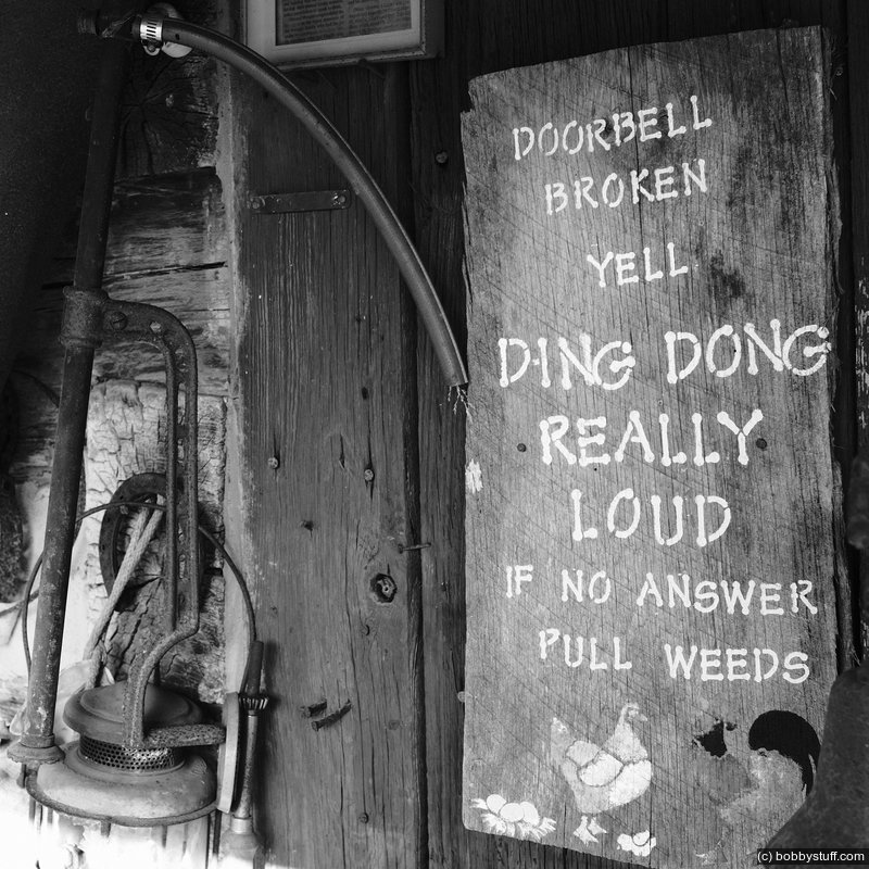
Swamp Valley
My Mom spoiled me with some good home cooking. I had a great visit with the folks and got on the road about 7:00AM.
I was riding through Menifee County when a sign caught my attention. I had all day to get to Dickson TN so I made a U turn and went back to check it out. While taking some photos a fellow parked across the road and approached me. I yelled "Howdy" and struck up a conversation.
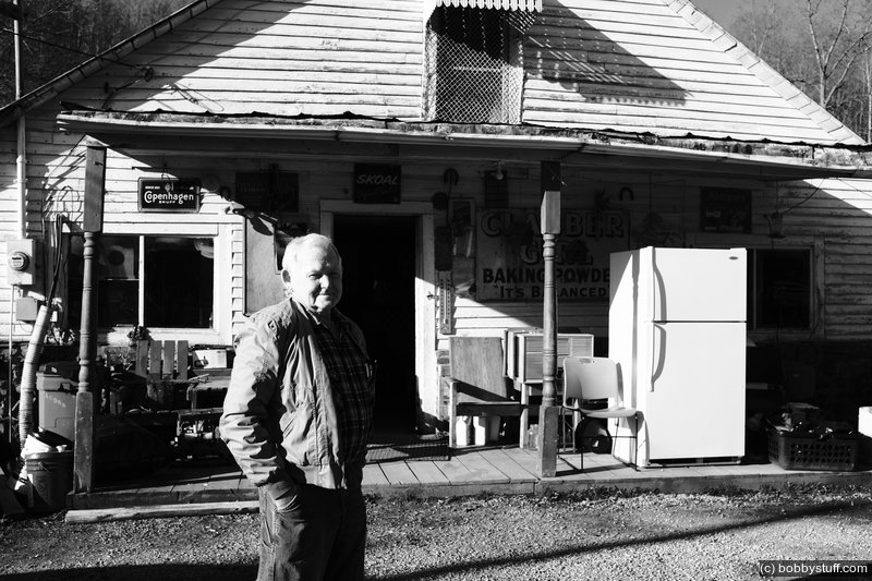
He is one of 10 siblings and his mother owns the place. She does not open the doors much after their Dad died but his brother opens one of the buildings from time to time. It is mostly the "ole home place" where the family gathers from time to time. His name was Benny and I asked him if I could take his photo.
In my neck of the woods it is common for folks to repond to a photo request with "I might break your camera."
I assured Benny that I had photographed people uglier than him and my camera was still intact so he agreed to let me take his photo.
Benny left for work and I took a few more photos. Then his brother showed up. His name was Gary and we chatted for a bit and talked motorcycles. In his younger days he had a Honda 400 that he rode along the ridges.
I asked if I could take his photo and he reponded with the same "I might break your camera." I replied that I had just taken a photo of his brother and Benny was uglier than him so I think we are good. He agreed.
Benny and Gary, if you see this, I enjoyed meeting you and talking for a spell.
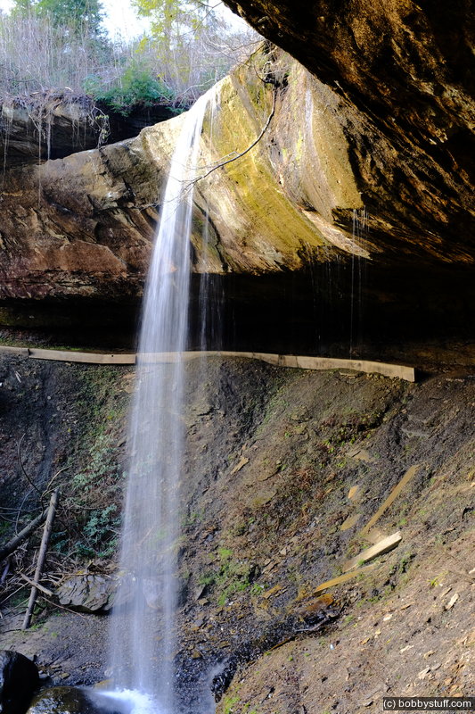
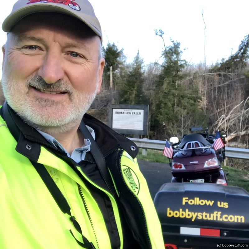
Broke Leg Falls
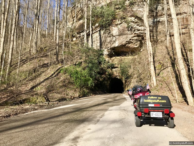
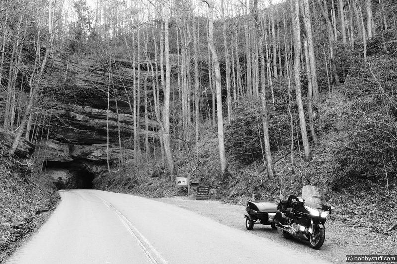
Nada Tunnel in Red River Gorge
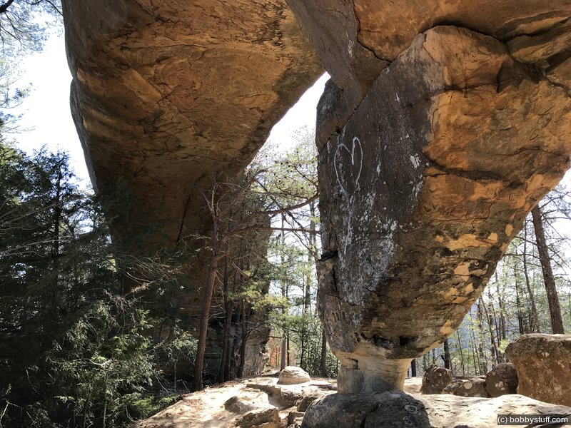
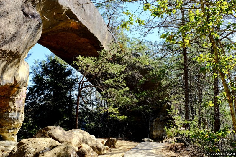
Sky Bridge in the Red River Gorge
Check out the 360 photo.
360 Photo !!!
Click and drag on the photo below to see a 360 view. Pinch to zoom in or out on your mobile device or use your mouse scroll wheel on your desktop. Click the box in the top left of the image to view in full screen.
Arch on Sky Bridge Loop Trail 214, Red River Gorge KY
 Elevation Changes During the Day
The day started at 794 feet and ended at 869 feet. The highest altitude was 1,298 feet and the lowest altitude was 410 feet.
 Google Map Track Log
| Day 2 NC to my Folks |
Topics
TagsConfederate Statues (32),Motorcycle (97),National Parks (9),Odd (1),Route 66 (33),Unemployment (6),Zombies (1)