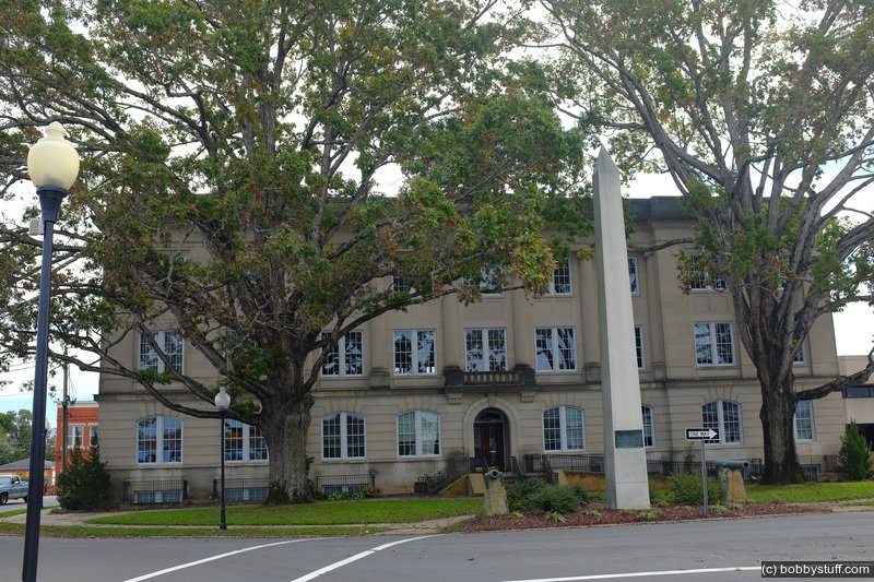
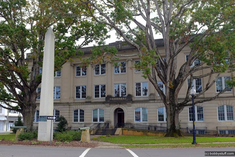
Moore County Courthouse in Carthage, North Carolina
Laurie and I like riding our Gold Wing motorcycle. But it is easy to get into a rut and just ride the same roads. So to force ourselves to ride to places we would not normally visit we made a goal to visit and photograph all 100 North Carolina courthouses within 1 year.
As usual, we got a little behind. We started in July 2015 and finished 99 out of 100 by June 2018. The last courthouse was in our home county of Wake and it took us until Feb 2021 to get that final one. But we made it! This blog is about one of those visits.
Many NC courthouses were added to the National Register of Historic Places in 1979. The nomination form has some interesting facts about the various courthouse styles over the years.
Courthouse Information
Wikipedia says the following about the courthouse:
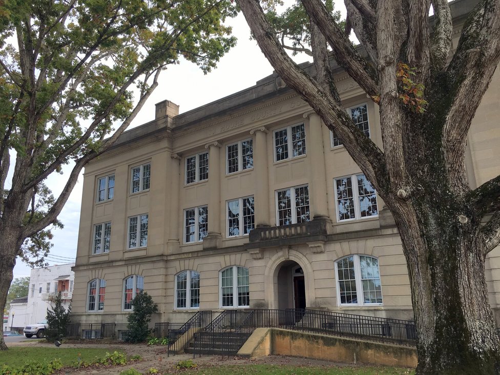
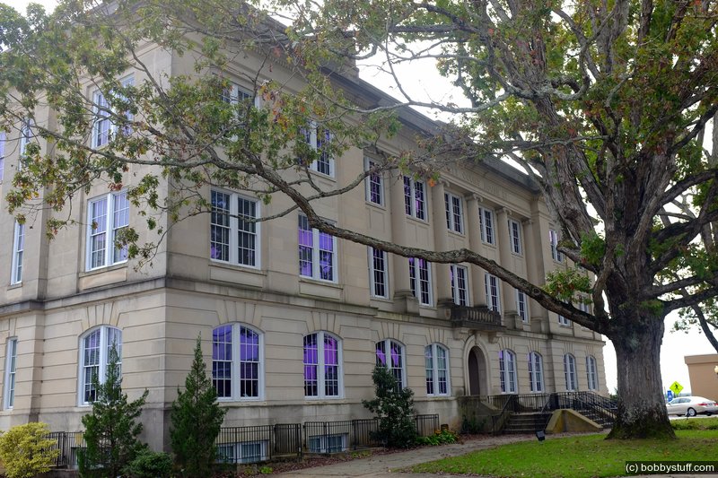
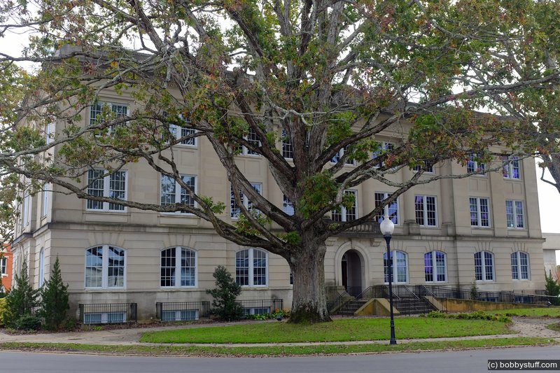
Moore County Courthouse is a historic courthouse located at Carthage, Moore County, North Carolina. It was built in 1922-1923, and is a three-story, rectangular, limestone-faced building in the Renaissance Revival style. It has a rusticated base pierced by arched paired windows, upper floor windows divided by pilasters, and a series of Ionic order half columns in the slightly recessed central section.
It was added to the National Register of Historic Places in 1979.
County Information
The North Carolina History Project lists the following information for this county:
A border county between North Carolina's Piedmont and Coastal Plain Regions, Moore County was established in 1784. Named after Alfred Moore, a Revolutionary War veteran and U.S. Supreme Court justice, Moore County was annexed from Cumberland County shortly after the American Revolution. Carthage, the county seat, was established in 1796, bearing the name of the ancient African city. Other towns and communities include Aberdeen, Seven Lakes, Pinehurst, Hill Crest, Cameron, Southern Pines, Eastwood, Eagle Springs, Parkwood, and Robbins.
Originally settled by the Highland Scots, Moore County's economy centered on agriculture and lumber. A gun factory, carriage manufacturer, and other minor business enterprises developed after the American Revolution. The Raleigh and Augusta Railroad eventually passed through Moore County in the 1870s. Soon after the railroad arrived, the lumber market increased almost exponentially because transportation improvements facilitated the shipment of goods.
In the late 1890s, the new railroad led to the formation of the resort towns of Southern Pines (originally Shaw's Ridge) and Pinehurst. Northerners and Southerners alike soon took advantage of the balmy weather and the recreations these towns offered. Today, Southern Pines and Pinehurst are known for their golf courses, and golfers from around the world consider Moore County a sporting destination. In 2005, in fact, Pinehurst Number Two Course hosted the U.S. Open Championship.
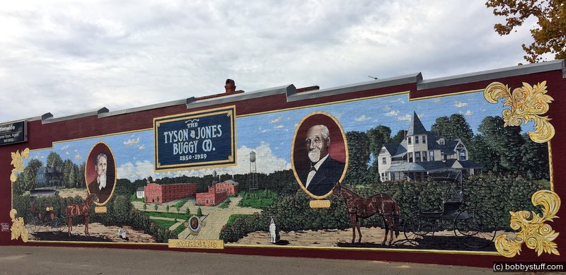
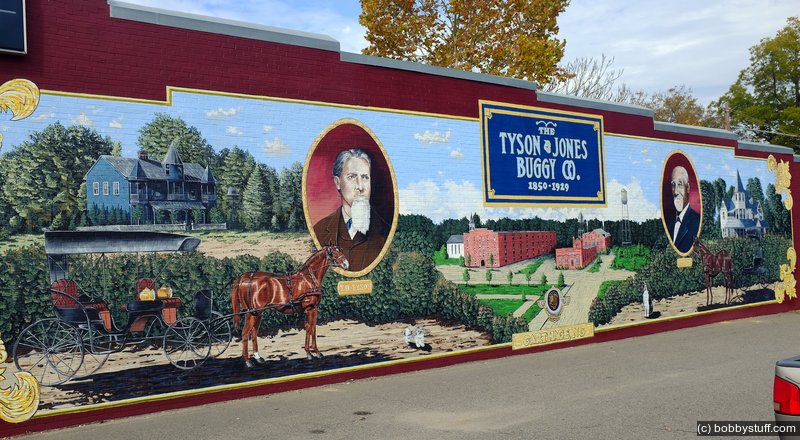
Moore County is also rich with historical and cultural hallmarks, including the House in the Horseshoe, the Carolina Hotel, and the Aberdeen Historic District and several cultural institutions featuring the arts, literature, and gardening. The Moore County Agricultural Fair, the Bark-in-the-Park Festival, the Carthage Buggy Festival, and the North Carolina Playwright Festival provide other recreational and cultural opportunities.
Our Experience
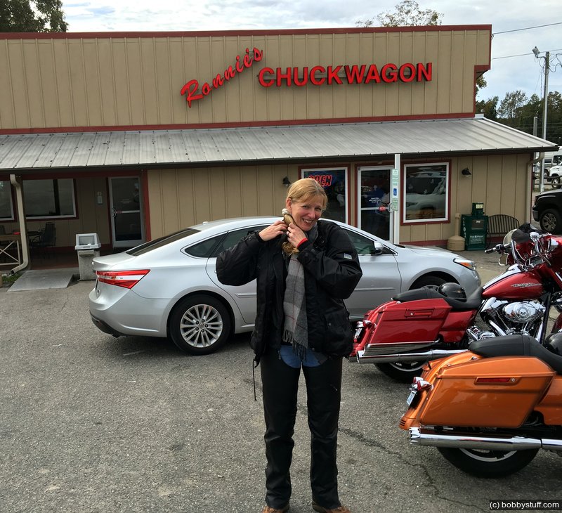
We were well past feeding time for Laurie, so the first order of business was a stop at Ronnie's Chuck Wagon. It was very popular with the locals. The food might not have been healthy but it was good. Chili, hush puppies and an apple turnover satisfied my hunger. I think Laurie had a beef vegetable soup.
The lighting was just all wrong to get a good photo of the courthouse. But this is the only courthouse I remember so far that does not have power and phone lines in front of the building to mar the view.
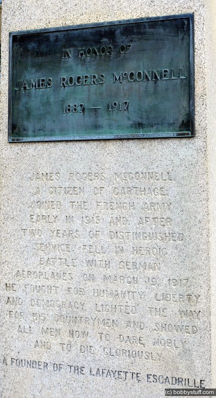
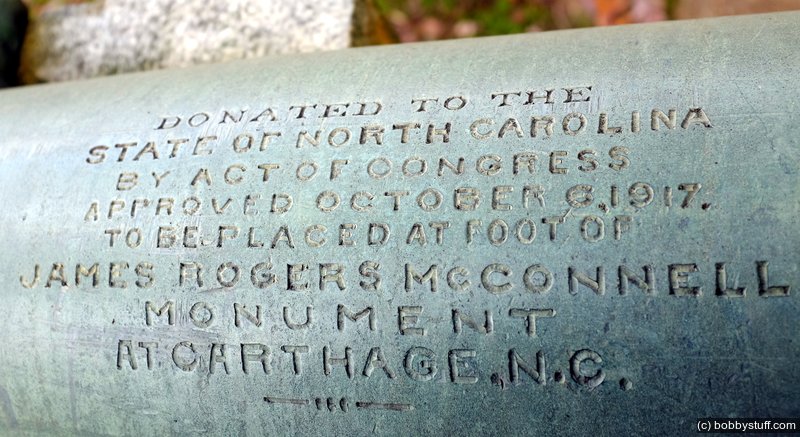
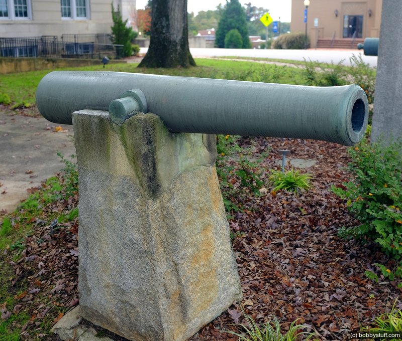
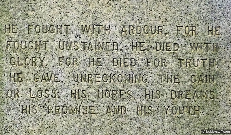
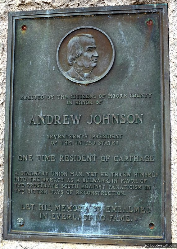
The obelisk and canons are a memorial to James Rogers McConnell. This website from the State Library of North Carolina says:
...Although it would be three more years from 1914 until the U.S. ended its neutrality in April 1917, from the outset Americans independently joined up with British and French military groups or with the American Ambulance Corps. James Rogers McConnell was one such independent who joined up with the American Ambulance Corps in Vosges, France in 1915. Not long after that he joined the Escadrille Americaine in the Lafayette Escadrille, the elite French fighting pilots. McConnell was killed over France on March 19, 1917 during an air battle with German fighter planes.
Buried and honored in France, his service was honored locally in Carthage by both the citizens of his adopted town and by the French. On April 17, 1917, Carthage dedicated a granite obelisk in front of the historic Moore County Courthouse, where it still stands today. Sometime during 1917, a second memorial was dedicated to McConnell in Carthage -a plaque sent by the French people -and installed at the old town hall. Today this plaque sits in front of the Gilliam-McConnell Airfield in Carthage, built and named in honor of James Rogers -known as "Jacques" to the French -McConnell. The substance of letters he wrote home also found permanence in 1917 in a book under his authorship, Flying For France With the American Escadrille at Verdun.
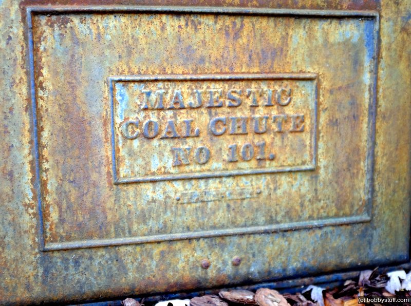
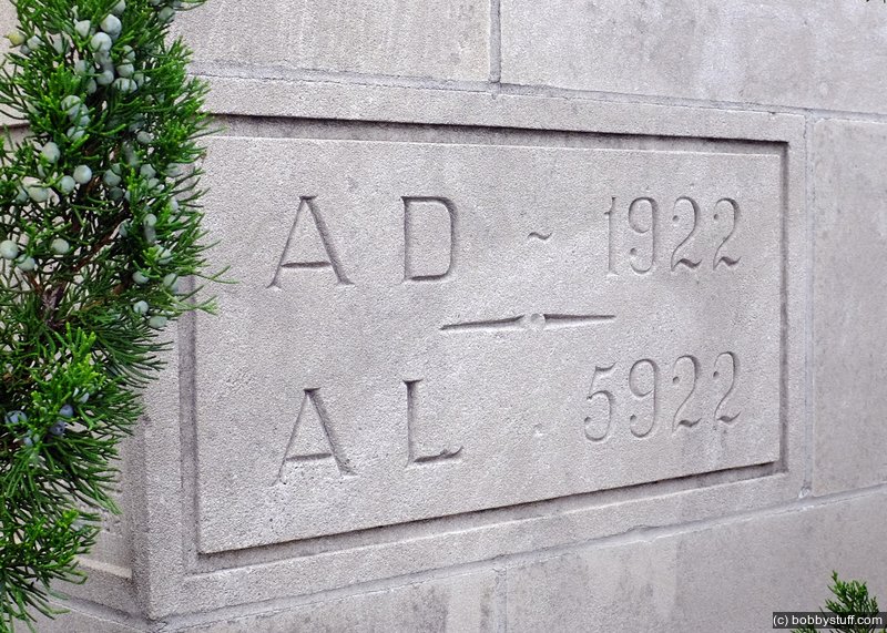
I like to look for the small details of a buildings construction. To the left of the main entrance, at ground level, I found the coal chute. I also found the cornerstone with an inscription I had never seen before; the normal build date of AD 1922 and then AL 5922. A Freemasonry website explained:
Click the link above for more details.Anno Lucis is Latin for "Year of Light." You will also see it abbreviated as "A.L." It is used as a calendar system within the Freemason fraternity.
Year of Light refers to the biblical account of the creation of the universe wherein God spoke and said: "Let there be light,...and there was light." (Genesis 1:3)
You will often see the abbreviation "A.L." on Masonic certificates, plaques and building cornerstones.
This calendar system is not exclusive to Freemasonry.
It was designed as a simplification of the Anno Mundi calendar by an Irish cleric, James Ussher (1581-1656) nearly a century before the formation of the United Grand Lodge of England in 1717. Ussher established the year 4004 B.C. (approximately 6013 years ago) as the date of the biblical creation of the Earth.
...
The term, Anno Lucis, is used by Freemasons to denote the Year of Light, which is the year in which God created the world, approximately 4,000 years before the beginning of the Common Era.

Moore County Courthouse in Carthage, North Carolina
Moore County Courthouse in Carthage, North Carolina
Laurie
Moore County Courthouse in Carthage, North Carolina
Moore County Courthouse in Carthage, North Carolina
Moore County Courthouse in Carthage, North Carolina
Moore County Courthouse in Carthage, North Carolina
Moore County Courthouse in Carthage, North Carolina
Moore County Courthouse in Carthage, North Carolina
Moore County Courthouse in Carthage, North Carolina
Moore County Courthouse in Carthage, North Carolina
Moore County Courthouse in Carthage, North Carolina
Moore County Courthouse in Carthage, North Carolina
Moore County Courthouse in Carthage, North Carolina
Moore County Courthouse in Carthage, North Carolina
Moore County Courthouse in Carthage, North Carolina
Moore County Courthouse in Carthage, North Carolina
Moore County Courthouse in Carthage, North Carolina

Moore County Courthouse in Carthage, North Carolina